MyTopo
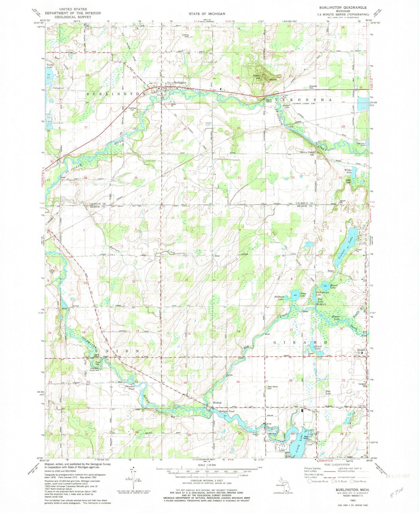
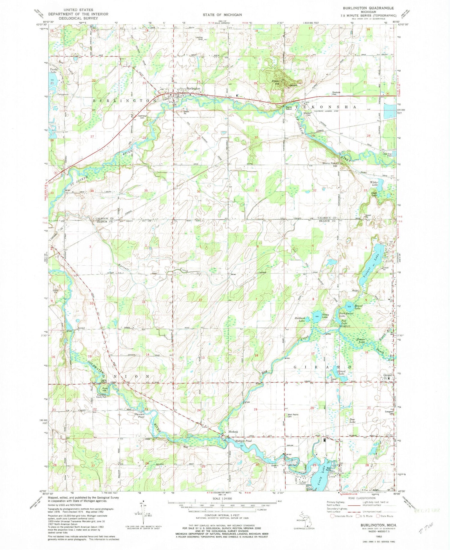
Classic USGS Burlington Michigan 7.5'x7.5' Topo Map
Couldn't load pickup availability
Historical USGS topographic quad map of Burlington in the state of Michigan. Map scale may vary for some years, but is generally around 1:24,000. Print size is approximately 24" x 27"
This quadrangle is in the following counties: Branch, Calhoun.
The map contains contour lines, roads, rivers, towns, and lakes. Printed on high-quality waterproof paper with UV fade-resistant inks, and shipped rolled.
Contains the following named places: Angel Cove Park, Bell School, Bidwell School, Burlington, Burlington Post Office, Burlington Station, Burlington Township Cemetery, Burlington Township Fire Department, Burlington Township Library, Cherry Flats, Church of God, Cobblestone School, Craig Lake, Dixon Hall, Dow Lake, Evergreen Cemetery, Fox Lake, Girard, Girard Lake, Girard Post Office, Hayner School, Heart Lake, Hodunk, Hodunk Pond, Hodunk Post Office, Hog Creek, Hubbard Lake, Kaufmans Landing Strip, Meserole School, Methodist Episcopal Church, Methodist Episcopal Church Historical Marker, Morey School, Musser Lake, North Branch Hog Creek, Olney Lake, Plains School, Pork Barrel Lake, Powatomie Recreation Area Campground, Riverbend County Park, Round Lake, Seventh Day Adventist Church, Sisco School, South Branch Hog Creek, Stancers Pond, Stony Point Hill, Township of Burlington, Township of Girard, Township of Tekonsha, Township of Union, Turtle Creek Golf Course, Van Shoick School, Village of Burlington, Vincent Lake, West Prairie Cemetery, Wilder Lake, Windfall Cemetery, Windfall School, ZIP Code: 49094