MyTopo
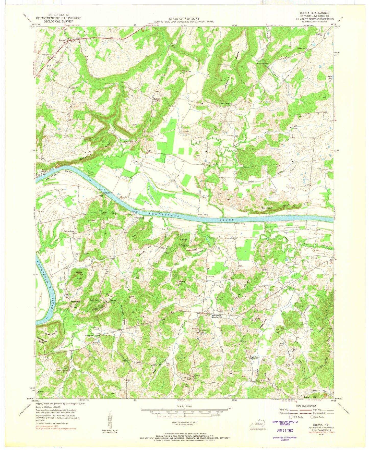
Classic USGS Burna Kentucky 7.5'x7.5' Topo Map
Couldn't load pickup availability
Historical USGS topographic quad map of Burna in the state of Kentucky. Map scale may vary for some years, but is generally around 1:24,000. Print size is approximately 24" x 27"
This quadrangle is in the following counties: Livingston.
The map contains contour lines, roads, rivers, towns, and lakes. Printed on high-quality waterproof paper with UV fade-resistant inks, and shipped rolled.
Contains the following named places: Anderson Cemetery, Atwood Mines, Bald Knob, Barnes Farm Airport, Barricks Hill, Beachdale School, Bissell Bluff, Bissell Creek, Burna, Burna Census Designated Place, Burna Community Fire Department, Burna Post Office, Cedar Grove Church, Clear Branch, Cook Spring Branch, Deason - Cochran Cemetery, Dobson Bluff, Doom Cemetery, Doom Spring, Doom Spring Branch, Dry Fork, Dunlap Cemetery, Dunlap Hill, Dunn Creek, Durham Cemetery, Ferguson Cemetery, Ferguson Creek, Franklin Quarry, Frozen Knob, Grand Lakes Fire Department Station 3, Grassham Hollow, Gravel Hill, Green-Johnson Cemetery, Hampton Cemetery, Hampton Hill, Harp Ridge, Harris Hill, Haw Hill, Hazel Branch, Heater, Heater Cemetery, Hickory Creek, Horseshoe Bend, Hudson Mine, Jewel Hill, Kibbler Hill, Klondike Mine, Kolb Quarry, Lee-Goldwell Cemetery, Leeper Cemetery, Leeper Hill, Lemen Cemetery, Lemen Landing, Lick Creek, Livingston Chapel, Livingston County, Lockett Cemetery, Lockhart Bluff, Lovelace Church, Lovelace Mine, Low Gap Hollow, Lower Ferguson Spring, Martin Cemetery, Mint Springs, Mint Springs Missionary Church, Mitchell Landing, Mount Zion School, Moxley Landing, Mullikin Junction, Oak Ridge, Peck Cemetery, Phillips Cemetery, Polecat Hollow, Robertson Family Cemetery, Rocked Spring, Rocky Branch, Ross Cemetery, Rudd Quarry, Sandy Creek, Scotts Chapel, Smith Creek, Snglin Creek, Steep Hollow, Sugar Creek, Sugar Creek Mission Church, Taylor Cemetery, Tiline Post Office, Tracey Cemetery, Vick Hill, Vicks Bluffs, Vicksburg, Wolfe Cemetery, ZIP Codes: 42028, 42083


