MyTopo
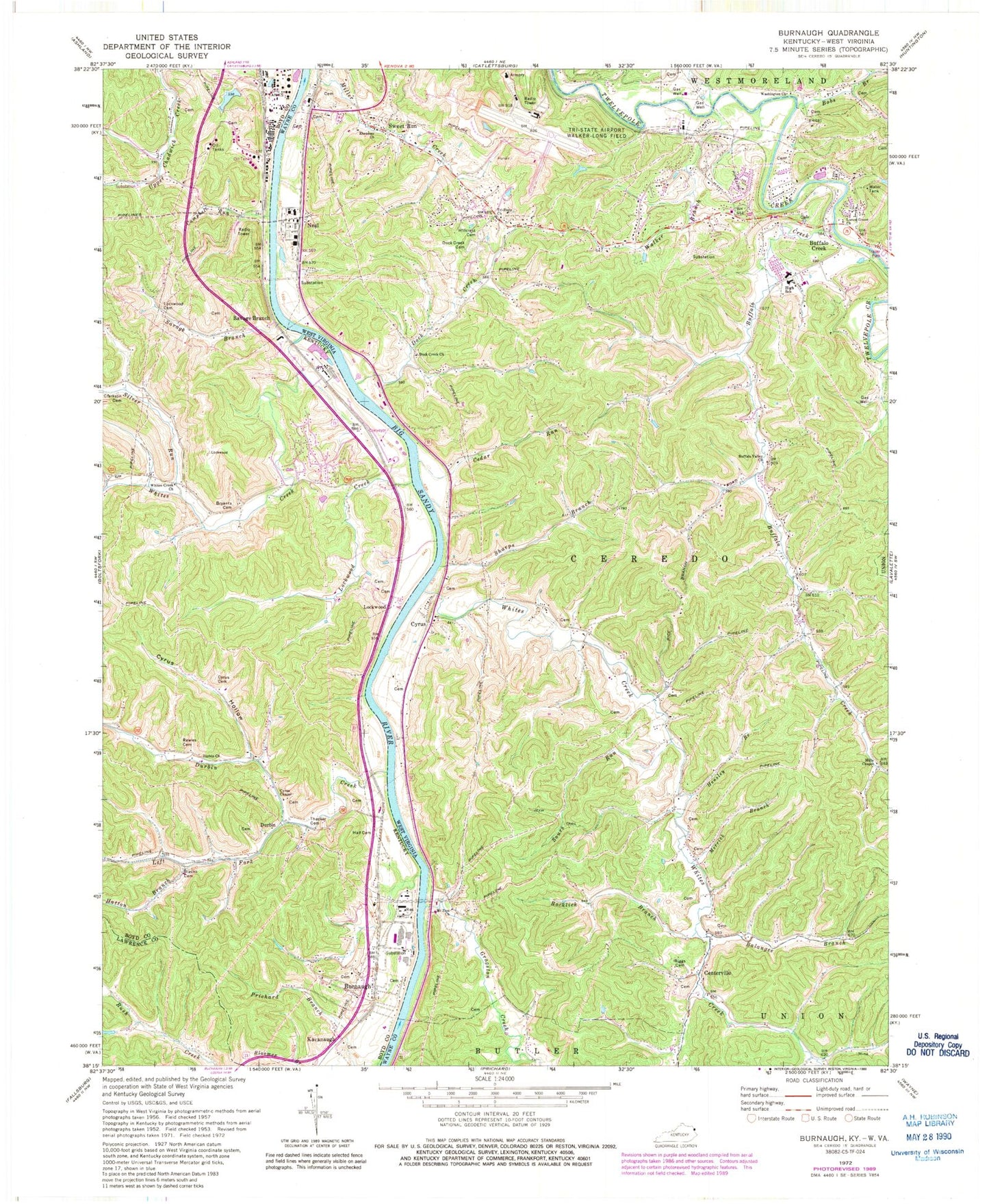
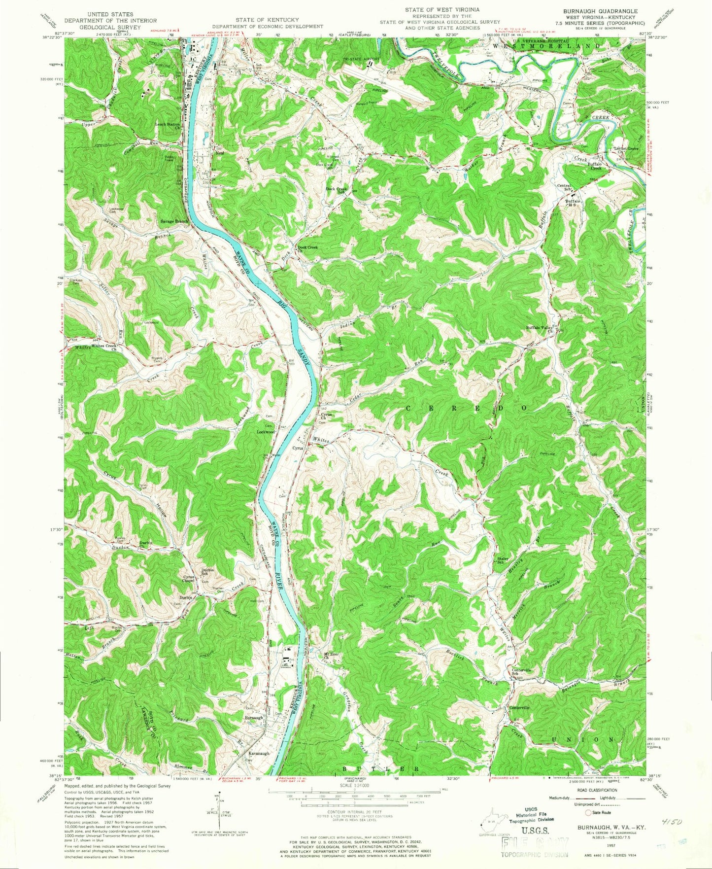
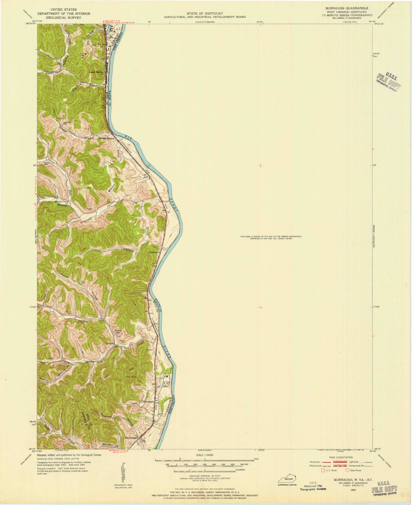
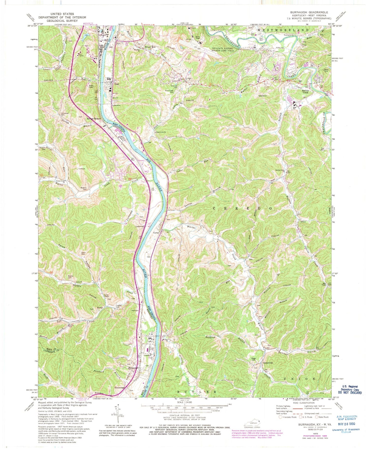
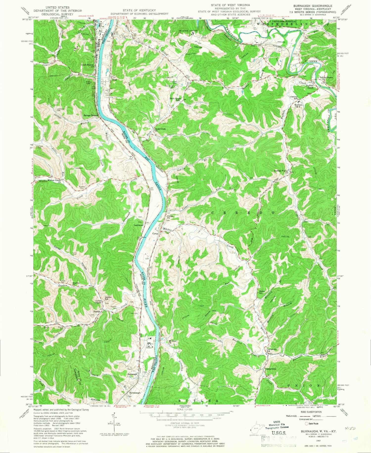
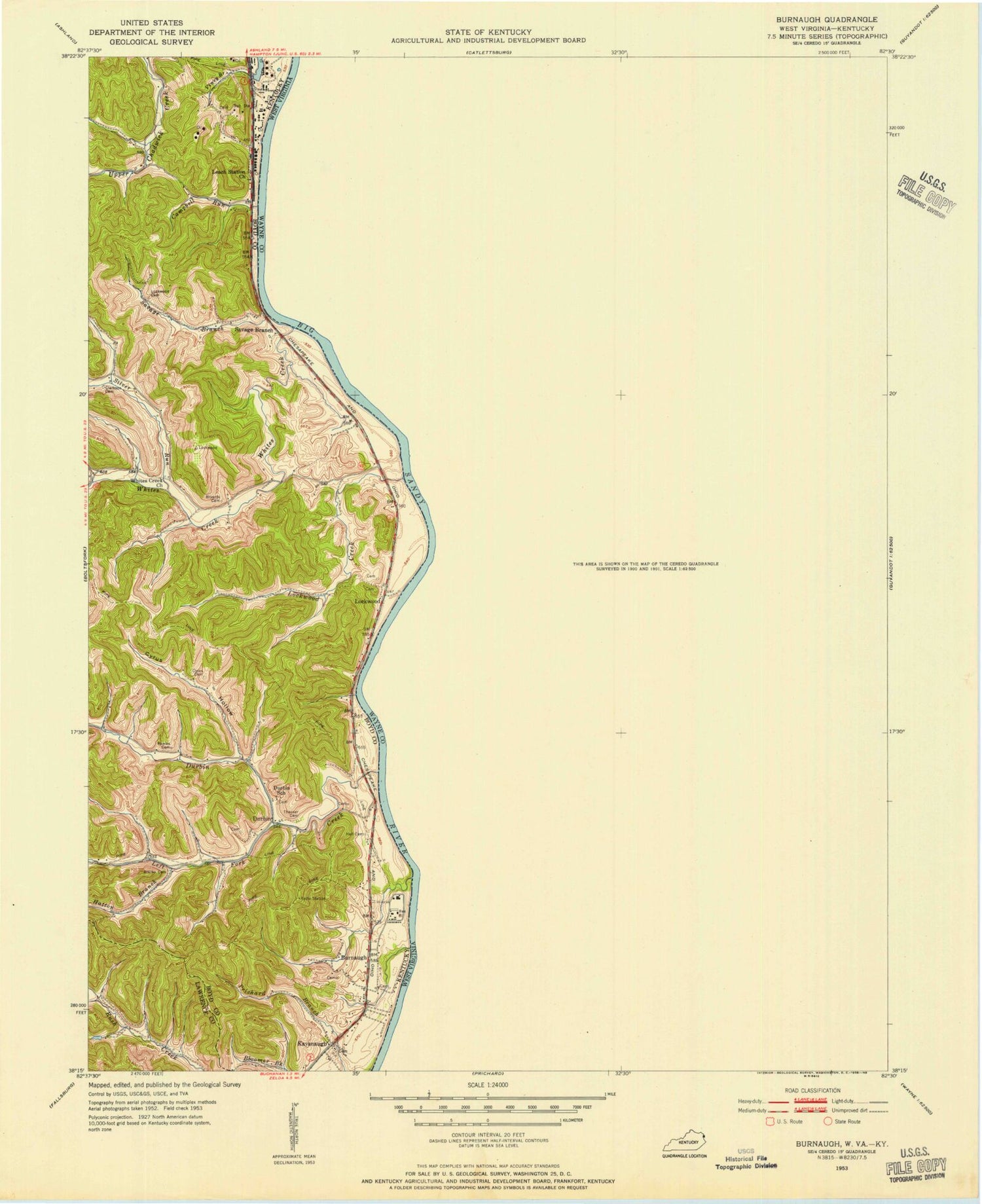
Classic USGS Burnaugh Kentucky 7.5'x7.5' Topo Map
Couldn't load pickup availability
Historical USGS topographic quad map of Burnaugh in the states of Kentucky, West Virginia. Typical map scale is 1:24,000, but may vary for certain years, if available. Print size: 24" x 27"
This quadrangle is in the following counties: Boyd, Lawrence, Wayne.
The map contains contour lines, roads, rivers, towns, and lakes. Printed on high-quality waterproof paper with UV fade-resistant inks, and shipped rolled.
Contains the following named places: Blacks Cemetery, Bryants Cemetery, Burnaugh, Campbell Run, Cyrus Cemetery, Cyrus Chapel, Cyrus Hollow, Dog Fork, Durbin Church, Durbin Creek, Hall Cemetery, Hatton Branch, Left Fork Durbin Creek, Lockwood Cemetery, Lockwood Creek, Prichard Branch, Rawles Cemetery, Savage Branch, Silver Run, Thacker Cemetery, White Creek Church, Whites Creek, Durbin, Kavanaugh, Lockwood, Savage Branch, Tennessee Gas Heliport, Catlettsburg Division, Alley Cemetery, Runyon Cemetery, Leach Railroad Station (historical), Leach Station Church, Whites Creek Church, Whites Creek (historical), Potomac Post Office (historical), Mary Moore School (historical), Johnston Cemetery, Lockwood Cemetery, Lockwood Railroad Station (historical), Lockwood Ferry (historical), Burgess Railroad Station (historical), Jim Wood Post Office (historical), Hatten Cemetery, Durbin School, Burgess Railroad Station (historical), Black Cemetery, Newman Cemetery, Durbin-Burnaugh (historical), Burnaugh Missionary Baptist Church, Kavanaugh Chapel Church, Wright Railroad Station (historical), Kavanaugh School, Big Sandy Fire Department, Balangee Branch, Bobs Branch, Buffalo Creek, Buffalo Creek, Buffalo Valley Church, Cedar Run, Dock Creek, Dock Creek Cemetery, Dock Creek Church, Ebenzer Church, Gragston Creek, Hensley Branch, Hillcrest Cemetery, Locust Grove Church, Merrick Branch, Mills Chapel, Mount Zion Church, Riggs Cemetery, Rocklick Branch, Sharps Branch, Sours Run, Tri-state Church, Walker Branch, Washington Church, Whites Creek, Centerville, Cyrus, Neal, Sweet Run, Tri-State Airport/Milton J Ferguson Field, Buffalo Elementary School, Buffalo High School (historical), Ellis Fork, Hidden Valley, Meadow Haven, Westmoreland District, Buffalo Middle School, Kenova Volunteer Fire Department Station 2, Braskem America's Neal Plant Ambulance, Plymale Cemetery, Ward Cemetery, James and Carol Wheeler Bridge, Huntington Tri State Airport Police Department, Akers Cemetery, Blacks Cemetery, Bryants Cemetery, Burnaugh, Campbell Run, Cyrus Cemetery, Cyrus Chapel, Cyrus Hollow, Dog Fork, Durbin Church, Durbin Creek, Hall Cemetery, Hatton Branch, Left Fork Durbin Creek, Lockwood Cemetery, Lockwood Creek, Prichard Branch, Rawles Cemetery, Savage Branch, Silver Run, Thacker Cemetery, White Creek Church, Whites Creek, Durbin, Kavanaugh, Lockwood, Savage Branch, Tennessee Gas Heliport, Catlettsburg Division, Alley Cemetery, Runyon Cemetery, Leach Railroad Station (historical), Leach Station Church, Whites Creek Church, Whites Creek (historical), Potomac Post Office (historical), Mary Moore School (historical), Johnston Cemetery, Lockwood Cemetery, Lockwood Railroad Station (historical), Lockwood Ferry (historical), Burgess Railroad Station (historical), Jim Wood Post Office (historical), Hatten Cemetery, Durbin School, Burgess Railroad Station (historical), Black Cemetery, Newman Cemetery, Durbin-Burnaugh (historical), Burnaugh Missionary Baptist Church, Kavanaugh Chapel Church, Wright Railroad Station (historical), Kavanaugh School, Big Sandy Fire Department, Balangee Branch, Bobs Branch, Buffalo Creek, Buffalo Creek, Buffalo Valley Church, Cedar Run, Dock Creek, Dock Creek Cemetery, Dock Creek Church, Ebenzer Church, Gragston Creek, Hensley Branch, Hillcrest Cemetery, Locust Grove Church, Merrick Branch, Mills Chapel, Mount Zion Church, Riggs Cemetery, Rocklick Branch, Sharps Branch, Sours Run, Tri-state Church, Walker Branch, Washington Church, Whites Creek, Centerville, Cyrus, Neal, Sweet Run, Tri-State Airport/Milton J Ferguson Field, Buffalo Elementary School, Buffalo High School (historical), Ellis Fork, Hidden Valley, Meadow Haven, Westmoreland District, Buffalo Middle School, Kenova Volunteer Fire Department Station 2, Braskem America's Neal Plant Ambulance, Plymale Cemetery, Ward Cemetery, James and Carol Wheeler Bridge, Huntington Tri State Airport Police Department, Akers Cemetery