MyTopo
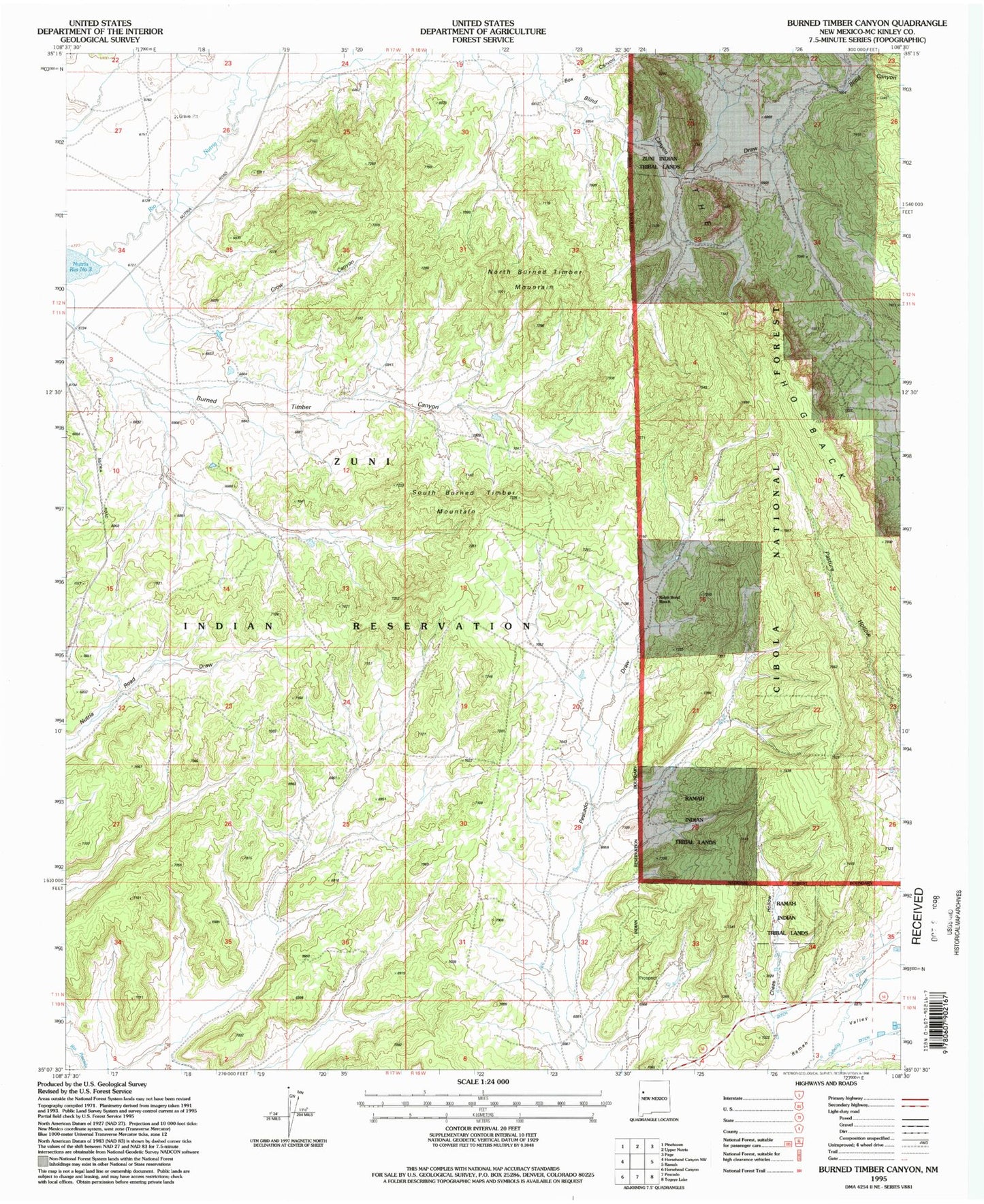
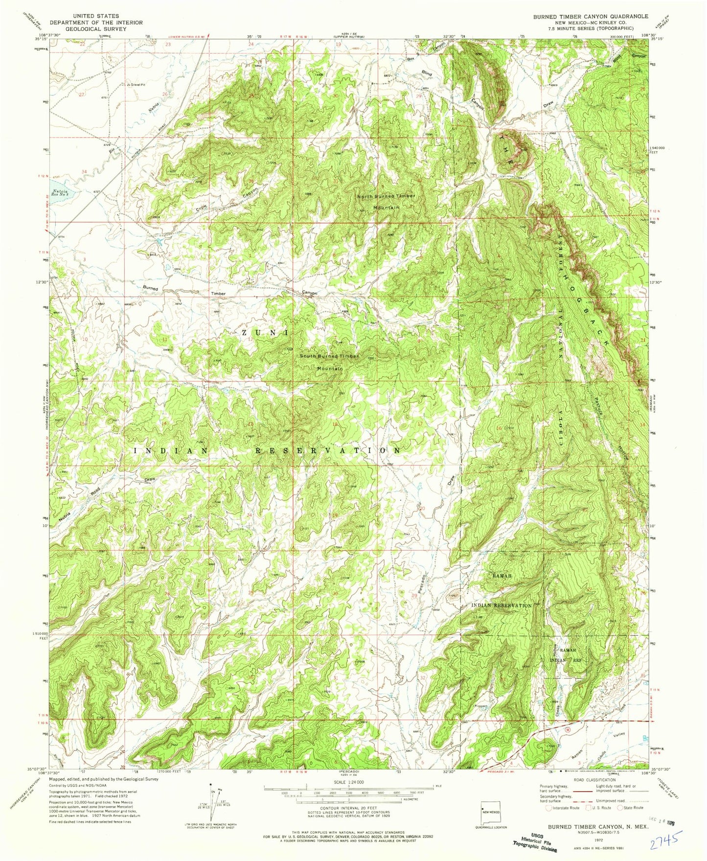
Classic USGS Burned Timber Canyon New Mexico 7.5'x7.5' Topo Map
Regular price
$16.95
Regular price
Sale price
$16.95
Unit price
per
Couldn't load pickup availability
Historical USGS topographic quad map of Burned Timber Canyon in the state of New Mexico. Map scale may vary for some years, but is generally around 1:24,000. Print size is approximately 24" x 27"
This quadrangle is in the following counties: McKinley.
The map contains contour lines, roads, rivers, towns, and lakes. Printed on high-quality waterproof paper with UV fade-resistant inks, and shipped rolled.
Contains the following named places: Blind Canyon, Blind Canyon Draw, Box S Canyon, Chees Hollow, Crow Canyon, North Burned Timber Mountain, Ralph Bond Ranch, Ramah Census Designated Place, Ramah Indian Tribal Lands, South Burned Timber Mountain, Zuni Indian Tribal Lands