MyTopo
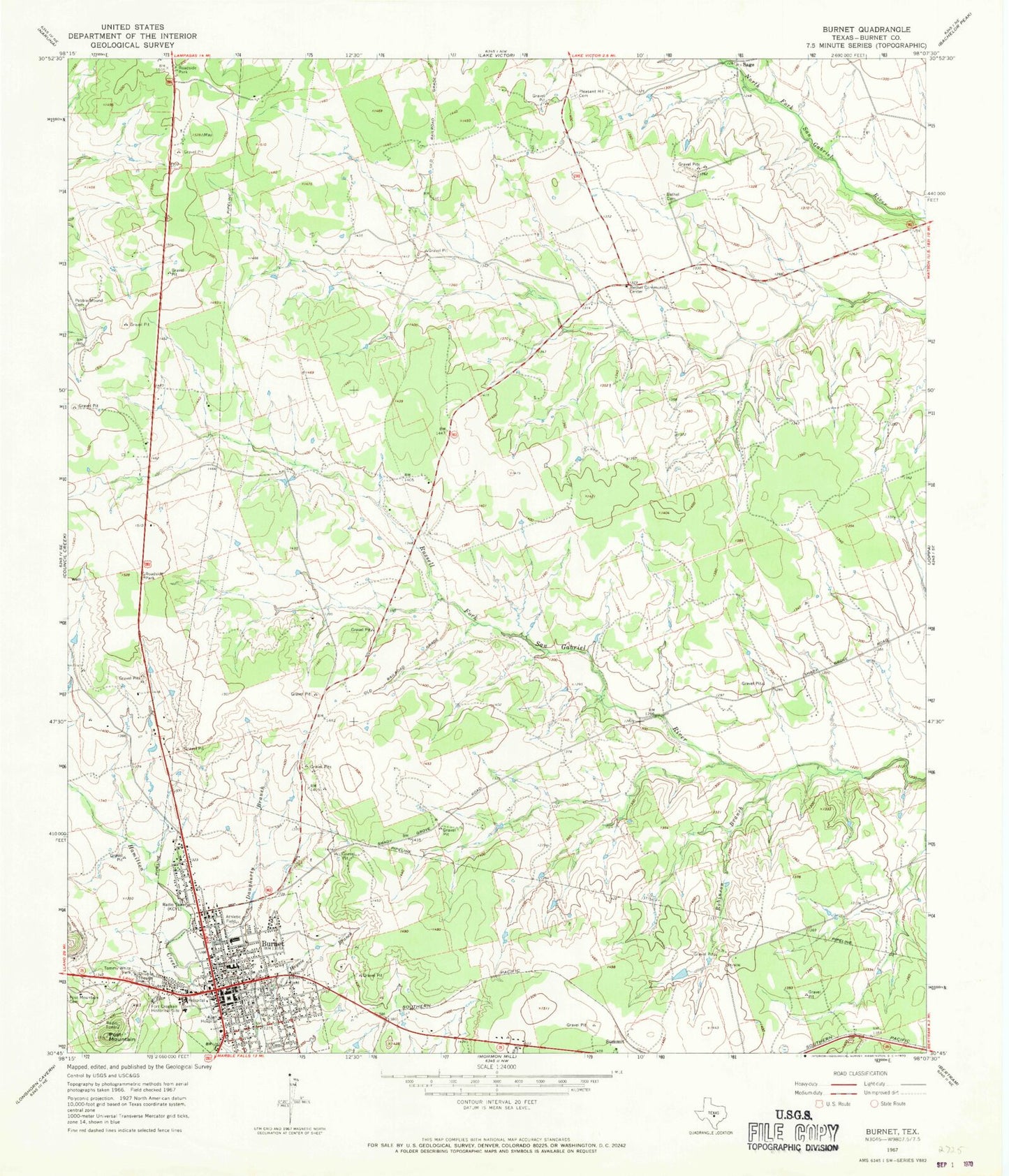
Classic USGS Burnet Texas 7.5'x7.5' Topo Map
Couldn't load pickup availability
Historical USGS topographic quad map of Burnet in the state of Texas. Map scale may vary for some years, but is generally around 1:24,000. Print size is approximately 24" x 27"
This quadrangle is in the following counties: Burnet.
The map contains contour lines, roads, rivers, towns, and lakes. Printed on high-quality waterproof paper with UV fade-resistant inks, and shipped rolled.
Contains the following named places: Allen Hospital, Bethel Cemetery, Bethel Community Center, Burent Middle School, Burnet, Burnet Cemetery, Burnet City Hall, Burnet County, Burnet County Constable's Office Precinct 1, Burnet County Constable's Office Precinct 2, Burnet County Courthouse, Burnet County Sheriff's Office, Burnet Elementary School, Burnet Fire Department, Burnet High School, Burnet Police Department, Burnet Post Office, Church of Christ, Daugherty Branch, Deiterich Ranch Airport, First Baptist Church, Fort Croghan Historical Site, Fort Croghan Museum, Frazier Ranch Cemetery, KHLB-AM (Burnet), Mandaean Cemetery, Odd Fellows Cemetery, Old Burnet Cemetery, Parsonage Baptist Church, Pleasant Hill Cemetery, Post Mountain, QUEST High School, Robinson Branch, Saint Matthew African Methodist Episcopal Church, Stephenville Public Library, Summit, Temple Baptist Church, Tommy White Park, Wallace Riddell Park