MyTopo
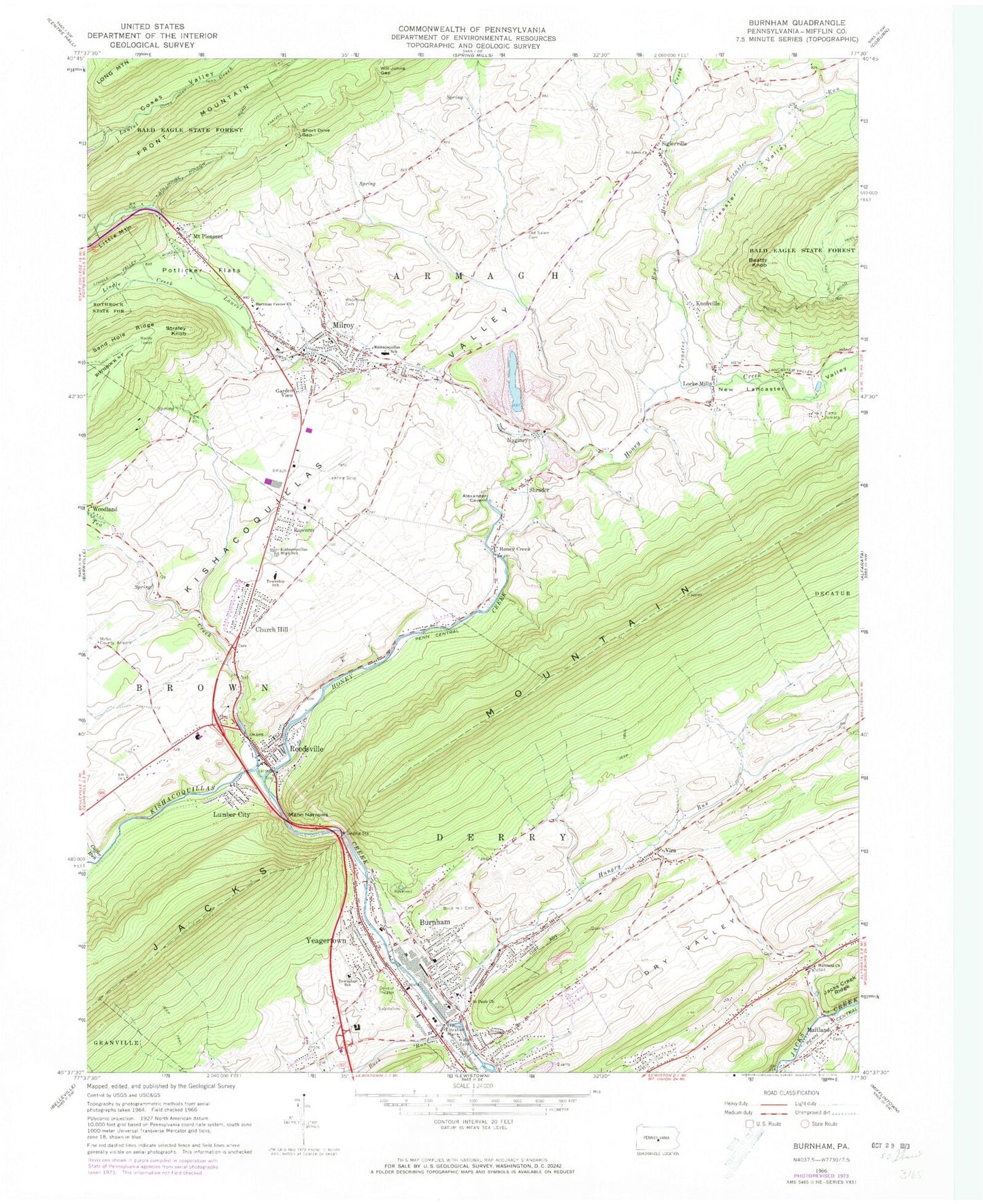
Classic USGS Burnham Pennsylvania 7.5'x7.5' Topo Map
Couldn't load pickup availability
Historical USGS topographic quad map of Burnham in the state of Pennsylvania. Map scale may vary for some years, but is generally around 1:24,000. Print size is approximately 24" x 27"
This quadrangle is in the following counties: Mifflin.
The map contains contour lines, roads, rivers, towns, and lakes. Printed on high-quality waterproof paper with UV fade-resistant inks, and shipped rolled.
Contains the following named places: Armagh Township Elementary School, Back Mountain Road Amish Cemetery, Beatty Knob, Birch Hill Cemetery, Borough of Burnham, Brice School, Brown Township Elementary School, Buck Run, Burnham, Burnham Fire Company - Station 1, Burnham Post Office, Camp Juniata, Church Hill, Church Hill Cemetery, Church Hill Census Designated Place, Coffee Run, Coxes Valley Trail, Damicantonio Family Cemetery, Derry Elementary School, Dry Valley, Early Maitland Brethren Cemetery, East Derry Volunteer Fire Company - Station 2, Garden View, Geisinger Lewistown Hospital, Hartman Center Church, Havice Creek, Honey, Honey Creek, Honey Creek Lime Quarry, Hoopes School, Hungry Run, Kishacoquillas High School, Kishacoquillas School, Knobville, Kratzer Trail, Laurel Creek, Lingle Creek, Little Valley Presbyterian Church Cemetery, Locke Mills, Lockes Bank Evangelical Church Cemetery, Lumber City, Lumber City Census Designated Place, Maitland, Maitland Brethren Cemetery, Maitland Church, Maitland Community Cemetery, Mammoth Spring, Mann Narrows, McCardle Farm Airport, McNitt School, Mifflin County Regional Police Station, Milroy, Milroy Census Designated Place, Milroy Hose Company Station 7, Milroy Post Office, Milroy Presbyterian Cemetery, Mount Pleasant, Mount Pleasant Census Designated Place, Naginey, New Lancaster Valley, Old Salem Cemetery, Potlicker Flats, Potlicker Flats Census Designated Place, Reedsville, Reedsville Census Designated Place, Reedsville Post Office, Reedsville Volunteer Fire Company Station 6, Roseann, Ruble Swartzell Cemetery, Saint Johns Church, Saint Pauls Church, Short Drive Gap, Shrader, Siglerville, Siglerville Census Designated Place, Straley Knob, Tea Creek, Township of Derry, Treaster Run, Treaster Valley, Vira, Vira Methodist Church Cemetery, Will Johns Gap, Woodland, Woodlawn Cemetery, Yeagertown, Yeagertown Census Designated Place, Yeagertown Fire Company Station 3, Yeagertown Lutheran Cemetery, Yeagertown Post Office, ZIP Codes: 17009, 17099