MyTopo
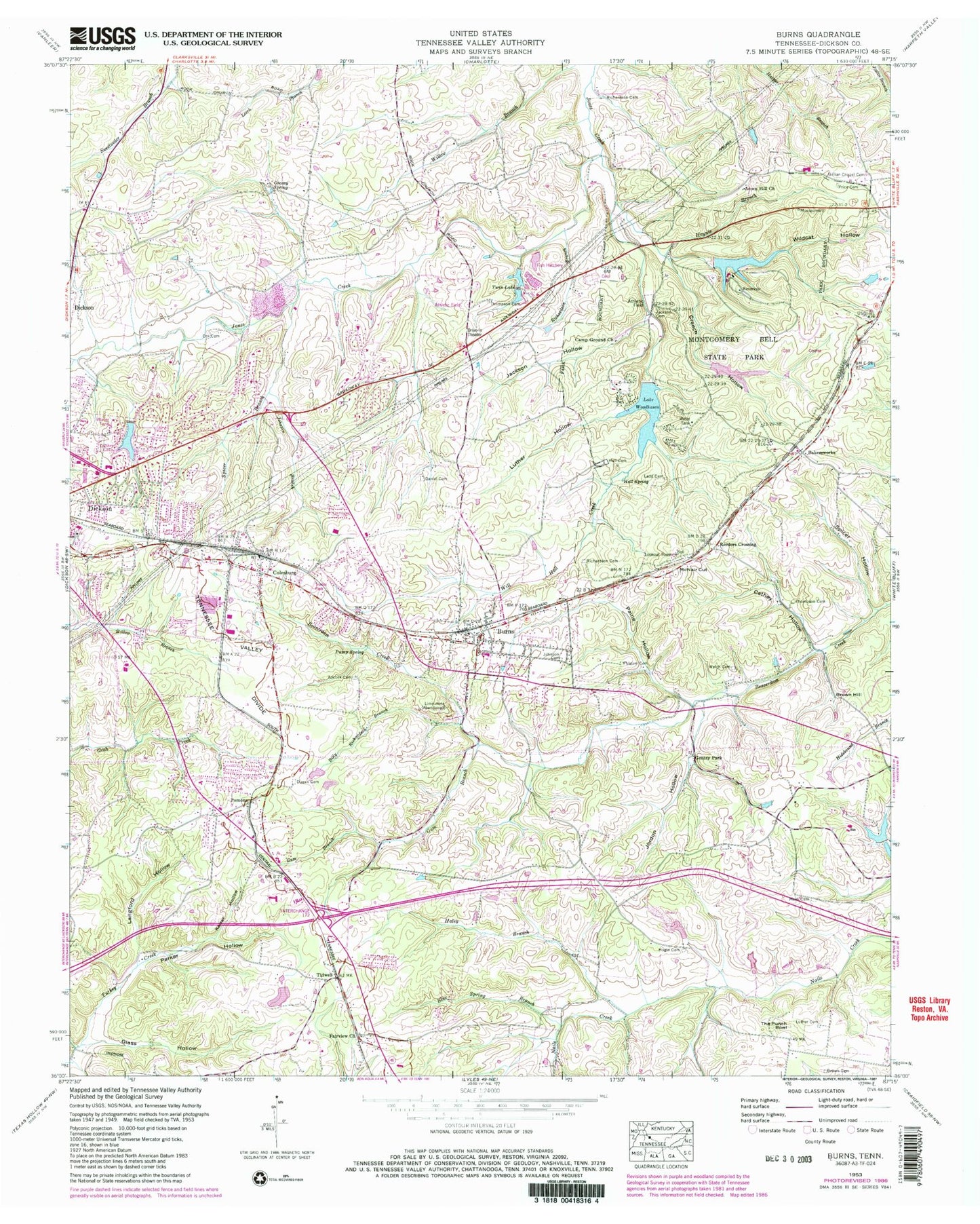
Classic USGS Burns Tennessee 7.5'x7.5' Topo Map
Couldn't load pickup availability
Historical USGS topographic quad map of Burns in the state of Tennessee. Typical map scale is 1:24,000, but may vary for certain years, if available. Print size: 24" x 27"
This quadrangle is in the following counties: Dickson.
The map contains contour lines, roads, rivers, towns, and lakes. Printed on high-quality waterproof paper with UV fade-resistant inks, and shipped rolled.
Contains the following named places: Spicer Branch, Spicer Hollow, The Punch Bowl, Thompson Cemetery, Thompson Cemetery, Twin Lake, Welch Cemetery, Wildcat Hollow, Lake Woodhaven, Adcock Cemetery, Billy Richardson Branch, Blue Spring Branch, Brown Cemetery, Brown Hill, Cathey Hollow, Cox Cemetery, Creech Hollow, Daniel Cemetery, Dugan Cemetery, Gentry Park, Glass Hollow, Grassy Spring, Gum Branch, Haley Branch, Hall Cemetery, Hall Spring, Haynie Branch, Hogin Cemetery, Jackson Cemetery, Jackson Hollow, Johnson Branch, Johnson Cemetery, Jordon Hollow, Kaiser Hollow, Ladd Cemetery, Luther Cemetery, Luther Hollow, Luther Lake, Meeks Cemetery, Montgomery Bell State Park, Paine Hollow, Parker Hollow, Price Cemetery, Pump Spring, Reeders Crossing, Richardson Branch, Richardson Cemetery, Richardson Cemetery, Craig Lake Number Two, Craig Lake Dam Number Two, Luther Lake Number Two Dam, Luther Lake Number Two, Luther Lake Number Four Dam, Luther Lake Number Four, Luther Lake Dam Number One, Creech Hollow Lake, Creech Hollow Lake Dam, Acorn Lake Dam, Acorn Lake, John Duke Lake Dam, John Duke Lake, Tidwell, Will Hall Creek, Acorn Hill Church, Bakersworks, Burns, Camp Ground Church, Colesburg, Fairview Baptist Church, Fulgum Cemetery, Gillian Chapel Cemetery, Langford Hollow, McNair Cut, Pomona, Woodhaven Lake Dam, Acorn Hill, Bakers School (historical), Burns Elementary School, Colesburg Church of Christ, Colesburg School (historical), Dickson County Industrial Park, Duke Quarry, Dukes Mill (historical), East Side High School (historical), Eastside Baptist Church, Fairview School (historical), Faith Freewill Baptist Church, Gilliland Chapel (historical), Happy Valley School (historical), Herbertson School (historical), Hoover Quarry, Laurel Furnace (historical), Laurel Furnace Mines, Marvins Chapel (historical), Montgomery Bell Ore Banks, Old Ball Station (historical), Pomona Baptist Church, Pomona Church of Christ, Tidwell School (historical), WDKN-AM (Dickson), WTNQ-FM (Dickson), East Side, Gentrys Branch, Wolfden Branch, Burns-White Bluff Division (historical), Burns Post Office, City of Dickson, Town of Burns, Commissioner District 10, Commissioner District 11, Commissioner District 6, Commissioner District 7, Broadway Drive-In, Burns Fire Department, Dickson Fire Department Station 2, First Call Ambulance Service Dickson, Burns Police Department