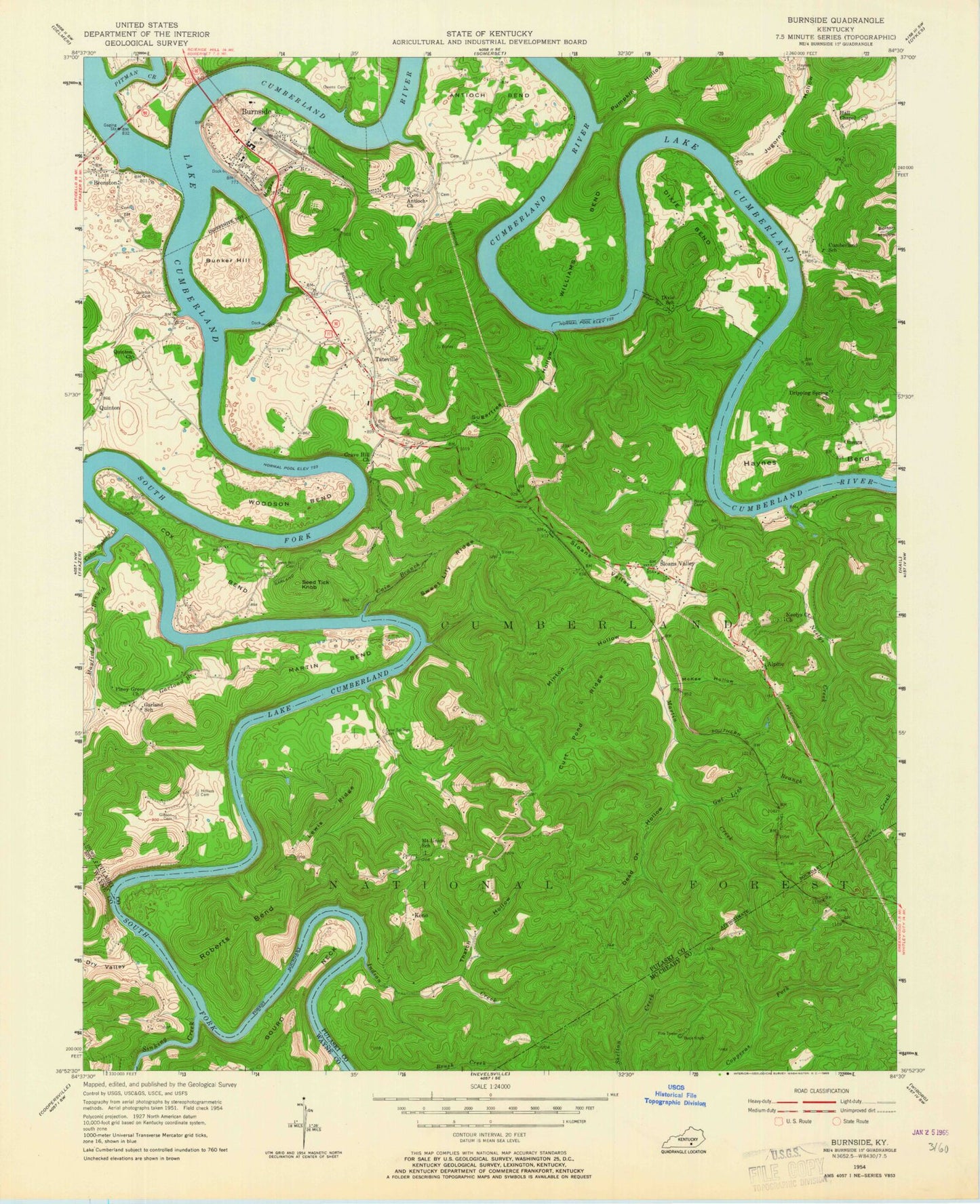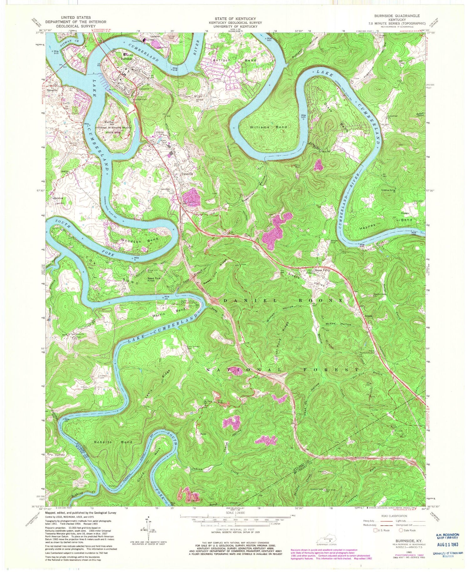

MyTopo
Classic USGS Burnside Kentucky 7.5'x7.5' Topo Map
Couldn't load pickup availability
Historical USGS topographic quad map of Burnside in the state of Kentucky. Map scale is 1:24000. Print size is approximately 24" x 27"
This quadrangle is in the following counties: McCreary, Pulaski, Wayne.
The map contains contour lines, roads, rivers, towns, and lakes. Printed on high-quality waterproof paper with UV fade-resistant inks, and shipped rolled.
Contains the following named places: Alpine, Alpine Recreation Area, Antioch Bend, Antioch Church, Baker Spring Creek, Big South Fork Cumberland River, Bronston, Bronston Fire Department, Bunker Hill, Burnside, Burnside Division, Burnside Fire Department, Burnside Police Department, Burnside Post Office, Cain Branch, Camp Burnside Historical Marker, Camp Burnside Historical Marker, Cave Springs Cemetery, Cedar Sinking Creek, Cox Bend, Cumberland Church, Curt Pond Ridge, Dead Ox Hollow, Deep Hollow, Dixie Bend, Dixie School, Drippling Spring Church, Dry Valley, First Boy Scout Troop Historical Marker, Garland Branch, Garland School, General Burnside Island State Park, Gibson Cemetery, Gourd Cemetery, Gourd Neck, Grave Hill Church, Gut Lick Branch, Hall Chapel, Hamilton Cemetery, Harriet Simpson Arnow Historical Marker, Hayes Branch, Haynes Bend, Haynes Cemetery, Hollars Cemetery, Indian Creek, John Sherman Cooper Power Plant, Jugornot Hollow, Keith Post Office (historical), Keno, Lewis Ridge, Maces Ferry (historical), Martin Bend, Martin Creek, Mayfield Branch, Mayfield Cemetery, McKee Hollow, Minton Hollow, Mount Union Baptist Church Cemetery, Mount Union School, Neelys Cemetery, Neelys Creek, Neelys Creek Church, Old Alpine Railroad Station (historical), Old Grave Hill Cemetery, Old Tateville Cemetery, Omega, Owens Cemetery, Piney Grove Church, Pitman Creek, Pumpkin Hollow, Quinton Cemetery, Quinton Church, Roberts Bend, Roberts Mill (historical), Seed Tick Knob, Sinking Creek, Sloans Valley, Sloans Valley, Sloans Valley Railroad Station (historical), Sugartree Hollow, Sweet Lily Ridge, Tateville, Tateville Railroad Station (historical), Tateville Volunteer Fire Department, Thatch Hollow, Williams Bend, Woodson Bend, Woodson Bend Resort, WSEK-FM (Somerset)