MyTopo
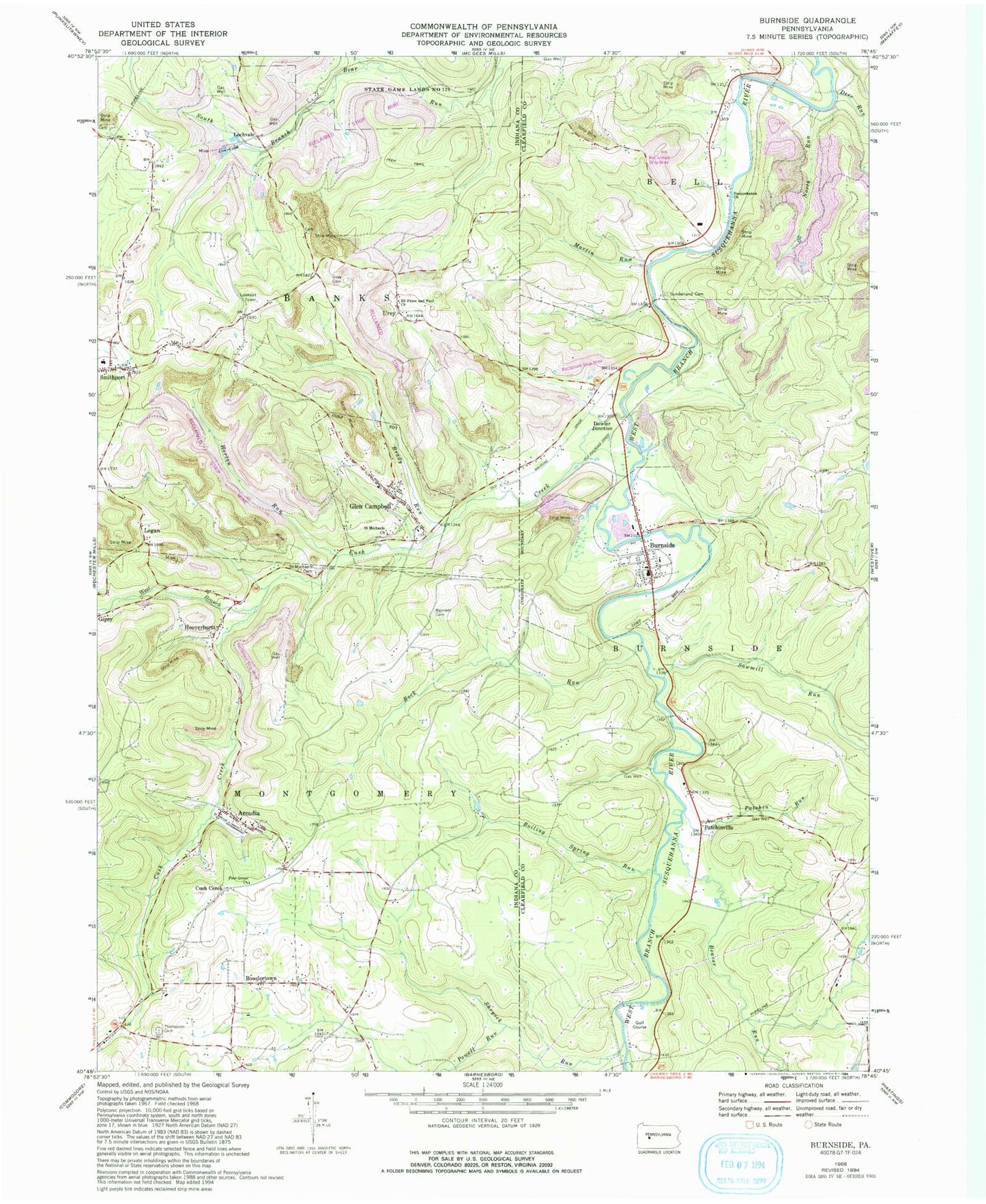
Classic USGS Burnside Pennsylvania 7.5'x7.5' Topo Map
Couldn't load pickup availability
Historical USGS topographic quad map of Burnside in the state of Pennsylvania. Map scale may vary for some years, but is generally around 1:24,000. Print size is approximately 24" x 27"
This quadrangle is in the following counties: Clearfield, Indiana.
The map contains contour lines, roads, rivers, towns, and lakes. Printed on high-quality waterproof paper with UV fade-resistant inks, and shipped rolled.
Contains the following named places: Arcadia, Arcadia Post Office, Beaver Run, Boiling Spring Run, Borough of Burnside, Borough of Glen Campbell, Bowdertown, Brady Run, Brickell Cemetery, Burnside, Burnside Cemetery, Chetremon Golf Course, Crossroads School, Cush, Cush Creek, Cush Creek Junction, Cush Creek School, Deer Run, Dowler Junction, Elk Lick Run, Elklick School, Gardner - Bennett Cemetery, Glen Campbell, Glen Campbell Fire Tower, Glen Campbell Post Office, Glen Campbell Volunteer Fire Department - Station 170, Graham Cemetery, Henry Cemetery, Hooverhurst, Horton Run, Lochvale, Logan, Martin Run, Mount Airie, North Run, Patchin Run, Patchinville, Patchinville Cemetery, Peles Cemetery, Pine Grove Church, Pine Grove School, Powell Run, Raytown, Ridge, Rock Run, Rock Run School, Rowley School, Saint Michaels Cemetery, Saint Michaels Church, Saints Peter and Paul Church, Sawmill Run, Sentry Volunteer Fire Company Station 64, Shryock Run, Smithville, Sunderland Cemetery, Susquehanna Church, Thompson Cemetery, Township of Banks, Township of Burnside, Township of Montgomery, United Brethren in Christ Church Cemetery, Urey, Urey Cemetery, West Branch Cush Creek, ZIP Codes: 15712, 15721, 15742