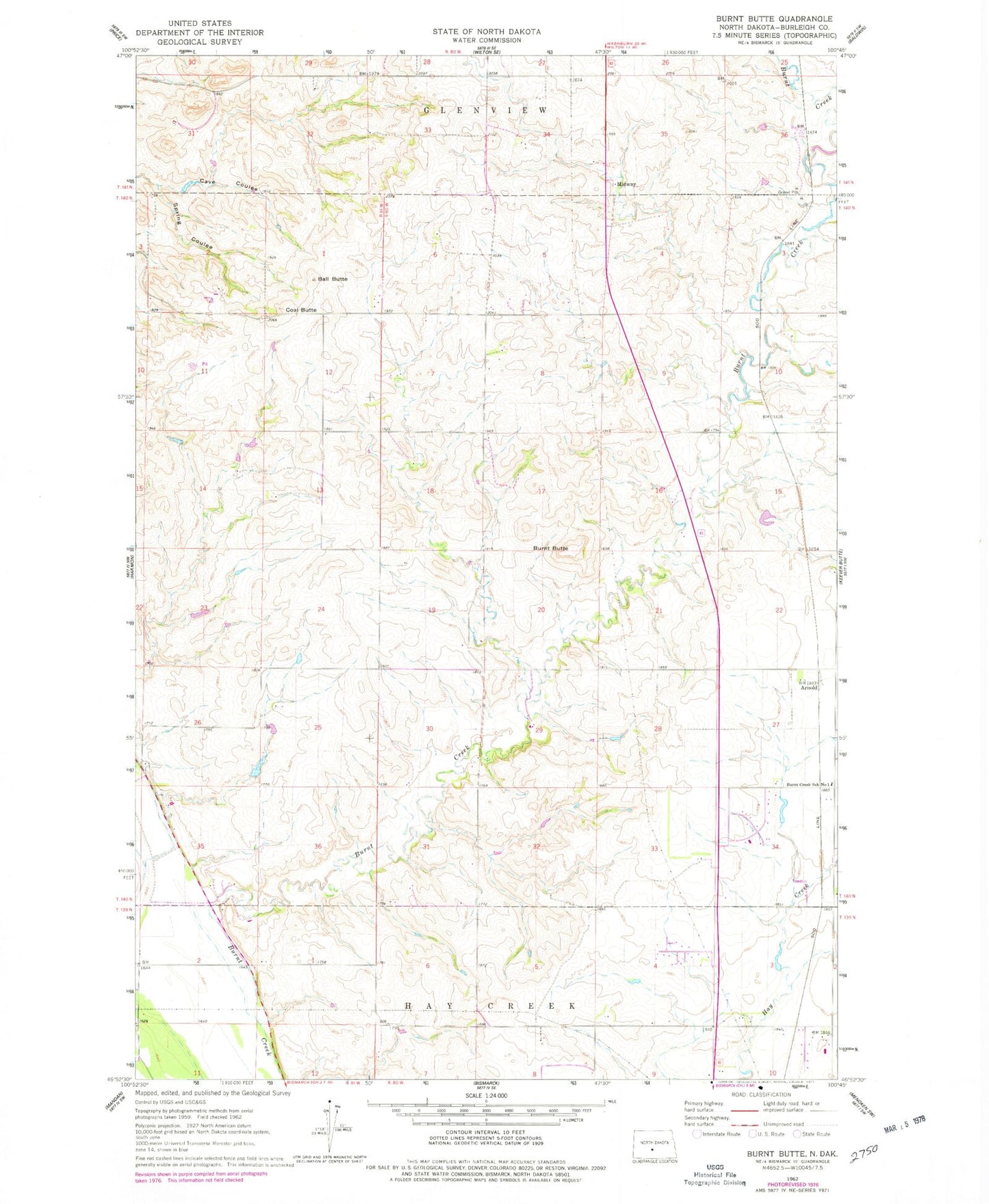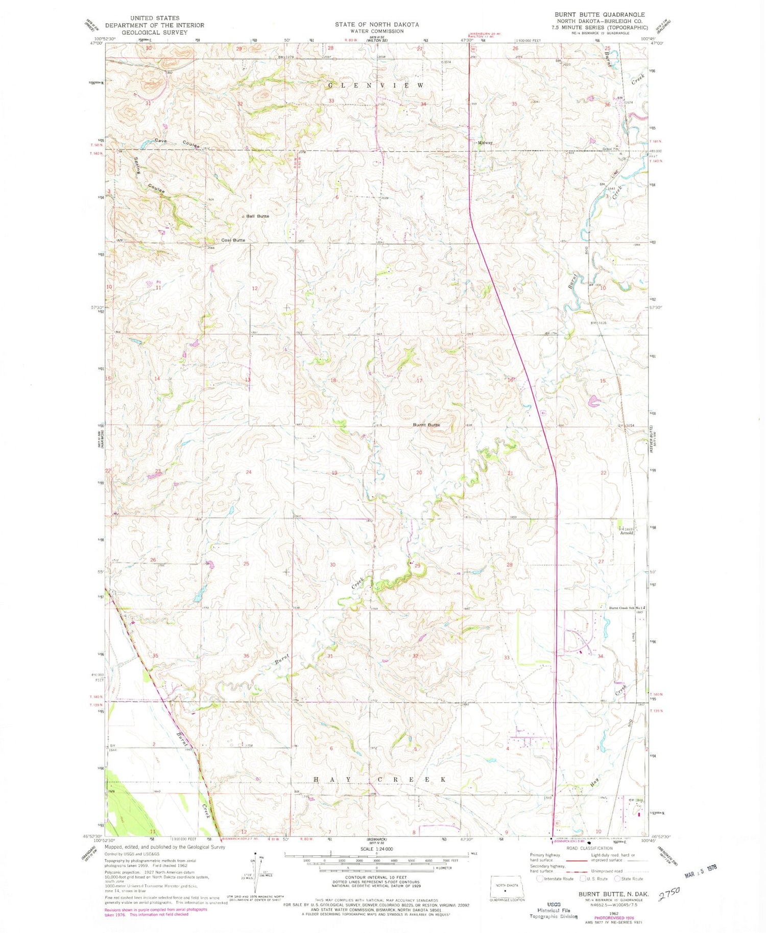
MyTopo
Classic USGS Burnt Butte North Dakota 7.5'x7.5' Topo Map
Couldn't load pickup availability
Historical USGS topographic quad map of Burnt Butte in the state of North Dakota. Map scale may vary for some years, but is generally around 1:24,000. Print size is approximately 24" x 27"
This quadrangle is in the following counties: Burleigh.
The map contains contour lines, roads, rivers, towns, and lakes. Printed on high-quality waterproof paper with UV fade-resistant inks, and shipped rolled.
Contains the following named places: Arnold, Brentwood Adventist Christian School, Burnt Butte, Burnt Creek School Number 1, Cave Coulee, Coal Butte, KBMR-AM (Bismarck), Kinnischtzke Airfield, Midway, Spring Coulee, Unorganized Territory of Burnt Creek-Riverview, Unorganized Territory of West Burleigh, ZIP Code: 58503