MyTopo
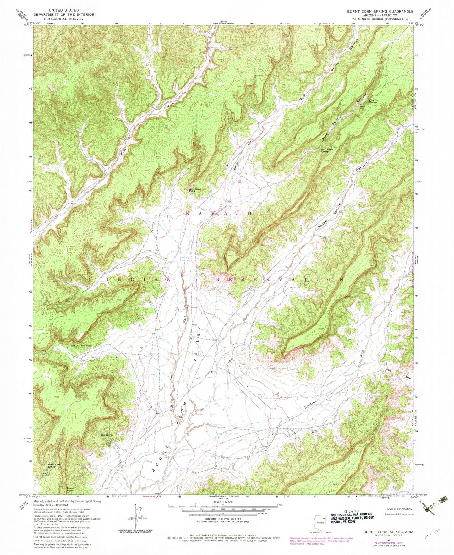
Classic USGS Burnt Corn Spring Arizona 7.5'x7.5' Topo Map
Regular price
$16.95
Regular price
Sale price
$16.95
Unit price
per
Couldn't load pickup availability
Historical USGS topographic quad map of Burnt Corn Spring in the state of Arizona. Map scale may vary for some years, but is generally around 1:24,000. Print size is approximately 24" x 27"
This quadrangle is in the following counties: Apache, Navajo.
The map contains contour lines, roads, rivers, towns, and lakes. Printed on high-quality waterproof paper with UV fade-resistant inks, and shipped rolled.
Contains the following named places: Blue Gap, Burnt Corn, Burnt Corn Spring, Devils Canyon, Donkey Spring Canyon, Pine Spring, Pine Spring Canyon, Ramhead Wash, Salt Water Spring, Teadepahto Spring, Toh De Coz, Toh Ha Tsil Dize, Tohadistoa Spring, Wind Rock Point