MyTopo
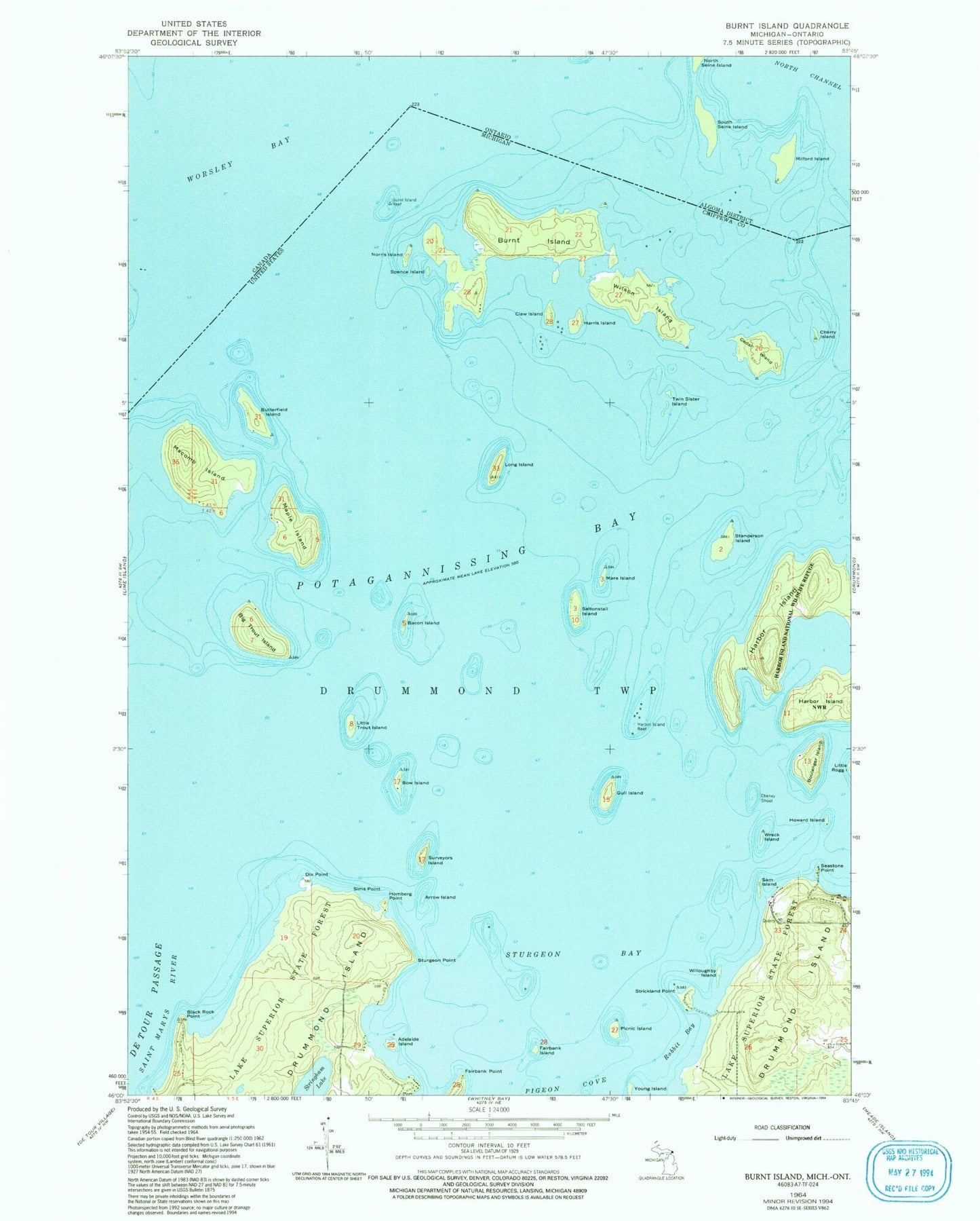
Classic USGS Burnt Island Michigan 7.5'x7.5' Topo Map
Couldn't load pickup availability
Historical USGS topographic quad map of Burnt Island in the state of Michigan. Typical map scale is 1:24,000, but may vary for certain years, if available. Print size: 24" x 27"
This quadrangle is in the following counties: Chippewa.
The map contains contour lines, roads, rivers, towns, and lakes. Printed on high-quality waterproof paper with UV fade-resistant inks, and shipped rolled.
Contains the following named places: Adelaide Island, Arrow Island, Bacon Island, Big Trout Island, Black Rock Point, Boulanger Island, Bow Island, Burnt Island, Burnt Island Reef, Butterfield Island, Cedar Island, Cheney Shoal, Cherry Island, Claw Island, Dix Point, Fairbank Island, Gull Island, Harbor Island, Harbor Island Reef, Harris Island, Homberg Point, Howard Island, Little Trout Island, Long Island, Macomb Island, Maple Island, Mare Island, Norris Island, Picnic Island, Potagannissing Bay, Rabbit Bay, Saltonstall Island, Sam Island, Seastone Point, Sims Point, Spence Island, Standerson Island, Strickland Point, Stringham Lake, Sturgeon Bay, Sturgeon Point, Twin Sister Island, Willoughby Island, Wilson Island, Wreck Island, Young Island, Nate's Marina, Surveyors Island, Harbor Island National Wildlife Refuge