MyTopo
Classic USGS Burnt Strip Mountain Idaho 7.5'x7.5' Topo Map
Regular price
$16.95
Regular price
Sale price
$16.95
Unit price
per
Couldn't load pickup availability
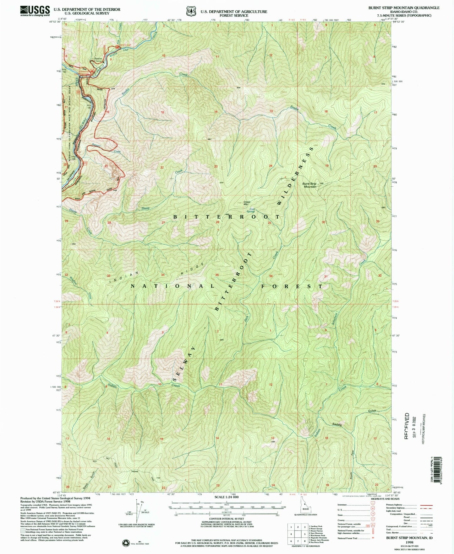
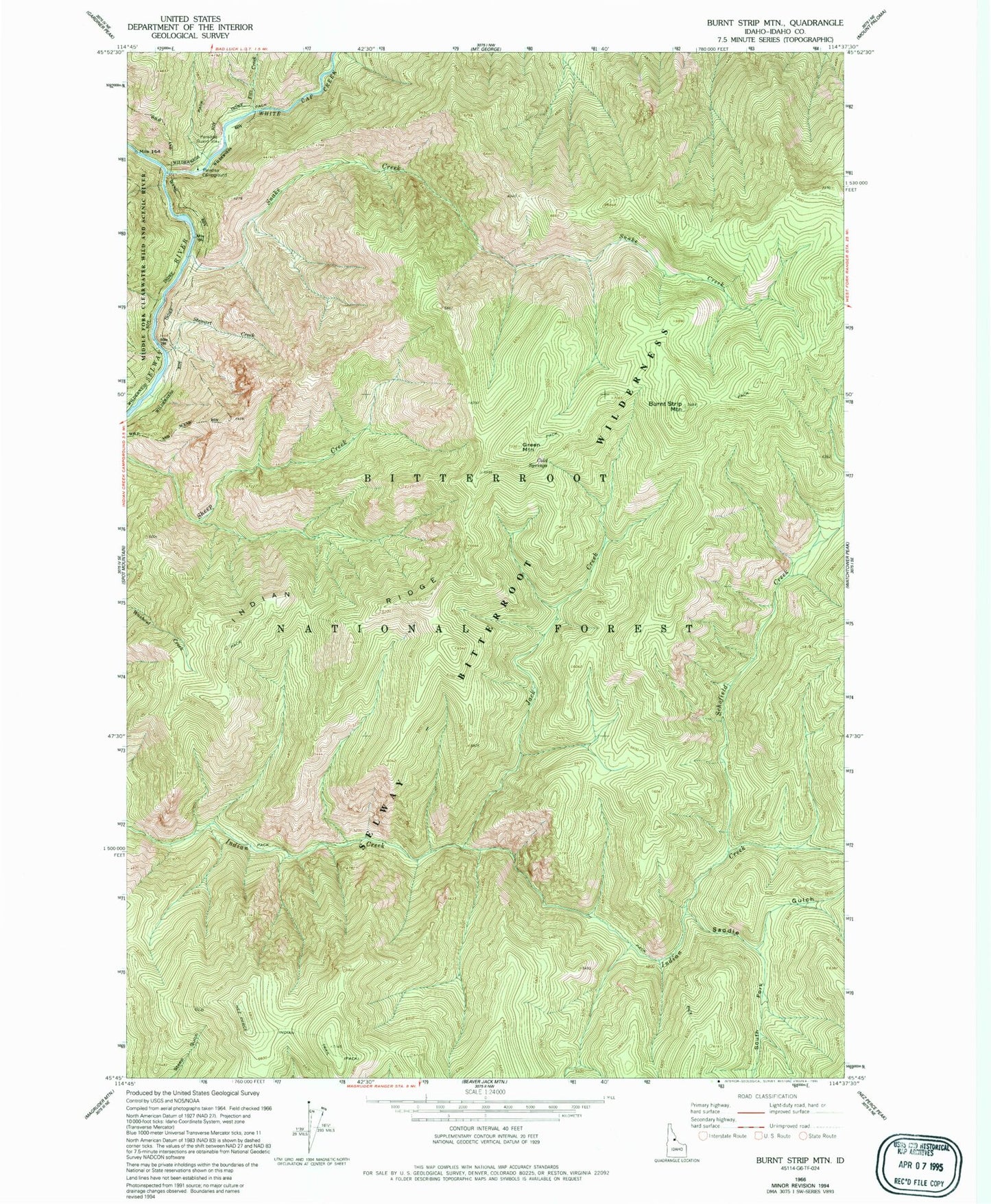
Historical USGS topographic quad map of Burnt Strip Mountain in the state of Idaho. Map scale is 1:24000. Print size is approximately 24" x 27"
This quadrangle is in the following counties: Idaho.
The map contains contour lines, roads, rivers, towns, and lakes. Printed on high-quality waterproof paper with UV fade-resistant inks, and shipped rolled.
Contains the following named places: Burnt Strip Mountain, Cold Springs, Fitz Creek, Green Mountain, Indian Ridge, Jack Creek, Paradise Campground, Paradise Guard Station, Saddle Gulch, Schofield Creek, Snake Creek, South Fork Saddle Gulch, Stewart Creek, White Cap Creek, White Cap Trailhead