MyTopo
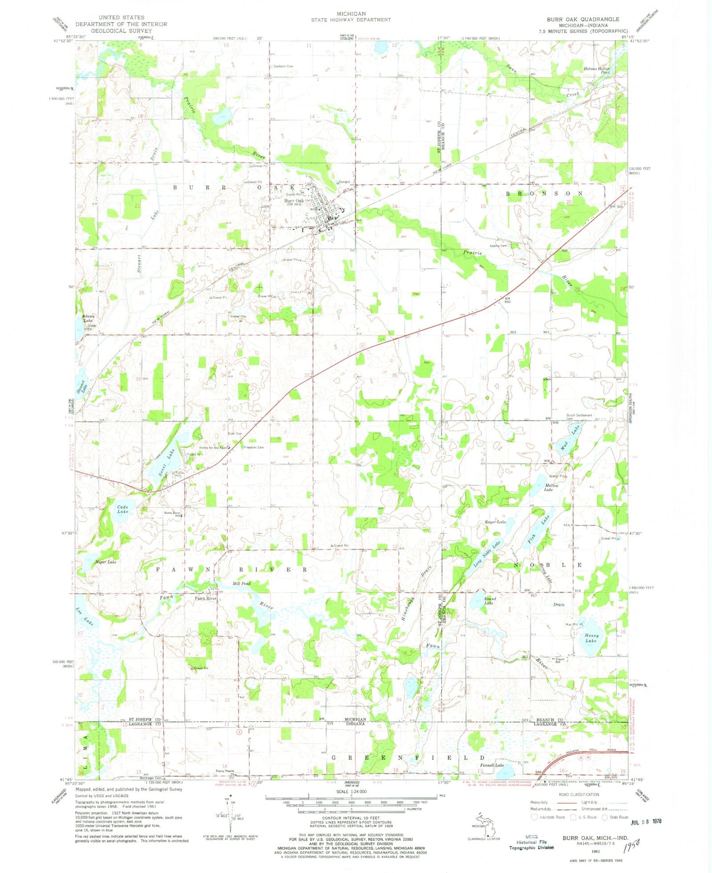
Classic USGS Burr Oak Michigan 7.5'x7.5' Topo Map
Couldn't load pickup availability
Historical USGS topographic quad map of Burr Oak in the states of Michigan, Indiana. Map scale may vary for some years, but is generally around 1:24,000. Print size is approximately 24" x 27"
This quadrangle is in the following counties: Branch, LaGrange, St. Joseph.
The map contains contour lines, roads, rivers, towns, and lakes. Printed on high-quality waterproof paper with UV fade-resistant inks, and shipped rolled.
Contains the following named places: Adams Cemetery, Adams Lake, Blair Airport, Bontrager Cemetery, Bordner Farms, Burr Oak, Burr Oak Community Schools, Burr Oak Fire Department, Burr Oak Missionary Church, Burr Oak Police Department, Burr Oak Post Office, Burr Oak Public Library, Burr Oak Station, Burr Oak Township Cemetery, Burr Oak Township Hall, Burrows Post Office, Cade Lake, Cade Lake County Park, Dark Lake, Dutch Settlement Cemetery, Farview Farm, Fawn River, Fawn River Post Office, Fawn River School, Fawn River Township Cemetery, Fennell Lake, Fish Lake, Freedom Cemetery, Freedom Hills Golf Course, Himebaugh Drain, Holmes Hollow Pond, Honey Lake, Honey Lake Drain, Lee Lake, Long Noble Lake, Mallow Lake, Mill Pond, Mud Lake, Pretty Prairie Church, Round Lake, Royer Lake, Saint John's Evangelical Lutheran Church, Saint Joseph County Infirmary Cemetery, Sanborn Cemetery, Stewart Lake, Stewart Lake Drain, Sweet Lake, Sweet Lake Mobile Home Park, Township of Burr Oak, Township of Fawn River, Trayer Cemetery, Trayer School, Tri Pine Farm, United Methodist Church, Village of Burr Oak, ZIP Code: 49030