MyTopo
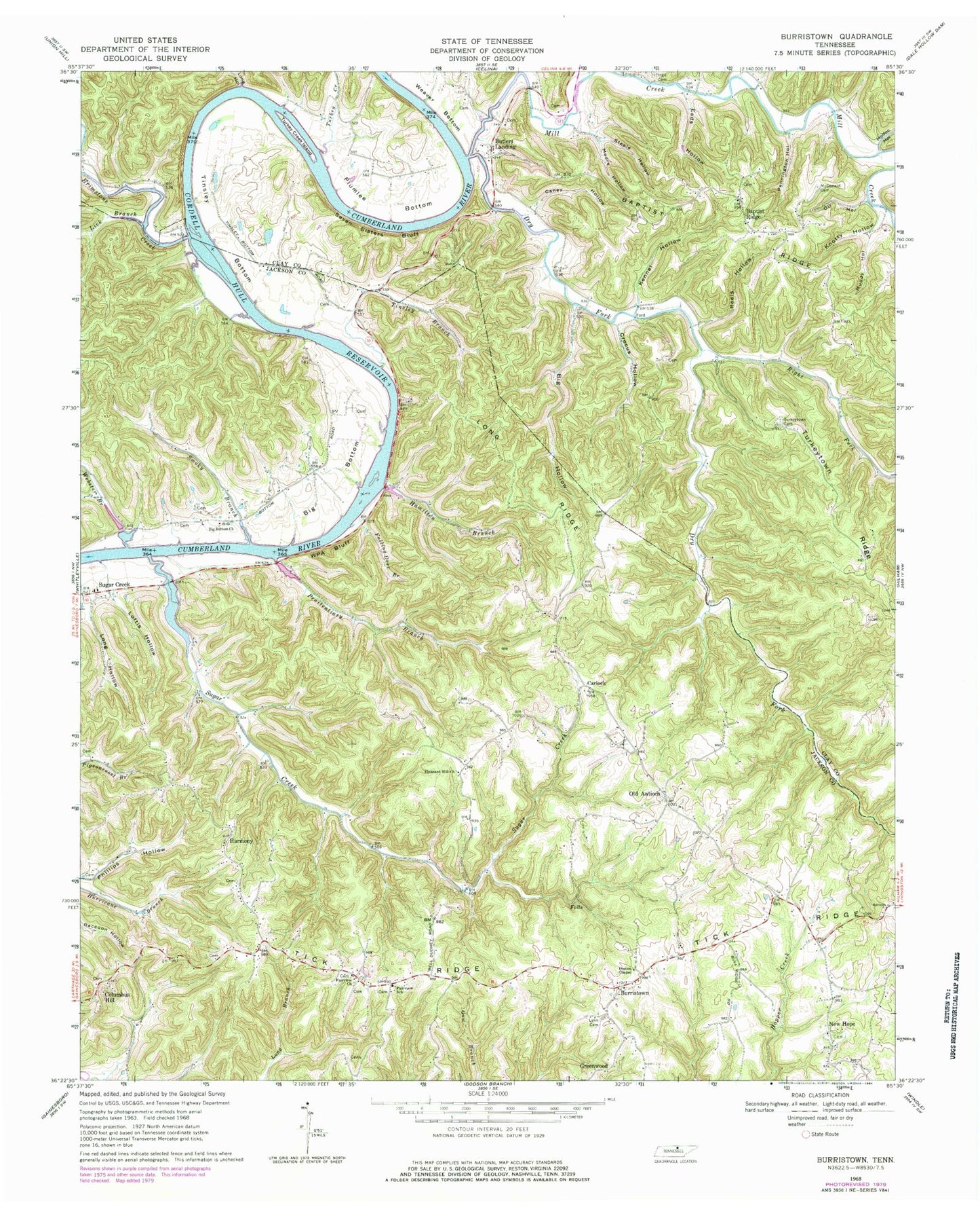
Classic USGS Burristown Tennessee 7.5'x7.5' Topo Map
Couldn't load pickup availability
Historical USGS topographic quad map of Burristown in the state of Tennessee. Map scale may vary for some years, but is generally around 1:24,000. Print size is approximately 24" x 27"
This quadrangle is in the following counties: Clay, Jackson.
The map contains contour lines, roads, rivers, towns, and lakes. Printed on high-quality waterproof paper with UV fade-resistant inks, and shipped rolled.
Contains the following named places: Antioch School, Baptist Ridge, Baptist Ridge Baptist Church, Baptist Ridge School, Baptist Ridge Volunteer Fire Department, Big Bottom, Big Bottom Church, Big Bottom School, Big Hollow, Brimstone Creek, Brimstone Island, Burchard Branch, Burristown, Burristown Division, Butlers Ferry, Butlers Landing, Butlers Landing Church of Christ, Butlers Landing School, Caney Hollow, Carlock, Columbus Hill, Columbus Hill School, Commissioner District 2, Crocus Hollow, Dry Fork, Dry Fork Church, Dry Fork School, Eads Hollow, Fairview Church, Fairview School, Fairview Volunteer Fire Department, Falling Over Branch, Floating Mill Island, Greenwood, Greenwood School, Hall Cemetery, Halls Landing, Hamilton Branch, Harmony, Hicks Ferry, Kennel Hollow, Knotty Hollow, Lick Branch, Lick School, Loftis Hollow, Long Branch, Long Hollow, Long Ridge, Lynn Cemetery, McDonald Cemetery, Mercer Hollow, Mill Creek, Modoc Hollow, Moore Hollow, Muddy Hollow, New Hope, New Hope Church, New Hope School, Oak Grove Church of Christ, Oil Hollow, Old Antioch, Old Antioch School, Pendleton Hollow, Penitentiary Branch, Pennington Hollow, Pharris Chapel, Phillips Hollow, Pigg Cemetery, Pleasant Hill Cemetery, Pleasant Hill Church, Pleasant Hill School, Plumlee Bottom, Poston Chapel, Reels Hollow, Right Fork Dry Fork, Rose Bar, Rose Shoals, Scantlin Island, Seven Sisters Bluff, Smoky Branch, Stacy Ridge, Steele Hollow, Sugar Creek, Sugar Creek School, Tick Ridge, Tinsley Bottom, Tinsley Branch, Tinsleys Bottom Church of Christ, Tinsleys Bottom School, Turkey Creek, Turkey Creek Island, Turkey Creek School, Turkeytown, Turkeytown Cemetery, Turkeytown Ridge, Webster Branch, Wpa Bluff