MyTopo
Classic USGS Burro Mesa Arizona 7.5'x7.5' Topo Map
Couldn't load pickup availability
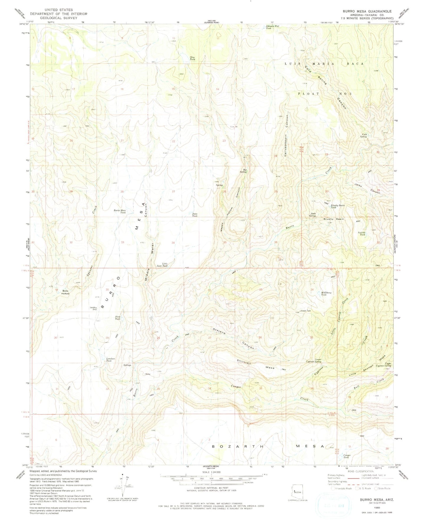
Historical USGS topographic quad map of Burro Mesa in the state of Arizona. Map scale may vary for some years, but is generally around 1:24,000. Print size is approximately 24" x 27"
This quadrangle is in the following counties: Yavapai.
The map contains contour lines, roads, rivers, towns, and lakes. Printed on high-quality waterproof paper with UV fade-resistant inks, and shipped rolled.
Contains the following named places: Big Spring, Bolix Hollow, Brushy Basin, Brushy Basin Tank, Bull Creek, Burro Mesa, Burro Mesa Dam, Burro Mesa Tank, Cold Spring, Cold Spring Canyon, Conger Creek, Conger Dam, Conger Tank, Cypress Creek, First Tank, Happy Hollow Canyon, Hellzapoppin Canyon, Hellzapoppin Creek, Jerky Canyon, Johnson Flat Tank, Juan Tank, Little Cypress Creek, Little Juan Tank, Lovelace Tank, McElheny Tank, Middle Water Canyon, Oley Tank, Orejans Canyon, Scratch Canyon, Shirttail Mesa, Soda Spring, Suicide Tank, Upper Cypress Spring