MyTopo
Classic USGS Burrows Indiana 7.5'x7.5' Topo Map
Couldn't load pickup availability
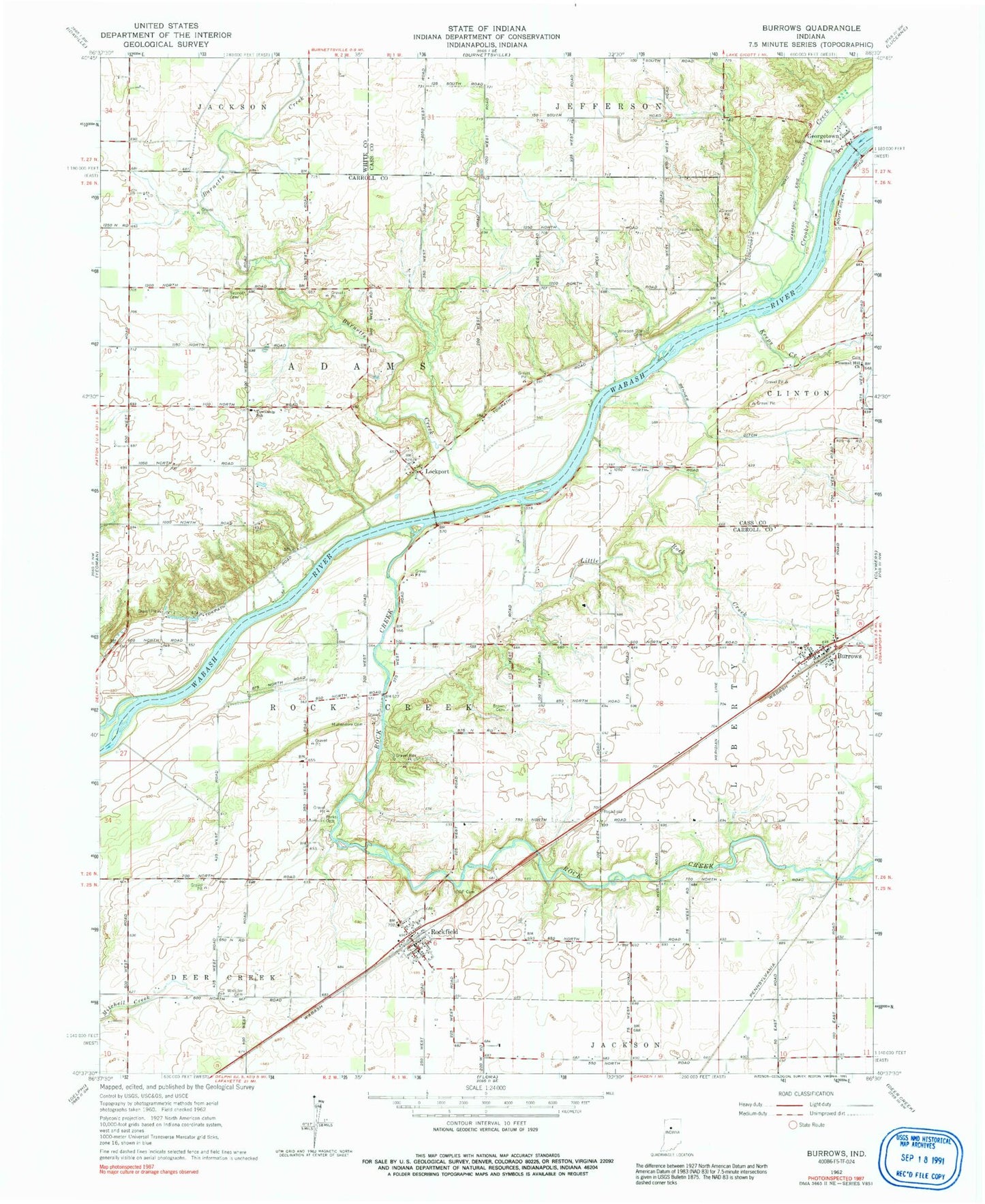
Historical USGS topographic quad map of Burrows in the state of Indiana. Map scale may vary for some years, but is generally around 1:24,000. Print size is approximately 24" x 27"
This quadrangle is in the following counties: Carroll, Cass, White.
The map contains contour lines, roads, rivers, towns, and lakes. Printed on high-quality waterproof paper with UV fade-resistant inks, and shipped rolled.
Contains the following named places: Benner Ditch, Brown Church Cemetery, Burnetts Creek, Burrows, Burrows Census Designated Place, Burrows Fire Department, Burrows Post Office, Crooked Creek, Flax, Georgetown, Georgetown Volunteer Fire Department, Great Eastern Cemetery, Independent Order of Odd Fellows Cemetery, Johnson City Cemetery, Keeps Creek, Little Rock Creek, Lockport, Mullendore Cemetery, Parks - Groninger Cemetery, Pleasant Hill Church, Rattlesnake Creek, Rock Creek, Rockfield, Rockfield Census Designated Place, Rockfield Fire Department, Seceder Cemetery, Shafer Cemetery, Township of Adams, Township of Liberty, Township of Rock Creek, Whistler Cemetery