MyTopo
Classic USGS Burt Lake Michigan 7.5'x7.5' Topo Map
Couldn't load pickup availability
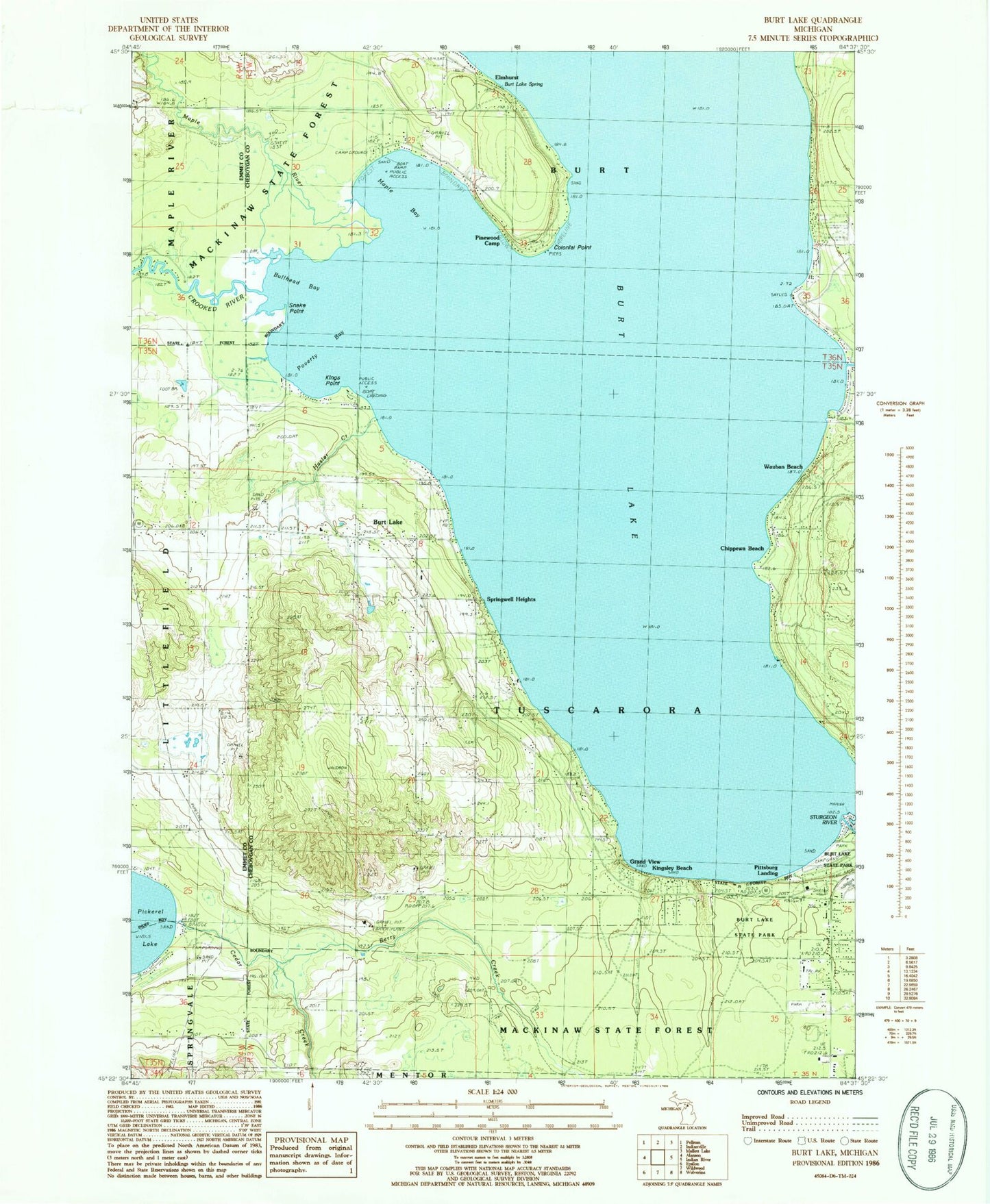
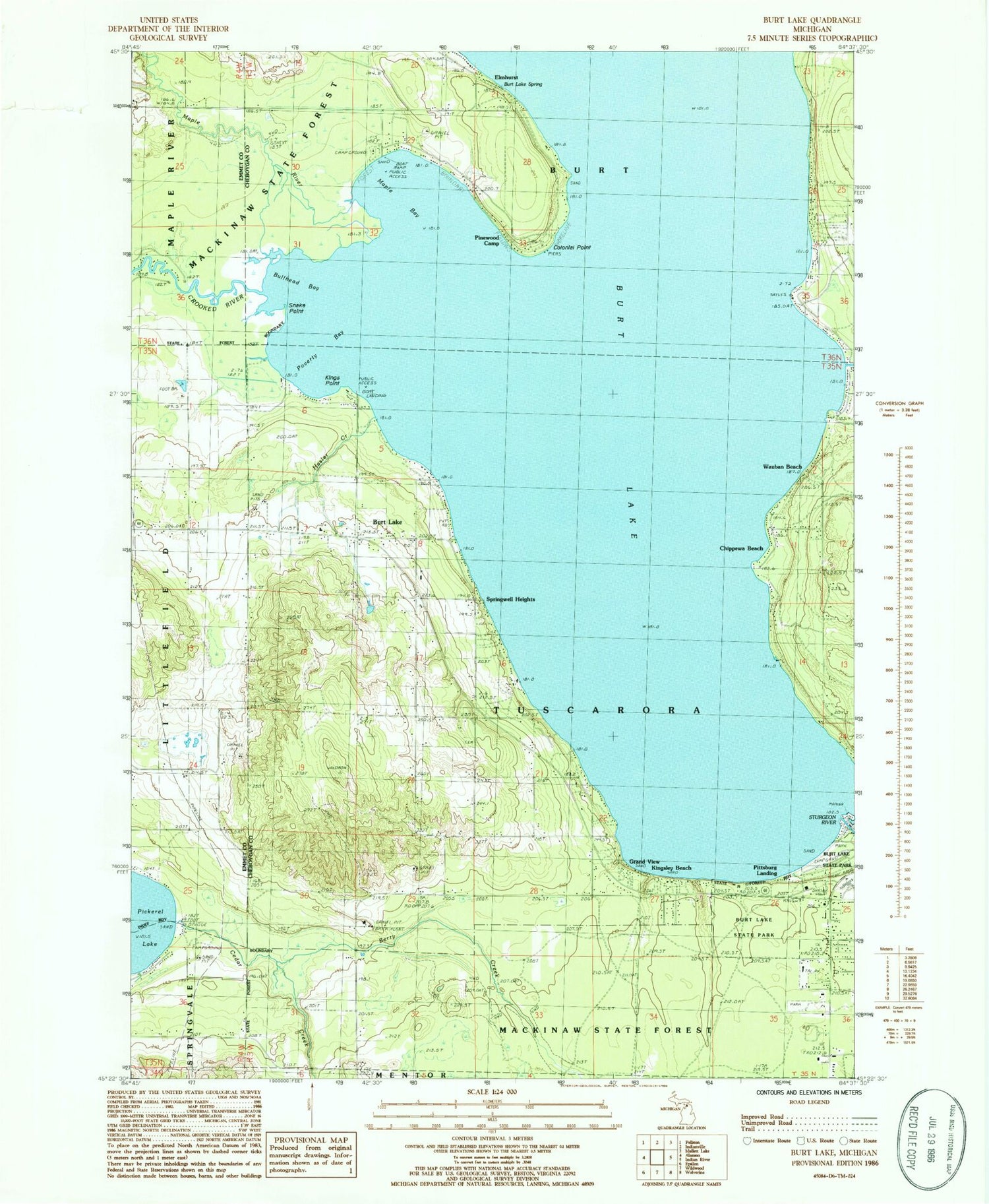
Historical USGS topographic quad map of Burt Lake in the state of Michigan. Map scale may vary for some years, but is generally around 1:24,000. Print size is approximately 24" x 27"
This quadrangle is in the following counties: Cheboygan, Emmet.
The map contains contour lines, roads, rivers, towns, and lakes. Printed on high-quality waterproof paper with UV fade-resistant inks, and shipped rolled.
Contains the following named places: Berry Creek, Bullhead Bay, Burt Lake, Burt Lake Christian Church, Burt Lake Post Office, Burt Lake Spring, Burt Lake State Park, Cedar Creek, Cheboygan Life Support Systems, Chippewa Beach, Colonial Point, Cooperation Park, Crooked River, Cross of the Woods Church, Elmhurst, Grand View, Harmon Grave, Hasler Creek, Indian River Catholic Shrine, Inland Lakes School, Kings Point, Kingsley Beach, Littlefield Church, Maple Bay, Maple Bay State Forest Campground, Maple River, Michigan Department of Natural Resources Indian River Field Office, Northern Michigan Bible Church, Northern Michigan Christian Academy, Ohioville Cemetery, Ohioville School, Peter L Brisbine House Historical Marker, Pinewood Camp, Pittsburg Landing, Poverty Bay, Saint Mary's Indian Cemetery, Snake Point, Springwell Heights, Township of Tuscarora, Transfiguration Episcopal Church, Tuscarora Township Fire Department, United Methodist Church, Wauban Beach, ZIP Code: 49717