MyTopo
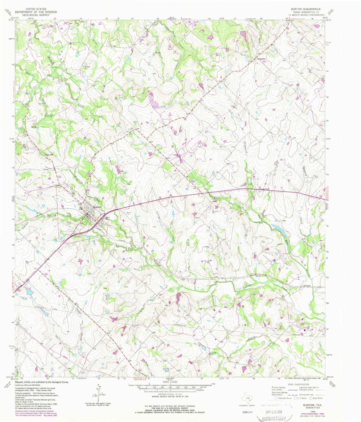
Classic USGS Burton Texas 7.5'x7.5' Topo Map
Couldn't load pickup availability
Historical USGS topographic quad map of Burton in the state of Texas. Map scale may vary for some years, but is generally around 1:24,000. Print size is approximately 24" x 27"
This quadrangle is in the following counties: Washington.
The map contains contour lines, roads, rivers, towns, and lakes. Printed on high-quality waterproof paper with UV fade-resistant inks, and shipped rolled.
Contains the following named places: Artesian Park, Bethany Cemetery, Broesche Cemetery, Burton, Burton Cemetery, Burton Commercial Historic District, Burton Division, Burton Farmers Gin, Burton Fire Department, Burton High School, Burton Police Department, Burton Post Office, Carver School, City of Burton, Doctor Charles Laas House, Gantt-Jones House, Hall Cemetery, Herbert Nienstedt House, Hodde Drugstore, Kneip-Bredthauer House, Lee Lake, Lee Lake Dam, Longpoint, Mayfield Creek, Mitchell Lake, Mitchell Lake Dam, Nelms Lake, Nelms Lake Dam, Oak Hill Cemetery, Opossum Creek, Saint Paul Church, Section Creek, Sheppard Creek, Union Hill, Washington County Constable's Office Precinct 4, Wehring Shoe Shop and Residence, William Edward Sanders House, William Neumann House, William Nienstedt House, Zuehlke Lake, Zuehlke Lake Dam, ZIP Code: 77835