MyTopo
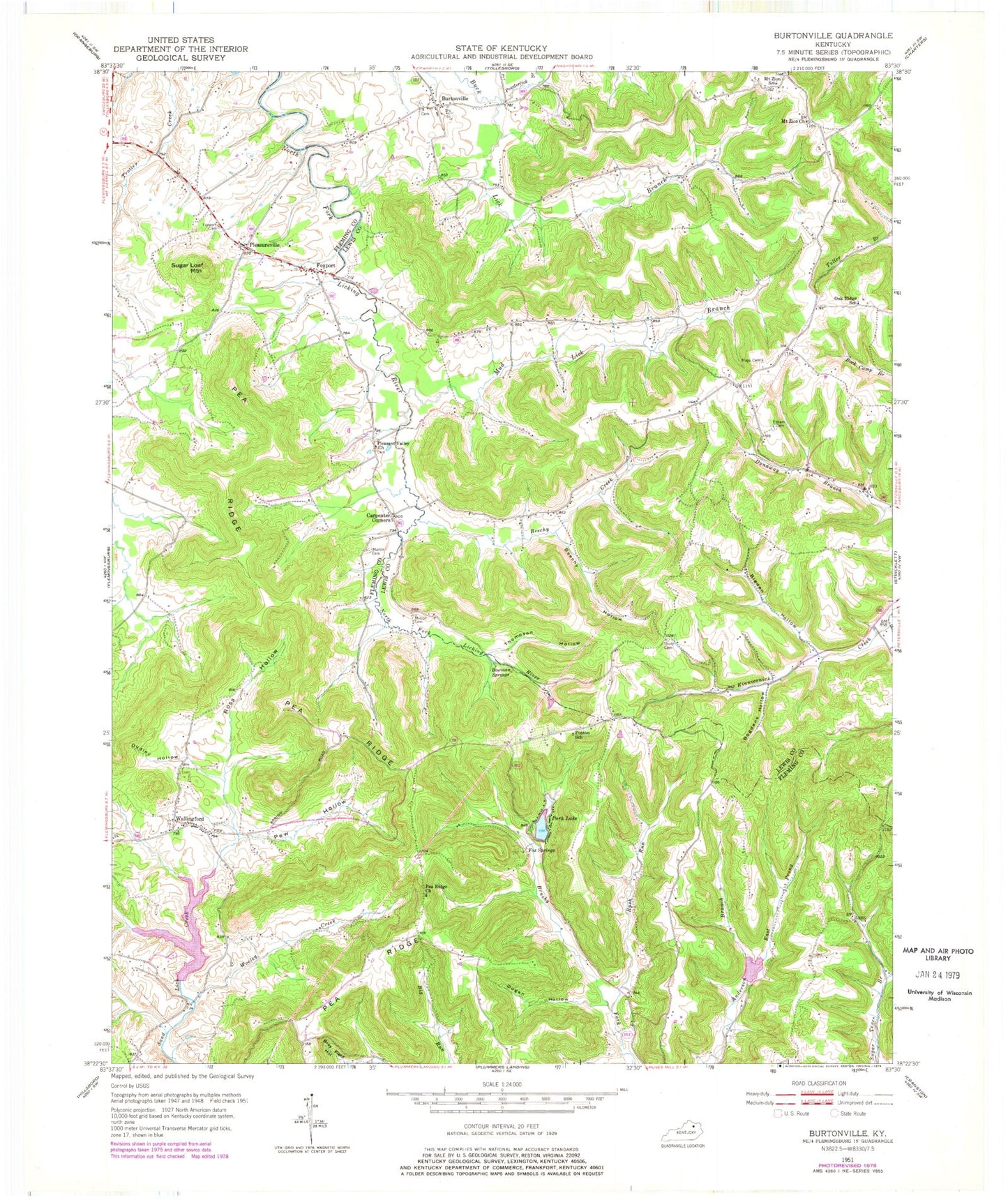
Classic USGS Burtonville Kentucky 7.5'x7.5' Topo Map
Couldn't load pickup availability
Historical USGS topographic quad map of Burtonville in the state of Kentucky. Map scale may vary for some years, but is generally around 1:24,000. Print size is approximately 24" x 27"
This quadrangle is in the following counties: Fleming, Lewis.
The map contains contour lines, roads, rivers, towns, and lakes. Printed on high-quality waterproof paper with UV fade-resistant inks, and shipped rolled.
Contains the following named places: Beechy Creek, Beechy Hollow, Bigden Hollow, Bogdens Hollow, Bowman Springs, Bray Field Hollow, Buck Lick Branch, Burtonville, Burtonville Cemetery, Burtonville Post Office, Carpenter Corners, Carpenters Store, Carpentersville, Cowan School, Dudley Hollow, Dugan Hollow, East Prong Anderson Branch, Eddman Branch, Esham Cemetery, Fox Springs, Foxport, Foxport Baptist Church, Foxport Cemetery, Fruit Hill Post Office, Martin Cemetery, Mays Cemetery, Million Cemetery, Mount Carmel Volunteer Fire Department, Mount Zion Church, Mount Zion School, Mud Lick Branch, Oak Ridge, Oak Ridge School, Park Lake, Park Lake Resort, Pea Ridge, Pea Ridge Church, Pea Ridge School, Pew Hollow, Pleasant Valley Church, Pleasureville, Poston School, Powderlick Branch, Ross Hollow, Rush Run, Sargent Branch, Sugar Loaf Mountain, Thompson Hollow, Thorp Cemetery, Throp Post Office, Wallingford, Wallingford Post Office, Wooley Creek, ZIP Code: 41093