MyTopo
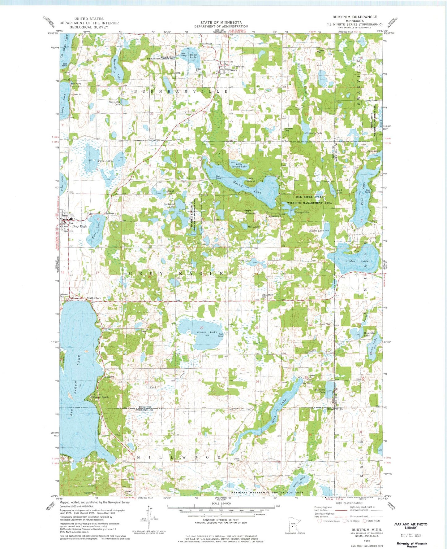
Classic USGS Burtrum Minnesota 7.5'x7.5' Topo Map
Couldn't load pickup availability
Historical USGS topographic quad map of Burtrum in the state of Minnesota. Map scale may vary for some years, but is generally around 1:24,000. Print size is approximately 24" x 27"
This quadrangle is in the following counties: Morrison, Stearns, Todd.
The map contains contour lines, roads, rivers, towns, and lakes. Printed on high-quality waterproof paper with UV fade-resistant inks, and shipped rolled.
Contains the following named places: August Glockzin Pond Dam, August Glockzin Reservoir, Bass Lake, Big Birch Lake, Bony Dog Lake, Brighter Days Family Church, Buck Lake, Buckhead Lake, Buckhead Lake State Wildlife Management Area, Burtrum, Burtrum Post Office, Cedar Lake, Cedar Lake Memorial Park, City of Burtrum, City of Grey Eagle, Coon Lake, Eagle Mountain, Eagle Mountain Winter Recreation Area, Faith Community Church, Fish Creek, Goose Lake, Grand Army of the Republic Cemetery, Grey Eagle, Grey Eagle City Hall, Grey Eagle Community Library, Grey Eagle Elementary School, Grey Eagle Fire Department, Grey Eagle Medical Clinic, Grey Eagle Post Office, Hill Lake, Horseshoe Lake, Ireland State Wildlife Management Area, Jim Lake, Lady Lake, Lakeview Cemetery, Little Mound Lake, Lovell Lake, Mary Lake, Molly Lake, Mound Lake, Mount Olive Lutheran Church, Mountain Lake, Nellies Lake, North Shore, Oak Ridge State Wildlife Management Area, Old Saint Marys Cemetery, Pine Lake, Pleasant Beach, Rock Lake, Saint John's Lutheran Church, Saint Peters Cemetery, Schreiers Lake, Slough Lake, Sponsa State Wildlife Management Area, Stony Lake, Stump Lake, The Mound, Township of Grey Eagle, Twin Lakes, United Methodist Church, ZIP Code: 56318