
MyTopo
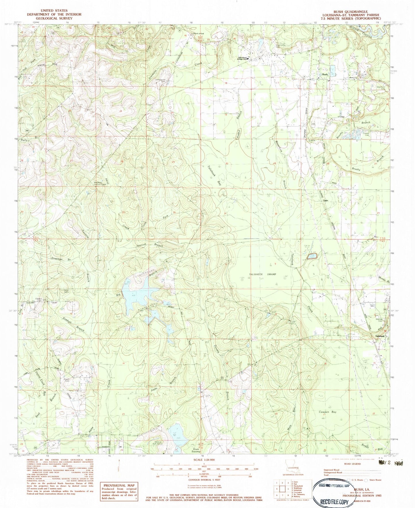
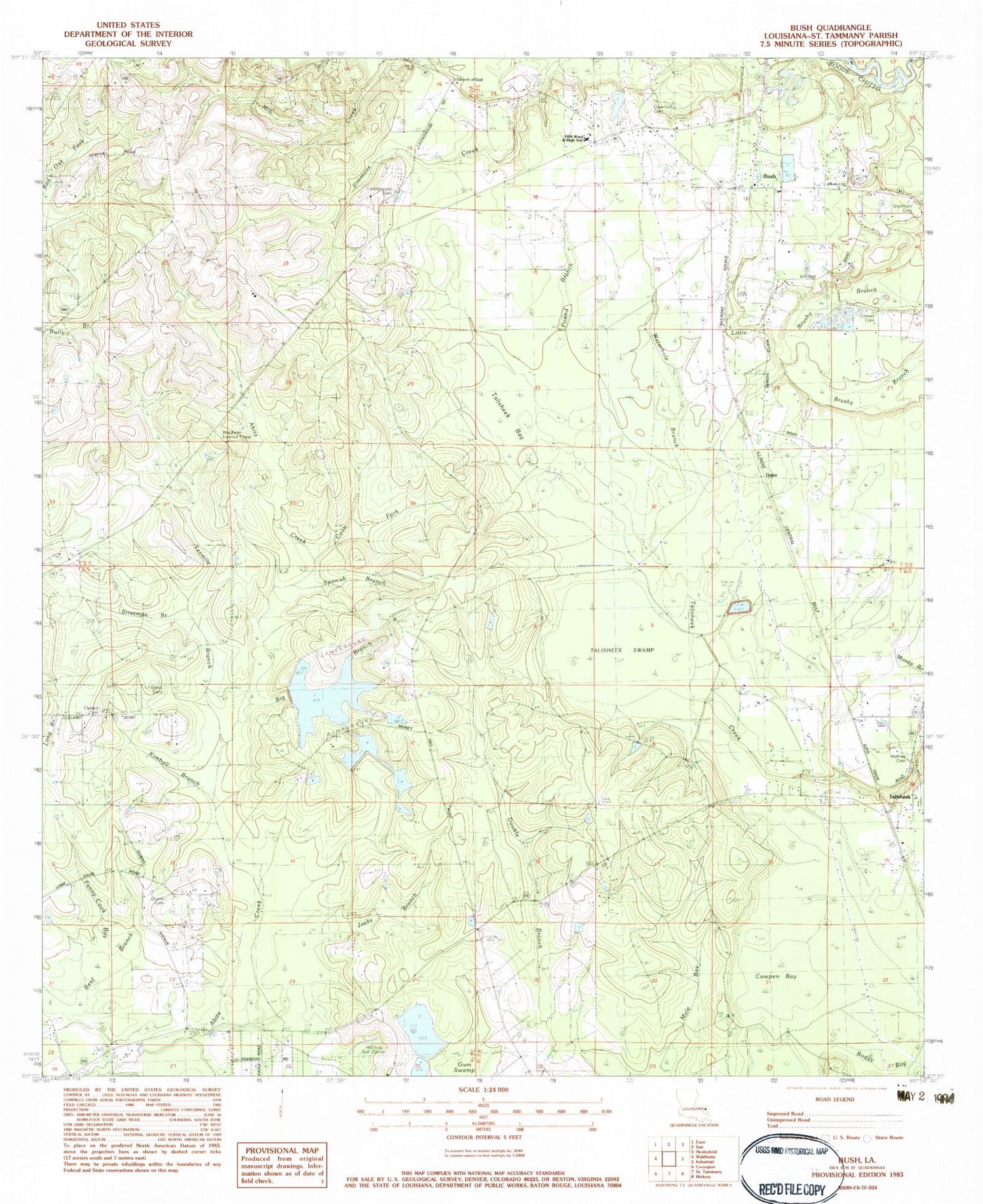
Classic USGS Bush Louisiana 7.5'x7.5' Topo Map
Couldn't load pickup availability
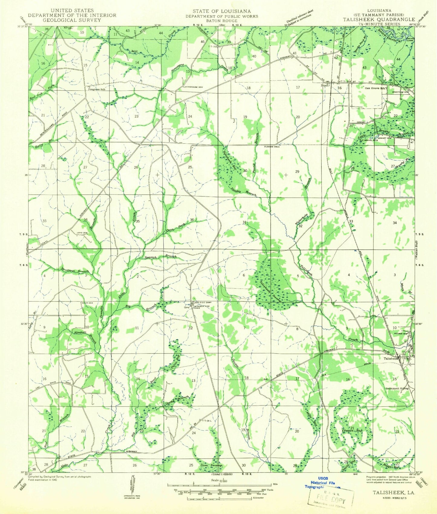
Historical USGS topographic quad map of Bush in the state of Louisiana. Map scale may vary for some years, but is generally around 1:24,000. Print size is approximately 24" x 27"
This quadrangle is in the following counties: St. Tammany.
The map contains contour lines, roads, rivers, towns, and lakes. Printed on high-quality waterproof paper with UV fade-resistant inks, and shipped rolled.
Contains the following named places: Beef Branch, Big Branch, Big Reed Break, Boggy Bay, Bush, Bush Church, Bush Post Office, Church of God, Cleland Cemetery, Coon Fork, Cowart Cemetery, Cowpen Bay, Crawford Cemetery, Dave, Davis Cemetery, Double Branch, Fanny Cook Bay, Fifth Ward Junior High School, Goodyears Pond, Grantham Cemetery, Gum Swamp, Gum Swamp Dam, Hillcrest Golf Course, Hillcrest Pond, Hillcrest Pond Dam, Holmes Cemetery, Jacks Branch, Kimball Branch, Lavinghouse Cemetery, Louisiana Noname 25 Dam, Louisiana Noname 26 Dam, Money Hill Dam, Money Hill Golf and Country Club, Mule Bay, New Beginning Baptist Church, Pound Branch, Quave Cemetery, Saint Tammany Parish Fire District 9 - Bush and Fifth Ward Volunteer Fire Department, Saint Tammany Parish Fire District 9 Station 91, Saint Tammany Parish Fire District 9 Station 93, Saint Tammany Parish Library Bush Branch, Saint Tammany Parish Sheriff's Office, Spanish Branch, Stratman Branch, Talisheek, Talisheek Bay, Talisheek Fire and Rescue, Talisheek Swamp, Tenmile Branch, Thurmans Pond, Thurmans Pond Dam, Victory Faith United Pentecostal Church, Waldheim Lookout Tower, Ward Five, Waterhole Branch, ZIP Codes: 70431, 70464