MyTopo
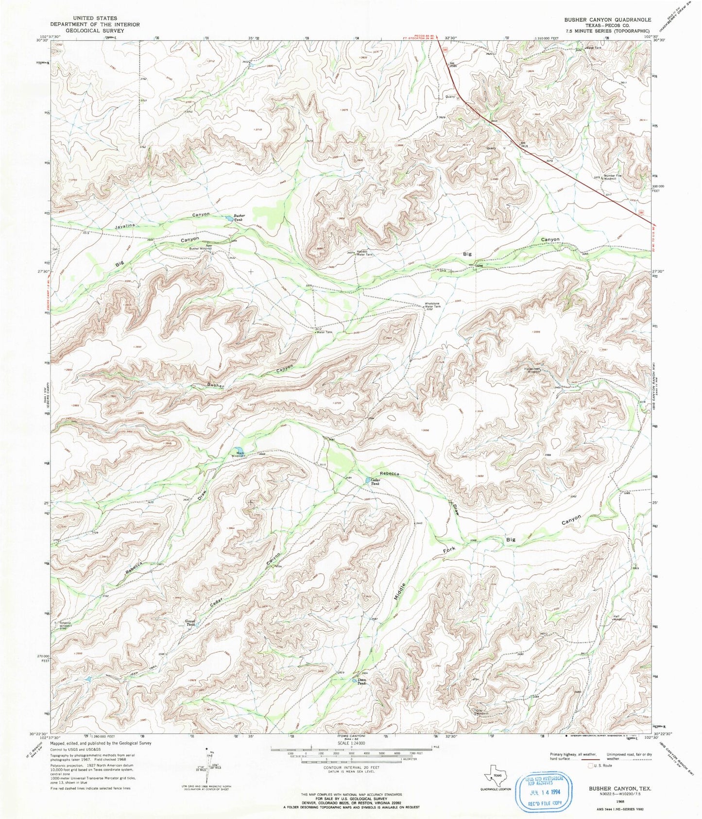
Classic USGS Busher Canyon Texas 7.5'x7.5' Topo Map
Couldn't load pickup availability
Historical USGS topographic quad map of Busher Canyon in the state of Texas. Map scale may vary for some years, but is generally around 1:24,000. Print size is approximately 24" x 27"
This quadrangle is in the following counties: Pecos.
The map contains contour lines, roads, rivers, towns, and lakes. Printed on high-quality waterproof paper with UV fade-resistant inks, and shipped rolled.
Contains the following named places: Big Divide, Busher Canyon, Busher Tank, Cedar Canyon, Cedar Tank, Dean Tank, Gravel Tank, Gray Windmill, Half Windmill, Hoodoo Water Tank, Horseshoes Windmill, Javalina Canyon, Mock Windmill, New Busher Windmill, Number Five Windmill, Rebecca Draw, Rebecca Windmill, Whetstone Water Tank