MyTopo
Classic USGS Bushkill Pennsylvania 7.5'x7.5' Topo Map
Couldn't load pickup availability
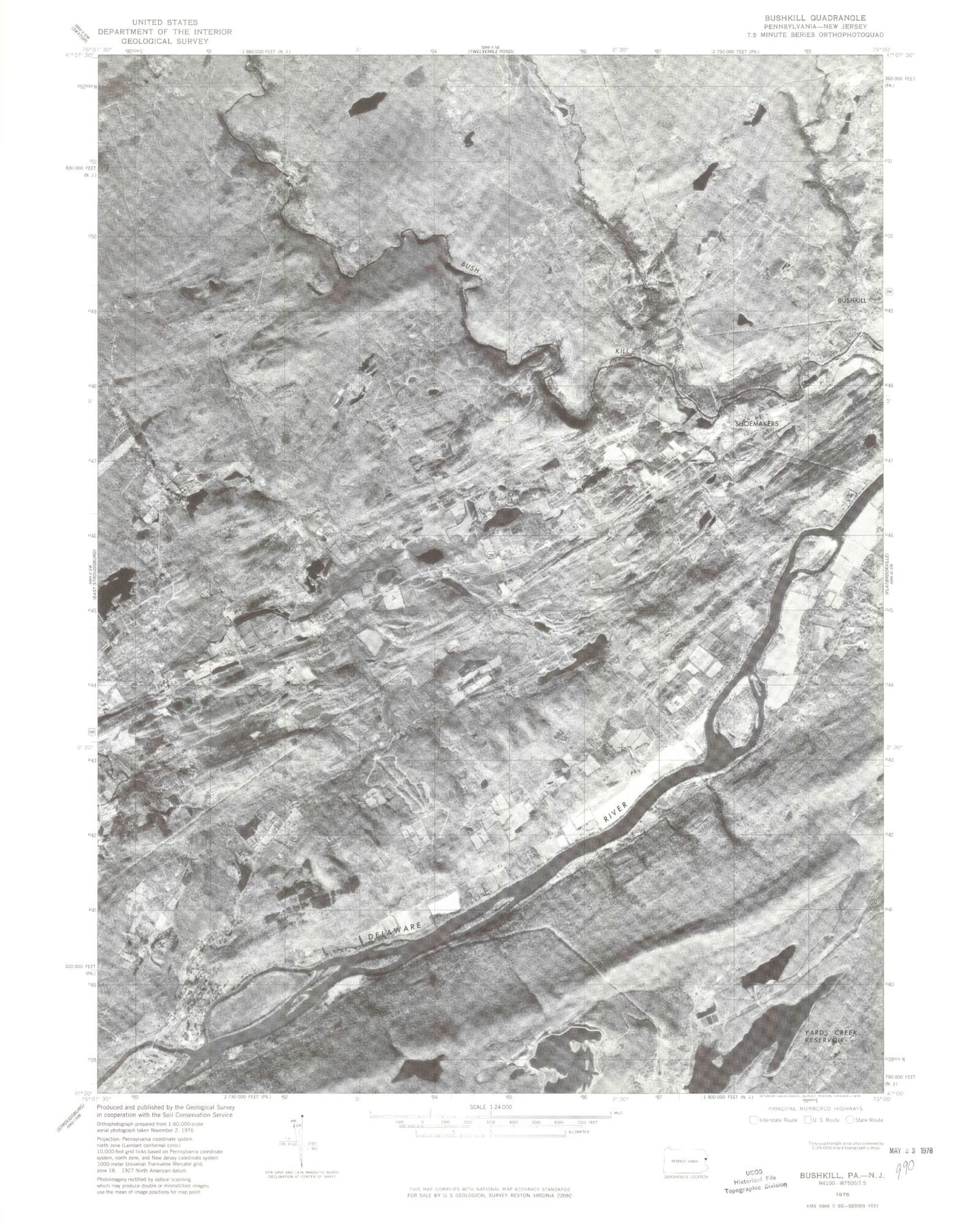
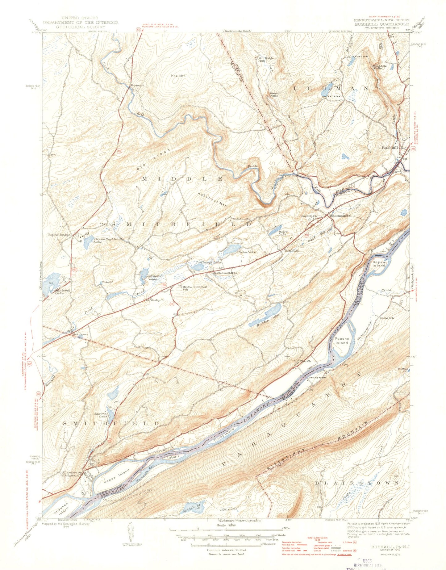
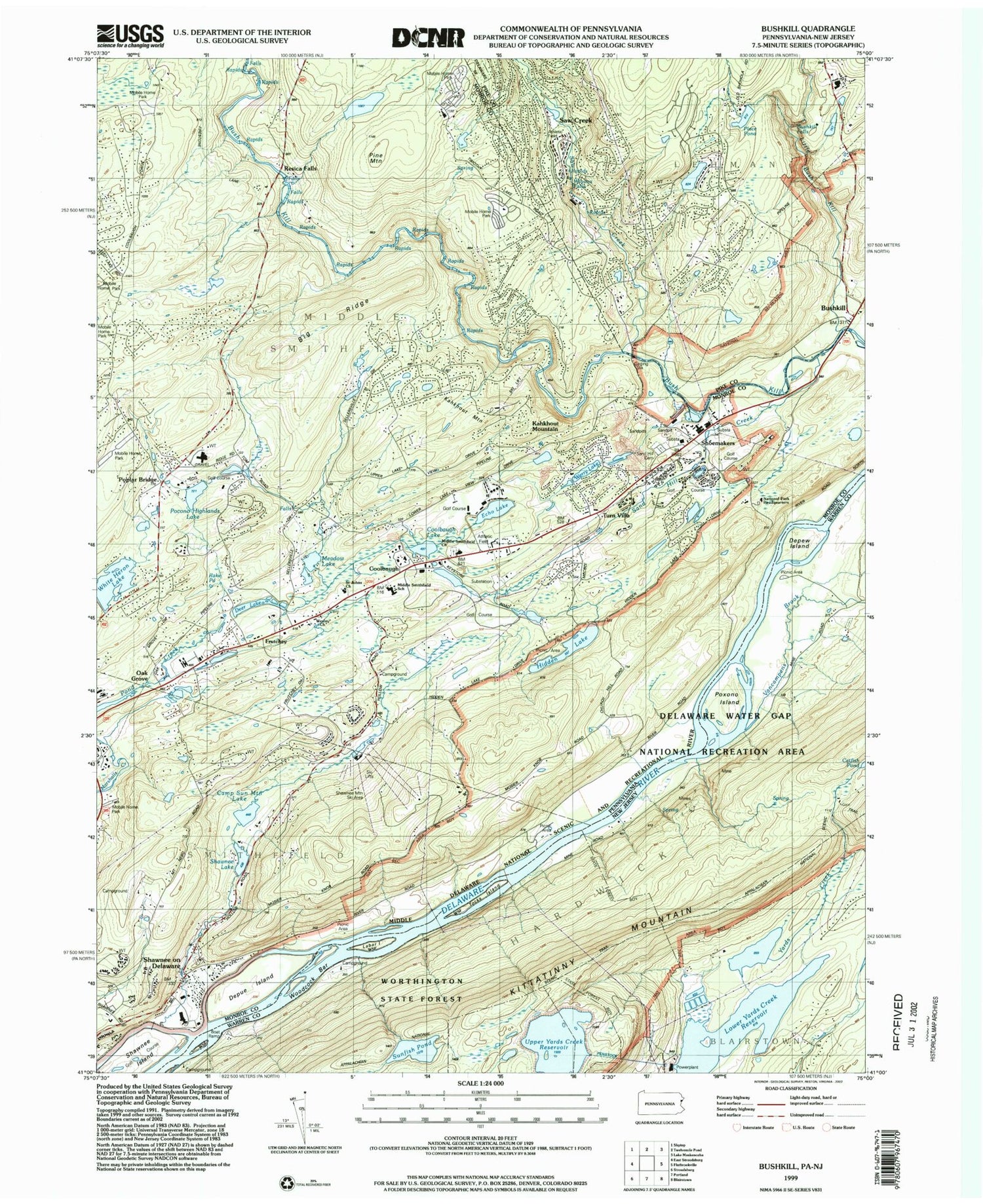
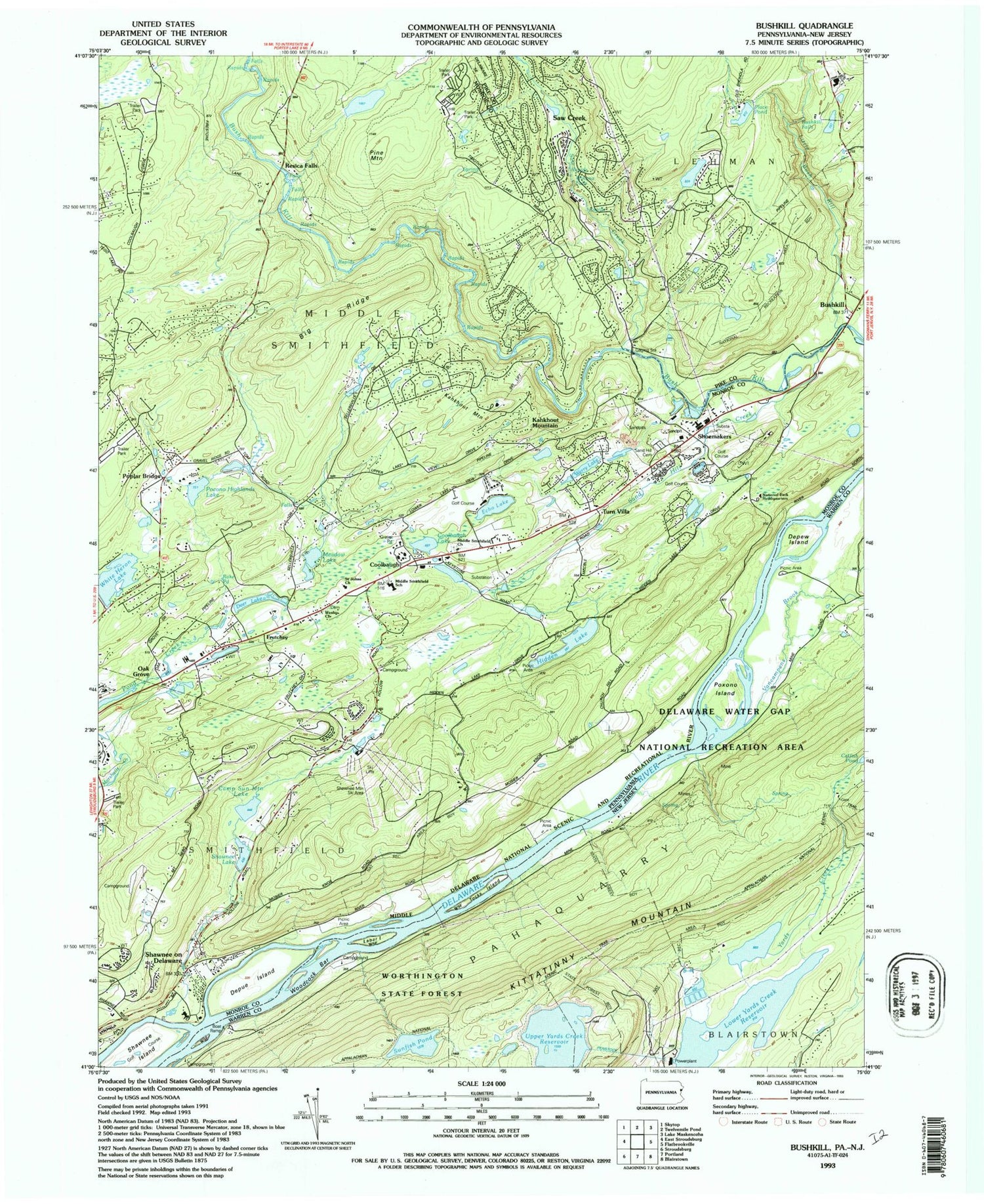
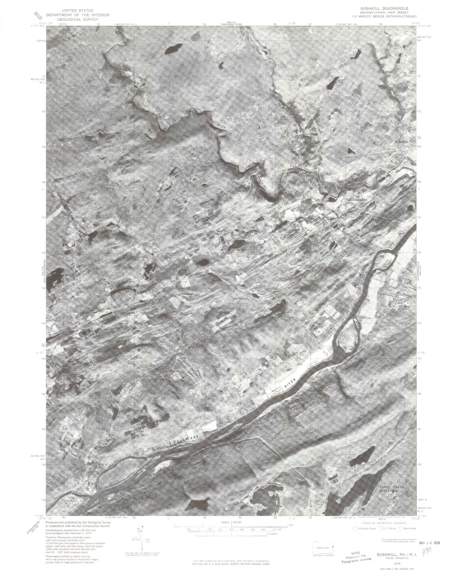
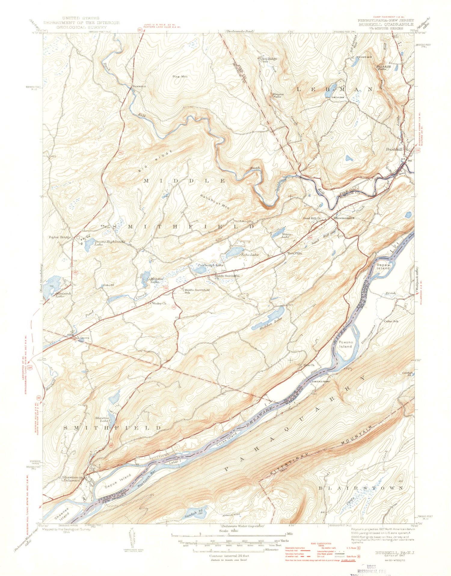
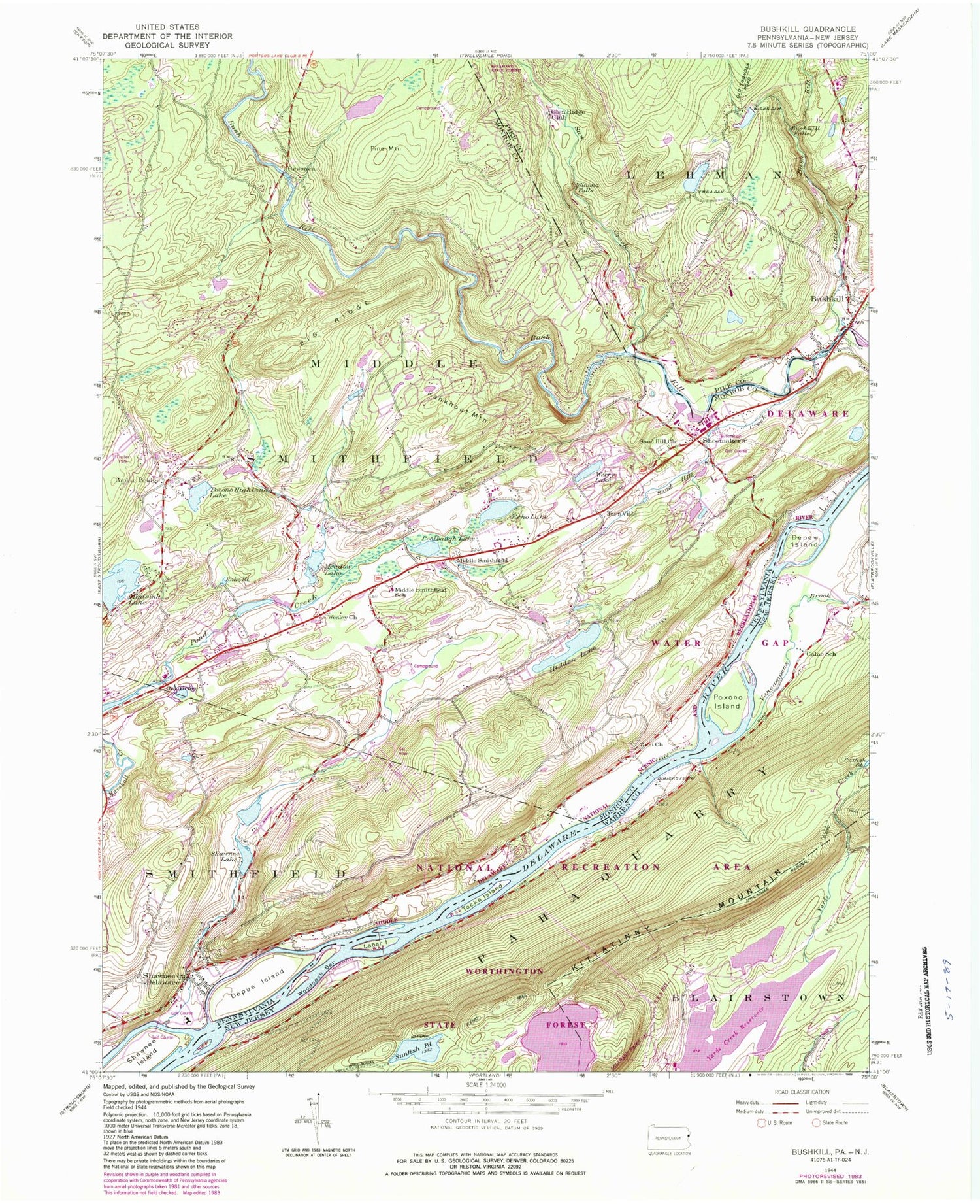
Historical USGS topographic quad map of Bushkill in the states of Pennsylvania, New Jersey. Typical map scale is 1:24,000, but may vary for certain years, if available. Print size: 24" x 27"
This quadrangle is in the following counties: Monroe, Pike, Warren.
The map contains contour lines, roads, rivers, towns, and lakes. Printed on high-quality waterproof paper with UV fade-resistant inks, and shipped rolled.
Contains the following named places: Big Ridge, Bushkill, Bushkill Falls, Coolbaugh Lake, Depue Island, Glen Ridge Club, Hidden Lake, Kahkhout Mountain, Little Bush Kill, Meadow Lake, Middle Smithfield Church, Pine Mountain, Pocono Highlands Lake, Poplar Bridge, Rake Pond, Sand Hill Creek, Saw Creek, Shawnee on Delaware, Shawnee Island, Shawnee Lake, Shoemakers, Werry Lake, Wesley Church, Wicks Dam, Winona Falls, Shawnee Dam, Camp Sun Mountain Lake, Camp Sun Mountain Dam, Marshall Lake, Hidden Lake Dam, Rakes Dam, Deer Lake, White Heron Dam, Meadow Lake Dam, Pocono Highland Dam, Werry Lake Dam, Wicks Dam, Place Pond, Mountain View School, Sand Hill School (historical), Suzie Creek, Central School, Coolbaugh, Mount Nebo School, Ellenberger School (historical), Poplar Bridge School, YMCA Dam, Oak Grove, Turn Villa, Saw Creek Ski Area, Fernwood Golf Course, Pocmont Lodge Dam, Werry Lake Dam, Pardee Place Dam, Indian Lake Camp Dam, Rake Dam, Shawnee Dam, Davidson Dam, Sand Hill Cemetery, Resica Falls, Sand Hill Church (historical), Zion Church, White Heron Lake, Frutchey, Fernwood Ski Area (historical), Shawnee Mountain Ski Area, Saw Creek, Echo Lake, Winona Lakes, Boy Scout Reservation, Castle Rock Acres, Kahkhout Mountain, Winona Lakes, Mountain Top Estates, Middle Smithfield Elementary School, Shawnee on Delaware Post Office (historical), Township of Middle Smithfield, Echo Lake Post Office (historical), Shawnee Creek, Saw Creek Census Designated Place, Bushkill Fire Company Station 24 Sugar Mountain, Bushkill Fire Company Station 24 Oak Ridge, National Park Service - Bushkill Fire Department, Shawnee Fire Company Station 36, Bushkill Emergency Squad Corps Station 3 Bushkill Station, Marshalls Creek Post Office, Shawnee on Delaware Post Office, Sons of Israel Cemetery, Middle Smithfield Presbyterian Burying Ground, Shawnee Presbyterian Church Cemetery, Frutchey's Methodist Church Cemetery, Zion Lutheran Church Cemetery, Sand Hill Cemetery, Calno School, Depew Island, Labar Island, Poxono Island, Sunfish Pond, Tocks Island, Vancampens Brook, Woodcock Bar, Township of Pahaquarry (historical), Calno, Pahaquarry Flat, Auxiliary Reservoir Dam, Upper Reservoir Dam, Dimicks Ferry (historical), Upper Yards Creek Reservoir, Lower Yards Creek Reservoir, Big Ridge, Bushkill, Bushkill Falls, Coolbaugh Lake, Depue Island, Glen Ridge Club, Hidden Lake, Kahkhout Mountain, Little Bush Kill, Meadow Lake, Middle Smithfield Church, Pine Mountain, Pocono Highlands Lake, Poplar Bridge, Rake Pond, Sand Hill Creek, Saw Creek, Shawnee on Delaware, Shawnee Island, Shawnee Lake, Shoemakers, Werry Lake, Wesley Church, Wicks Dam, Winona Falls, Shawnee Dam, Camp Sun Mountain Lake, Camp Sun Mountain Dam, Marshall Lake, Hidden Lake Dam, Rakes Dam, Deer Lake, White Heron Dam, Meadow Lake Dam, Pocono Highland Dam, Werry Lake Dam, Wicks Dam, Place Pond, Mountain View School, Sand Hill School (historical), Suzie Creek, Central School, Coolbaugh, Mount Nebo School, Ellenberger School (historical), Poplar Bridge School, YMCA Dam, Oak Grove, Turn Villa, Saw Creek Ski Area, Fernwood Golf Course, Pocmont Lodge Dam, Werry Lake Dam, Pardee Place Dam, Indian Lake Camp Dam, Rake Dam, Shawnee Dam, Davidson Dam, Sand Hill Cemetery, Resica Falls, Sand Hill Church (historical), Zion Church, White Heron Lake, Frutchey, Fernwood Ski Area (historical), Shawnee Mountain Ski Area, Saw Creek, Echo Lake, Winona Lakes, Boy Scout Reservation, Castle Rock Acres, Kahkhout Mountain, Winona Lakes, Mountain Top Estates, Middle Smithfield Elementary School, Shawnee on Delaware Post Office (historical), Township of Middle Smithfield, Echo Lake Post Office (historical), Shawnee Creek, Saw Creek Census Designated Place, Bushkill Fire Company Station 24 Sugar Mountain, Bushkill Fire Company Station 24 Oak Ridge, National Park Service - Bushkill Fire Department, Shawnee Fire Company Station 36, Bushkill Emergency Squad Corps Station 3 Bushkill Station, Marshalls Creek Post Office, Shawnee on Delaware Post Office, Sons of Israel Cemetery, Middle Smithfield Presbyterian Burying Ground, Shawnee Presbyterian Church Cemetery, Frutchey's Methodist Church Cemetery, Zion Lutheran Church Cemetery, Sand Hill Cemetery, Calno School, Depew Island, Labar Island, Poxono Island, Sunfish Pond, Tocks Island, Vancampens Brook, Woodcock Bar, Township of Pahaquarry (historical), Calno, Pahaquarry Flat, Auxiliary Reservoir Dam, Upper Reservoir Dam, Dimicks Ferry (historical), Upper Yards Creek Reservoir, Lower Yards Creek Reservoir, Big Ridge, Bushkill, Bushkill Falls, Coolbaugh Lake, Depue Island, Glen Ridge Club, Hidden Lake, Kahkhout Mountain, Little Bush Kill, Meadow Lake, Middle Smithfield Church, Pine Mountain, Pocono Highlands Lake, Poplar Bridge, Rake Pond, Sand Hill Creek, Saw Creek, Shawnee on Delaware