
MyTopo
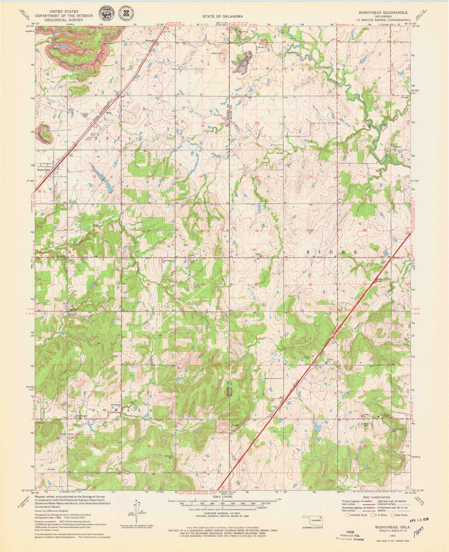
Classic USGS Bushyhead Oklahoma 7.5'x7.5' Topo Map
Couldn't load pickup availability
Historical USGS topographic quad map of Bushyhead in the state of Oklahoma. Map scale may vary for some years, but is generally around 1:24,000. Print size is approximately 24" x 27"
This quadrangle is in the following counties: Mayes, Rogers.
The map contains contour lines, roads, rivers, towns, and lakes. Printed on high-quality waterproof paper with UV fade-resistant inks, and shipped rolled.
Contains the following named places: Beck Cemetery, Bethel Church, Bethlehem Church, Bethlehem Lutheran Cemetery, Bushyhead, Dawes Cemetery, Diamondhead - Lone Chapel Fire and Rescue, Diver Creek, Foyil Fire Protection District Station 2, Good Hope Church, Hisle, Howard, Little Pryor Creek, Lone Chapel, Lone Chapel Cemetery, Oknoname 131010 Dam, Oknoname 131010 Reservoir, Polone Dam, Polone Reservoir, Washington Cemetery, Washington Church


