MyTopo
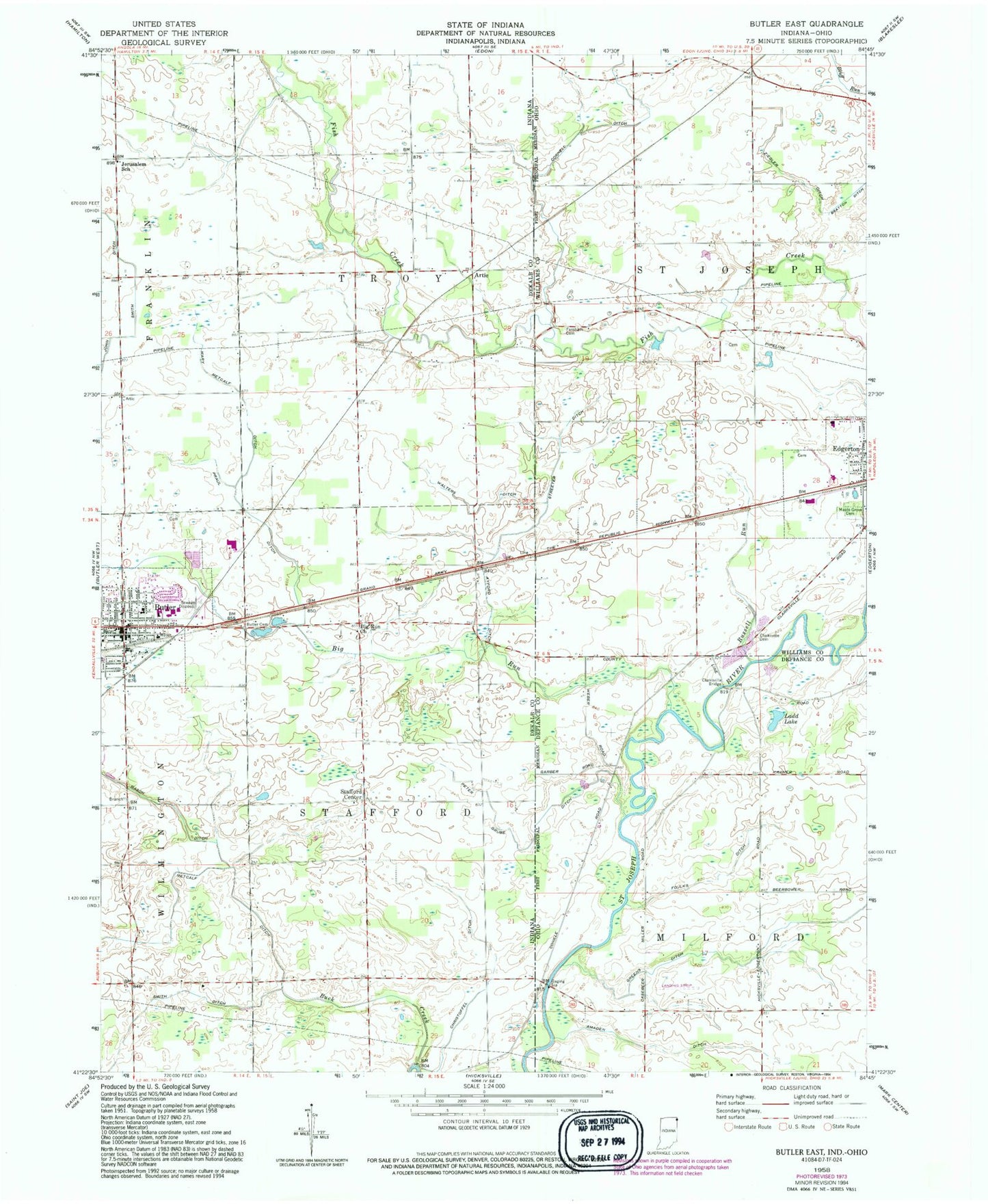
Classic USGS Butler East Indiana 7.5'x7.5' Topo Map
Couldn't load pickup availability
Historical USGS topographic quad map of Butler East in the states of Indiana, Ohio. Map scale may vary for some years, but is generally around 1:24,000. Print size is approximately 24" x 27"
This quadrangle is in the following counties: DeKalb, Defiance, Williams.
The map contains contour lines, roads, rivers, towns, and lakes. Printed on high-quality waterproof paper with UV fade-resistant inks, and shipped rolled.
Contains the following named places: Amaden Ditch, Artic, Ayford Ditch, Bethel Church, Big Run, Big Run Church, Bratton Ditch, Bratton School, Buck Creek, Butler, Butler Elementary School, Butler Police Department, Butler Post Office, Chridtoffel Ditch, Church of Christ, City of Butler, Clarksville, Clarksville Bridge, Clarksville Cemetery, Clarksville School, Cornell Ditch, Eastside Junior-Senior High School, Farnham Cemetery, Foulks Ditch, Goebel Farms, Greens Ditch, John Smith Ditch, Kline Field Airport, Koder School, Ladd Lake, Maple Grove Cemetery, Mary Metcalf Ditch, Miller Park, Peter Grube Ditch, Praul Ditch, Russell Run, School Number 6, Smith Ditch, Stafford Center, Streeter Ditch, Township of Stafford, Township of Troy, Walters Ditch, West Milford School, Wilson School, Ziegler Ditch