MyTopo
Classic USGS Butler Knob Pennsylvania 7.5'x7.5' Topo Map
Couldn't load pickup availability
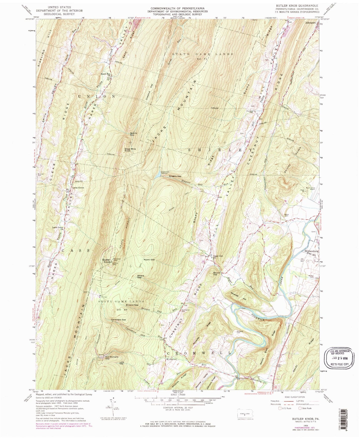
Historical USGS topographic quad map of Butler Knob in the state of Pennsylvania. Map scale may vary for some years, but is generally around 1:24,000. Print size is approximately 24" x 27"
This quadrangle is in the following counties: Huntingdon.
The map contains contour lines, roads, rivers, towns, and lakes. Printed on high-quality waterproof paper with UV fade-resistant inks, and shipped rolled.
Contains the following named places: Bare - Garver Cemetery, Beech Run Church, Blacklog Creek, Borough of Shirleysburg, Bowman Cemetery, Browns Gap, Browns Gap Run, Butler Knob, Butler Trail, Carothers Gap, Carothers Gap Run, Chestnut Flat, Chestnut Grove School, Chestnut Ridge, Colgate School, Dell Family Cemetery, Douglas Cemetery, Enyeart School, Fort Run, Gilboa Cemetery, Gilboa School, Jacks Mountain Firetower, Lake Mount Union Dam, Latta Grove, Latta Grove Church, Latta Grove School, Lincoln School, Little Gap, Logan Run, Lower Hill Valley School, Millers Gap, Miranda Hill, Monroe Valley, Mount Union Airport, Myers Gap, Old Baptist Cemetery, Old Womans Gap, Old Womans Run, Page, Querry Gap, Renecker Ridge, Ricketts Cemetery, Round Top, Runk Bridge, Sand Ridge, Sandy Ridge, Sherman School, Shirley Knobs, Silver Mine Knob, Singers Gap, Singers Gap Reservoir, Singers Gap Run, Snyder Cemetery, State Game Lands Number 71, Stony Ridge, Sugar Run, Sugar Run Brethren Cemetery, Sugar Run Church, Swartz Cemetery, Township of Union, ZIP Codes: 17052, 17260