MyTopo
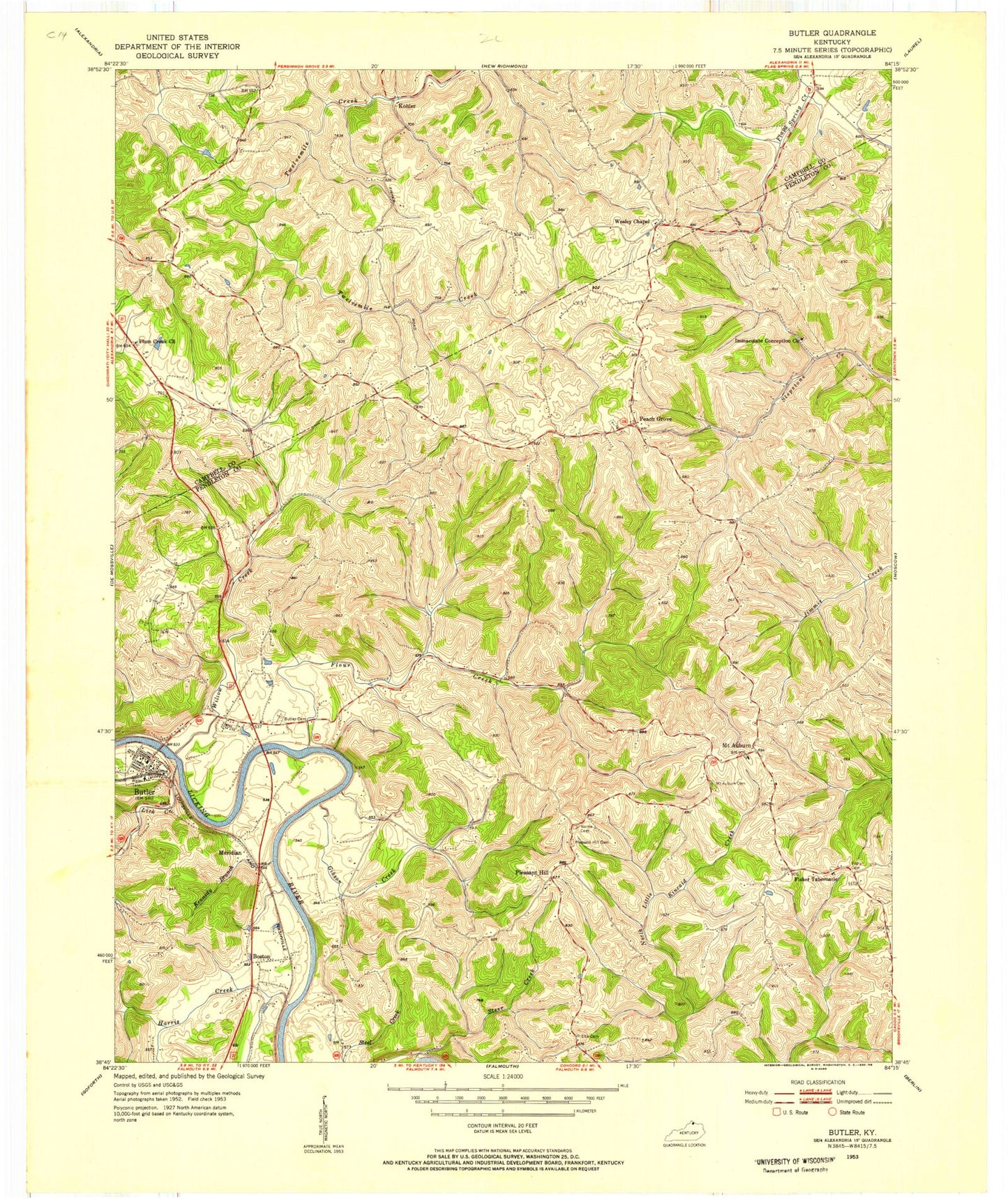
Classic USGS Butler Kentucky 7.5'x7.5' Topo Map
Couldn't load pickup availability
Historical USGS topographic quad map of Butler in the state of Kentucky. Map scale may vary for some years, but is generally around 1:24,000. Print size is approximately 24" x 27"
This quadrangle is in the following counties: Campbell, Pendleton.
The map contains contour lines, roads, rivers, towns, and lakes. Printed on high-quality waterproof paper with UV fade-resistant inks, and shipped rolled.
Contains the following named places: Aspen Grove Post Office, Aspen Grove Seminary, Boston, Boston Railroad Station, Boston Station Post Office, Brayville Post Office, Butler, Butler Cemetery, Butler Division, Butler Post Office, Butler Volunteer Fire Department, Cedar Grove School, City of Butler, Deer Lick, Dry Ridge, Dry Ridge School, Ellis Cemetery, Fisher Cemetery, Fisher Ridge, Fisher School, Fisher Tabernacle, Flour Christian Church, Flour Creek, Flour School, Flower Creek Post Office, Flower Town, Gibson Creek, Harris Creek, Holst Creek, Immaculate Conception Catholic School, Immaculate Conception Church, Immaculate Conception Church Cemetery, Kennedy Branch, Kohler, Kohler Post Office, Lick Creek, Lynn Railroad Station, Mahan School, Meridian, Meridian Post Office, Mount Auburn, Mount Auburn Cemetery, Mount Auburn Post Office, Mount Auburn School, Mount Hope Church, Mount Hope School, New Hope School, Norris Cemetery, Northern Pendleton Fire District, Northern School, Peach Grove, Peach Grove Cemetery, Peach Grove Post Office, Pindell Post Office, Pleasant Hill, Pleasant Hill Cemetery, Pleasant Hill School, Plum Creek, Plum Creek Church, Reis, Rouse Post Office, Rouses Mill, Tibbatts Crossroads Post Office, Wesley Chapel, Willow Creek, ZIP Code: 41006