MyTopo
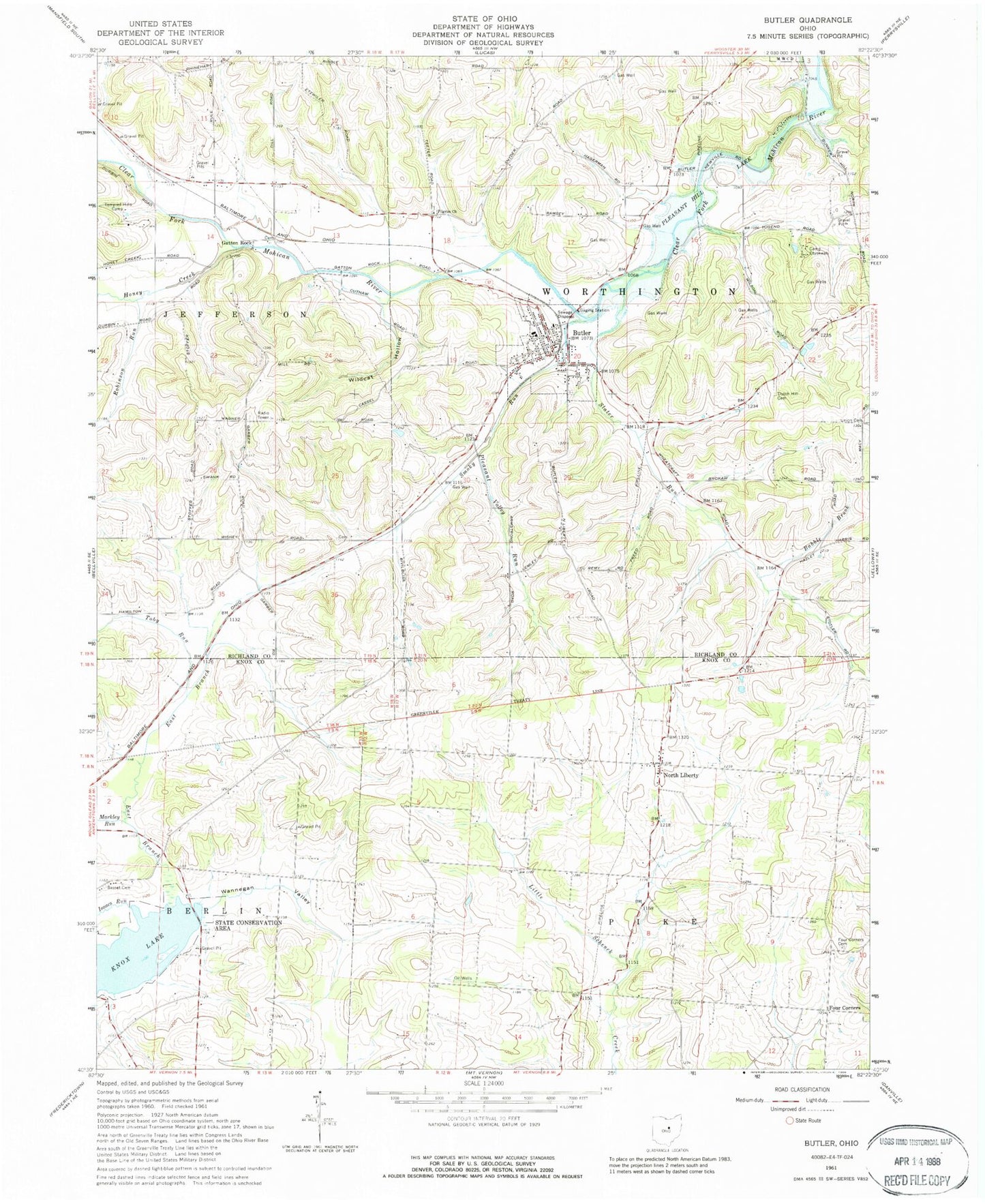
Classic USGS Butler Ohio 7.5'x7.5' Topo Map
Couldn't load pickup availability
Historical USGS topographic quad map of Butler in the state of Ohio. Map scale may vary for some years, but is generally around 1:24,000. Print size is approximately 24" x 27"
This quadrangle is in the following counties: Knox, Richland.
The map contains contour lines, roads, rivers, towns, and lakes. Printed on high-quality waterproof paper with UV fade-resistant inks, and shipped rolled.
Contains the following named places: Babble Brook, Basset Cemetery, Berger, Burger School, Butler, Butler Elementary School, Butler Post Office, Butler Trinity United Methodist Church, Butler Village Police Department, Camp Otyokwah, Center Grove School, Clearfork Mobile Home Park, Dutch Hill Cemetery, Eagle Grove School, Edward Smith Lake, Edward Smith Lake Dam, Forest School, Four Corners, Four Corners Cemetery, Four Corners School, Freeman Swank Farms Airport, Garber Cemetery, Gatton Rock, Hawk's Nest Airport, Honey Creek, Independence Cemetery, Isaacs Run, Knotty Oak School, Knox Lake, Knox Lake State Wildlife Area, Lockhart, Lutheran Cemetery, Markley Run, McConkie Grain Farm, Morgan School, Mount Sinai United Methodist Church, North Liberty, North Liberty Cemetery, North Liberty Post Office, Oak Hall School, Pleasant Valley Run, Pleasant Valley School, Prairie Run, Red Brush School, Robinson Run, School Number 4, School Number 7, Secrist Cemetery, Slater Run, Smoky Run, Summit School, Sunny Slope Farm, Templed Hills Camp, Toby Run, Tory Run, Township of Berlin, Township of Pike, Township of Worthington, Village of Butler, Wannegan Valley, WCOM-TV (Mansfield), Wildcat Hollow, Worthington Township Volunteer Fire Department, ZIP Code: 44822