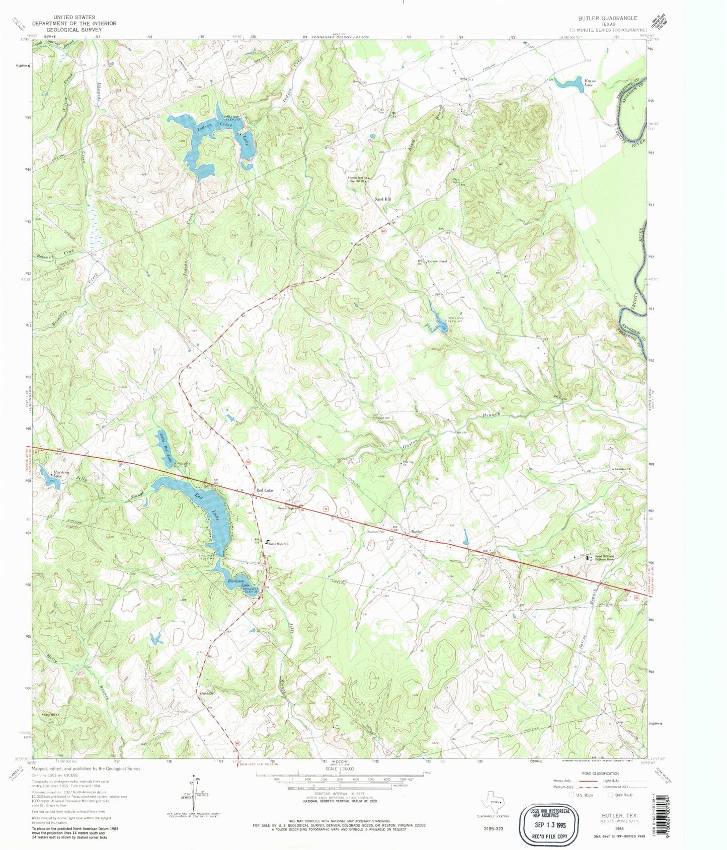
MyTopo
Classic USGS Butler Texas 7.5'x7.5' Topo Map
Couldn't load pickup availability
Historical USGS topographic quad map of Butler in the state of Texas. Map scale may vary for some years, but is generally around 1:24,000. Print size is approximately 24" x 27"
This quadrangle is in the following counties: Anderson, Freestone.
The map contains contour lines, roads, rivers, towns, and lakes. Printed on high-quality waterproof paper with UV fade-resistant inks, and shipped rolled.
Contains the following named places: Alum Branch, Batsmith Creek, Brinkley Creek, Burleson Lake, Burleson Lake Dam, Butler, Butler Division, Butler High School, Butler Volunteer Fire Department, Daniel Memorial Childrens Home, Evans Lake, Harding Lake, Harding Lake Dam, Indian Creek Lake, Indian Creek Lake Dam, Jerusalem Church, Little Red Lake, Little Red Lake Dam, Mayes Cemetery, Owens Chapel, Pearson Lake, Pearson Lake Dam, Pilgrim Rest Church, Pine Hill Church, Pine Top Church, Red Lake, Red Lake Dam, Red Lake Number 3, Red Lake Number 3 Dam, Sand Hill, Sand Hill Cemetery, Sand Hill Church, Shiloh Church, Waymon Chapel, Willow Creek