MyTopo
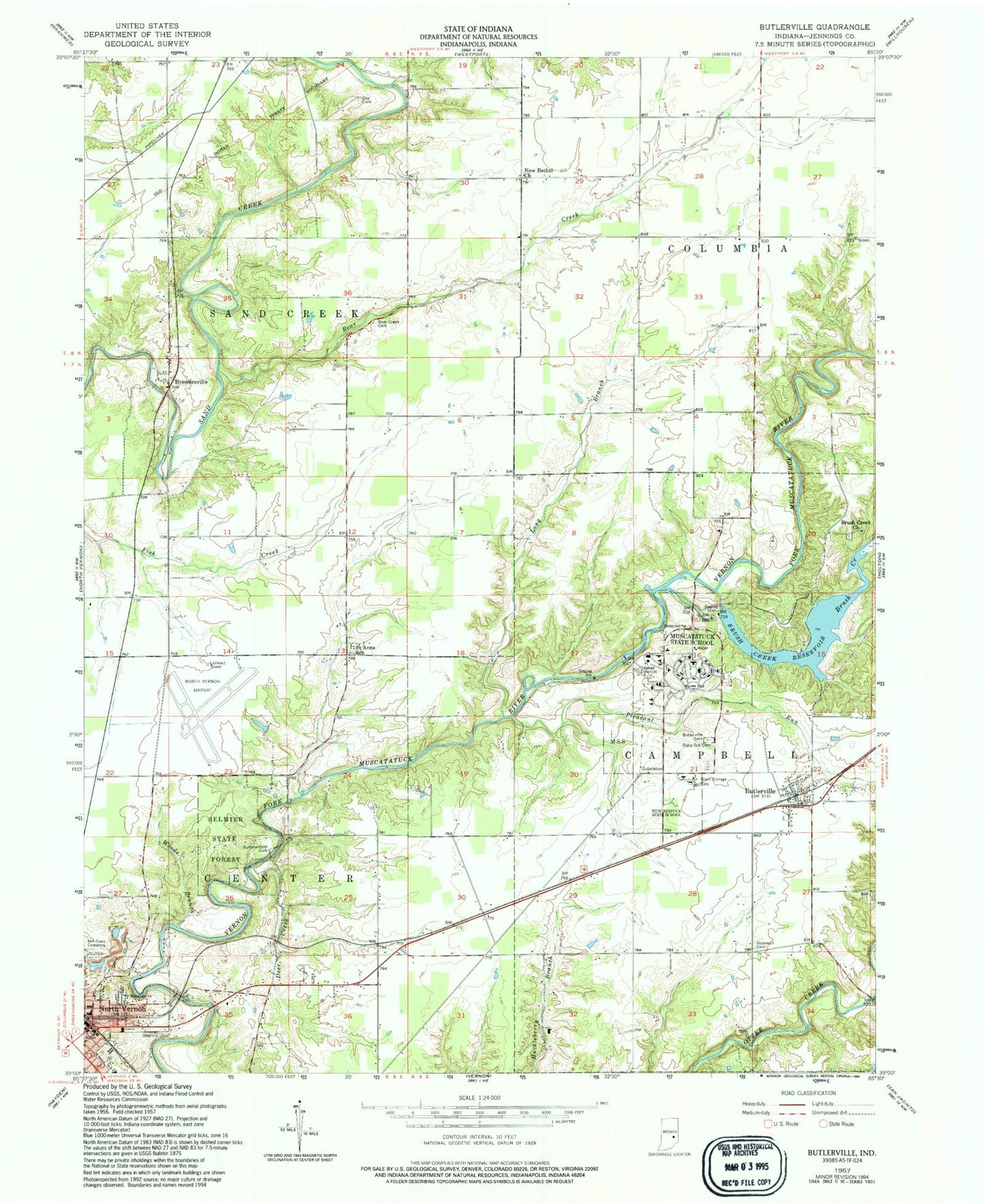
Classic USGS Butlerville Indiana 7.5'x7.5' Topo Map
Couldn't load pickup availability
Historical USGS topographic quad map of Butlerville in the state of Indiana. Typical map scale is 1:24,000, but may vary for certain years, if available. Print size: 24" x 27"
This quadrangle is in the following counties: Jennings.
The map contains contour lines, roads, rivers, towns, and lakes. Printed on high-quality waterproof paper with UV fade-resistant inks, and shipped rolled.
Contains the following named places: Bear Creek, Bear Creek Cemetery, Brewersville, Brush Creek, Brush Creek Church, Brush Creek Reservoir, Butlerville, Butlerville Cemetery, Day Cemetery, Deer Creek, Hill Crest Cemetery, Hopewell Cemetery, Long Branch, Muscatatuck State School, New Bethel Church, North Vernon, Pleasant Run, Saint Anns School, Selmier State Forest, State School Cemetery, Summerfield Cemetery, Woods Branch, Muscatatuck State Hospital and Training Center, Oakdale, North Vernon Airport, Township of Campbell, Township of Center, Township of Sand Creek, North Vernon Quarry, Butlerville Census Designated Place, North Vernon Fire Department Station 61, Campbell Township Volunteer Fire Department, Brush Creek Airport, Butlerville Post Office