MyTopo
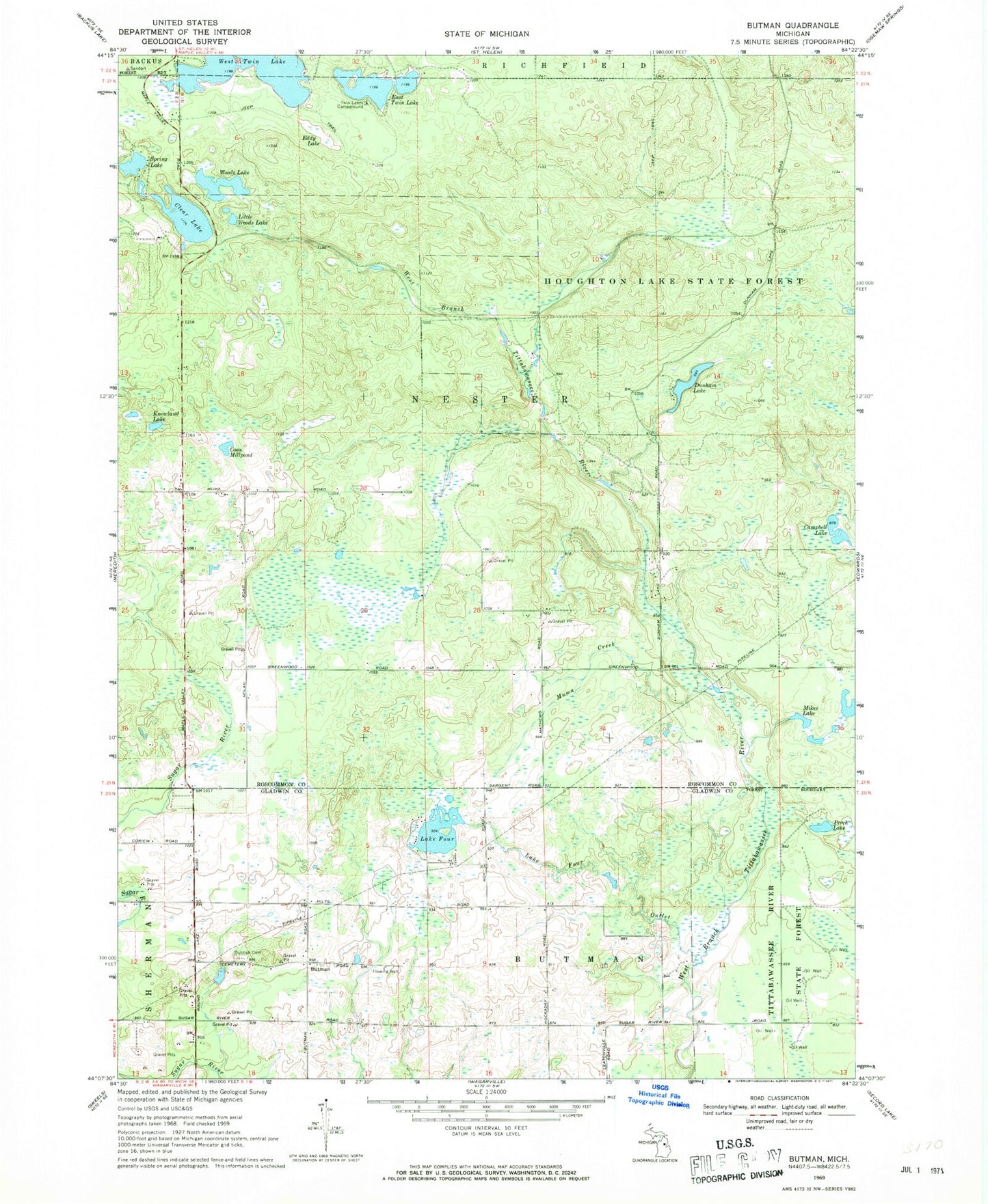
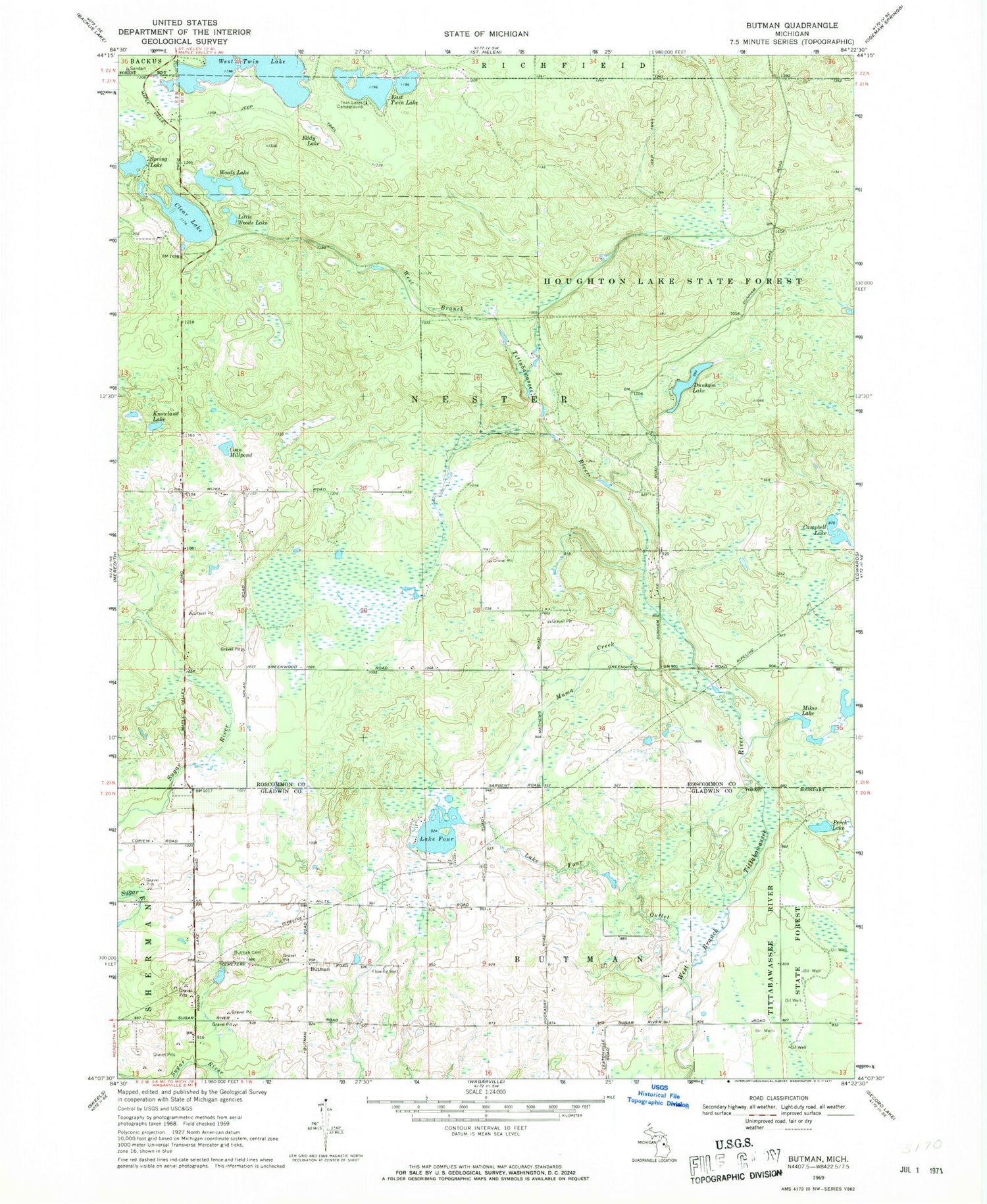
Classic USGS Butman Michigan 7.5'x7.5' Topo Map
Couldn't load pickup availability
Historical USGS topographic quad map of Butman in the state of Michigan. Map scale may vary for some years, but is generally around 1:24,000. Print size is approximately 24" x 27"
This quadrangle is in the following counties: Gladwin, Roscommon.
The map contains contour lines, roads, rivers, towns, and lakes. Printed on high-quality waterproof paper with UV fade-resistant inks, and shipped rolled.
Contains the following named places: Butman, Butman Cemetery, Butman Post Office, Campbell Lake, Clear Lake, Coan Millpond, Dunham Lake, East Twin Lake, Eddy Lake, Knowland Lake, Lake Four, Lake Four Outlet, Little Woods Lake, Lost Creek, Mikes Lake, Muma Creek, Nester Township Cemetery, Nester Township Fire Department, Nester Township Hall, Nolan Cemetery, Nolan Post Office, Nolan Station, Noren Creek, Perch Lake, Spring Lake, Sugar Springs Airpark, Sugar Springs Campground, Sugar Springs Country Club, Township of Nester, Twin Lakes Campground, West Twin Lake, Woods Lake