MyTopo
Classic USGS Butterfield Minnesota 7.5'x7.5' Topo Map
Couldn't load pickup availability
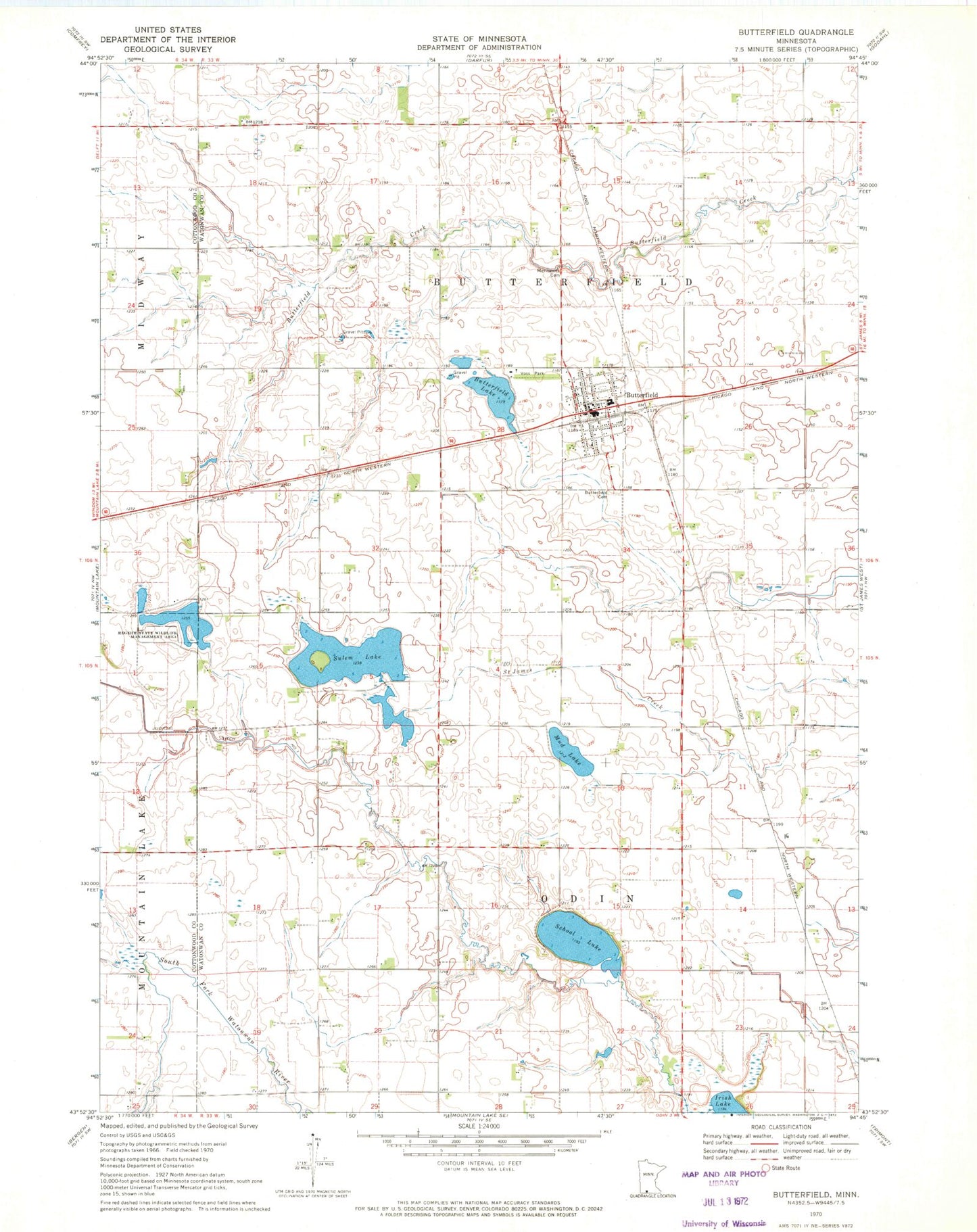
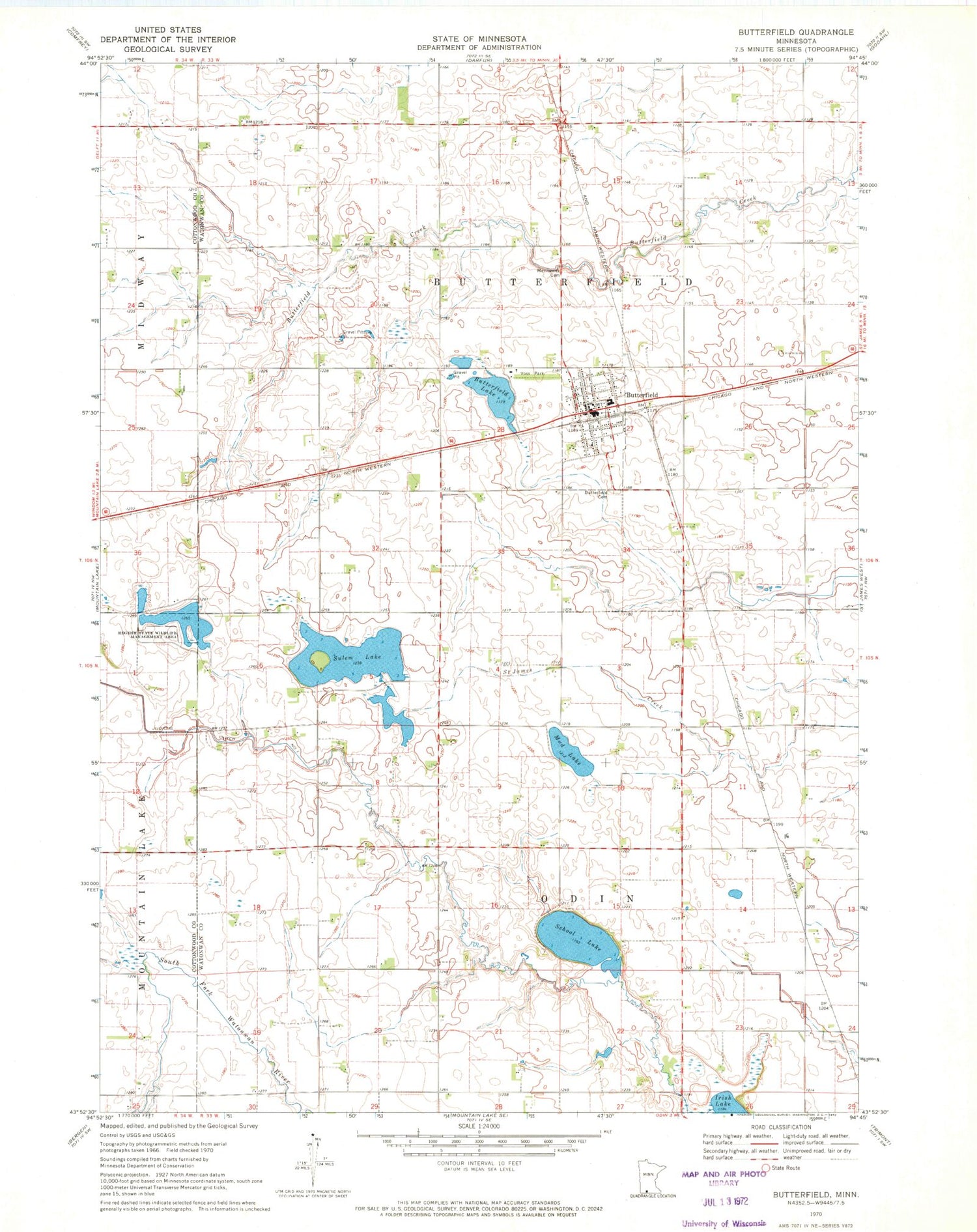
Historical USGS topographic quad map of Butterfield in the state of Minnesota. Map scale may vary for some years, but is generally around 1:24,000. Print size is approximately 24" x 27"
This quadrangle is in the following counties: Cottonwood, Watonwan.
The map contains contour lines, roads, rivers, towns, and lakes. Printed on high-quality waterproof paper with UV fade-resistant inks, and shipped rolled.
Contains the following named places: Butterfield, Butterfield Cemetery, Butterfield City Hall, Butterfield Lake, Butterfield Library, Butterfield Mennonite Church, Butterfield Post Office, Butterfield Public School, Butterfield Volunteer Fire Department, City of Butterfield, First Lutheran Church, Judicial Ditch Number One, Mennonite Cemetery, Mud Lake, Regehr State Wildlife Management Area, Saint John Evangelical Lutheran Church, Saint Matthew's Evangelical Church, School Lake, Sulem Lake, Township of Butterfield, Township of Odin, Voss Park, Voss Park Campground, ZIP Code: 56120