
MyTopo
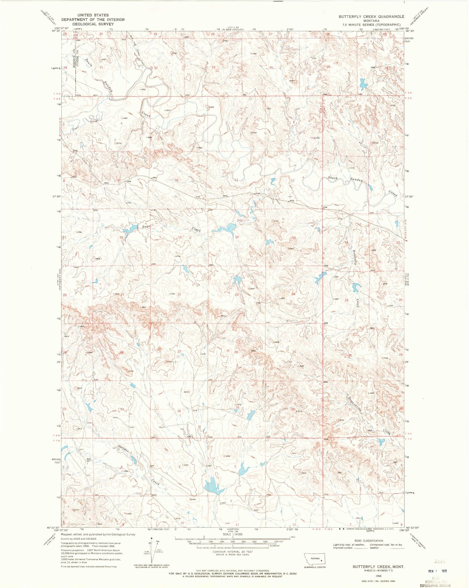
Classic USGS Butterfly Creek Montana 7.5'x7.5' Topo Map
Couldn't load pickup availability
Historical USGS topographic quad map of Butterfly Creek in the state of Montana. Map scale may vary for some years, but is generally around 1:24,000. Print size is approximately 24" x 27"
This quadrangle is in the following counties: Custer, Rosebud.
The map contains contour lines, roads, rivers, towns, and lakes. Printed on high-quality waterproof paper with UV fade-resistant inks, and shipped rolled.
Contains the following named places: 08N45E28ACAB01 Well, Bow and Arrow Creek, Brewer Number 3 Dam, Butterfly Creek, Clark Dam, Coal Creek, French Number 1 Dam, French Number 12 Dam, French Number 2 Dam, French Number 5 Dam, French Number 8 Dam, Heckmiller Number 1 Dam, Larson Number 2 Dam, Larson Number 3 Dam, Lookout Butte, Sage Creek


