MyTopo
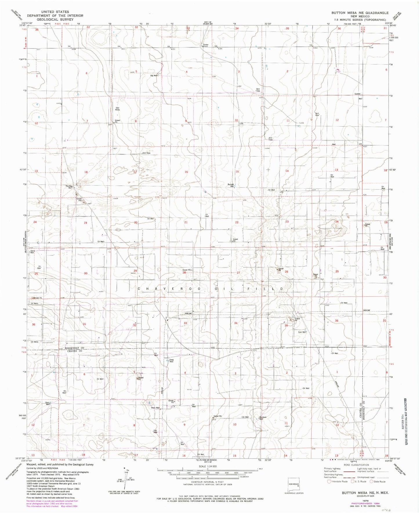
Classic USGS Button Mesa NE New Mexico 7.5'x7.5' Topo Map
Couldn't load pickup availability
Historical USGS topographic quad map of Button Mesa NE in the state of New Mexico. Map scale may vary for some years, but is generally around 1:24,000. Print size is approximately 24" x 27"
This quadrangle is in the following counties: Chaves, Roosevelt.
The map contains contour lines, roads, rivers, towns, and lakes. Printed on high-quality waterproof paper with UV fade-resistant inks, and shipped rolled.
Contains the following named places: 06186 Water Well, 06187 Water Well, 06208 Water Well, 06210 Water Well, 06211 Water Well, 06214 Water Well, 06215 Water Well, 06216 Water Well, 06217 Water Well, 06218 Water Well, 06219 Water Well, 12548 Water Well, Big Well, Burnett Well, Chaveroo Oil Field, Davis Well, Deep Well, Game Well, Murdock Well, Perry Well, The Big Well, Tucker Ranch