MyTopo
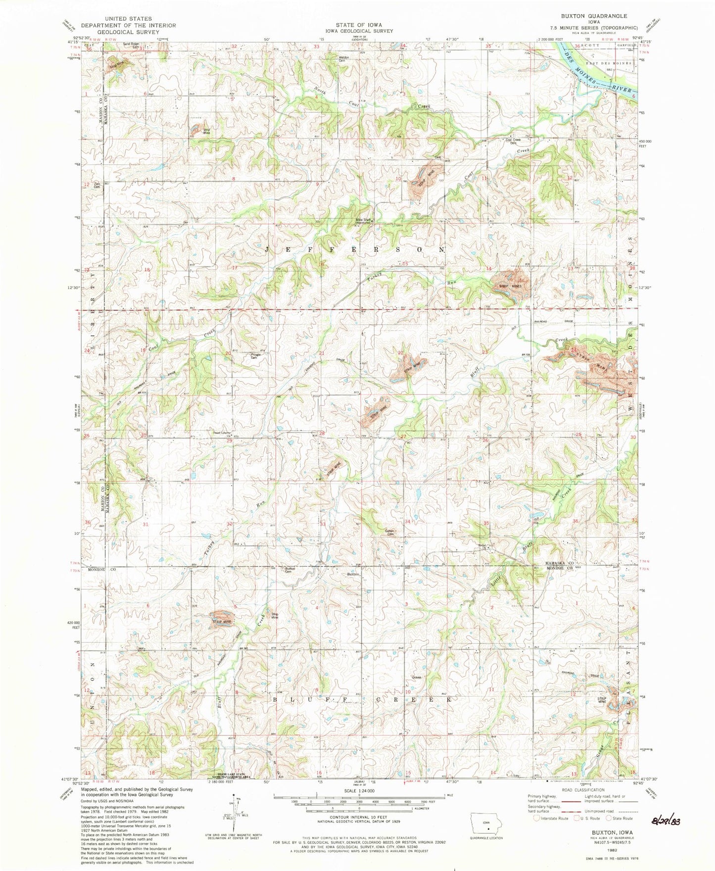
Classic USGS Buxton Iowa 7.5'x7.5' Topo Map
Couldn't load pickup availability
Historical USGS topographic quad map of Buxton in the state of Iowa. Map scale may vary for some years, but is generally around 1:24,000. Print size is approximately 24" x 27"
This quadrangle is in the following counties: Mahaska, Marion, Monroe.
The map contains contour lines, roads, rivers, towns, and lakes. Printed on high-quality waterproof paper with UV fade-resistant inks, and shipped rolled.
Contains the following named places: Bethel Cemetery, Bethel Church, Bluff Creek, Bluff Creek Off Highway Recreation Area, Bluff Creek School, Boles Cemetery, Brock Post Office, Buxton, Buxton Cemetery, Buxton Post Office, Center School, Coal Creek, Coal Creek Cemetery, Cohen Cemetery, Courtney's Landing, Cricket, Cricket Post Office, Eveland, Eveland Bridge, Eveland Grove Post Office, Fairview School, Ferry Post Office, Garfield School, Hoover School, Liberty Union School, Miami, Mount Carmel School, North Coal Creek, Opposition School, Pringle Cemetery, Rex Post Office, Sand Ridge Cemetery, Smith Cemetery, Township of Jefferson, Turkey Run, Union Liberty Church, Union School Number 1, Weldon Cemetery, White, White Post Office, Whiteburg, Whiteburg Post Office