MyTopo
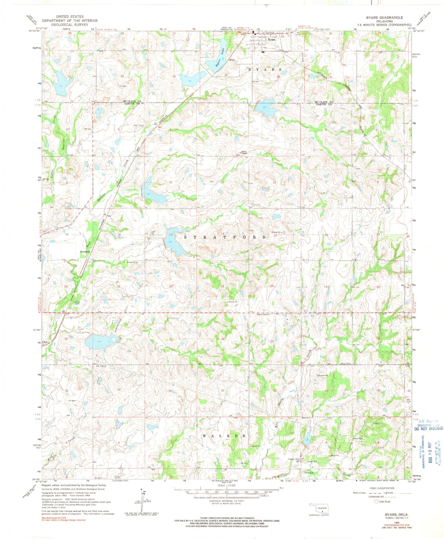
Classic USGS Byars Oklahoma 7.5'x7.5' Topo Map
Couldn't load pickup availability
Historical USGS topographic quad map of Byars in the state of Oklahoma. Map scale may vary for some years, but is generally around 1:24,000. Print size is approximately 24" x 27"
This quadrangle is in the following counties: Garvin, McClain.
The map contains contour lines, roads, rivers, towns, and lakes. Printed on high-quality waterproof paper with UV fade-resistant inks, and shipped rolled.
Contains the following named places: Abney Cemetery, Boudinot, Byars, Byars Cemetery, Byars Elementary School, Byars Lake, Byars Lake Dam, Byars Post Office, Byars Volunteer Fire Department, Cherokee Sandy Site 3 Dam, Cherokee Sandy Site 3 Reservoir, Cherokee Sandy Site 4 Dam, Cherokee Sandy Site 4 Reservoir, Cherokee Sandy Site 6 Dam, Cherokee Sandy Site 6 Reservoir, Civit Cemetery, Clabber Flats Cemetery, Dixon Chapel Cemetery, Dixon Chapel Presbyterian Church, Northeast Civit Oil Field, Oknoname 04921 Dam, Oknoname 04921 Reservoir, Peavine Creek Site 1 Dam, Peavine Creek Site 1 Reservoir, Peavine Creek Site 11 Dam, Peavine Creek Site 11 Reservoir, Peavine Creek Site 2 Dam, Peavine Creek Site 2 Reservoir, Peavine Creek Site 3 Dam, Peavine Creek Site 3 Reservoir, Peavine Creek Site 4 Dam, Peavine Creek Site 4 Reservoir, Peavine Creek Site 5 Dam, Peavine Creek Site 5 Reservoir, Peavine Creek Site 6 Dam, Peavine Creek Site 6 Reservoir, Town of Byars, Township of Stratford