MyTopo
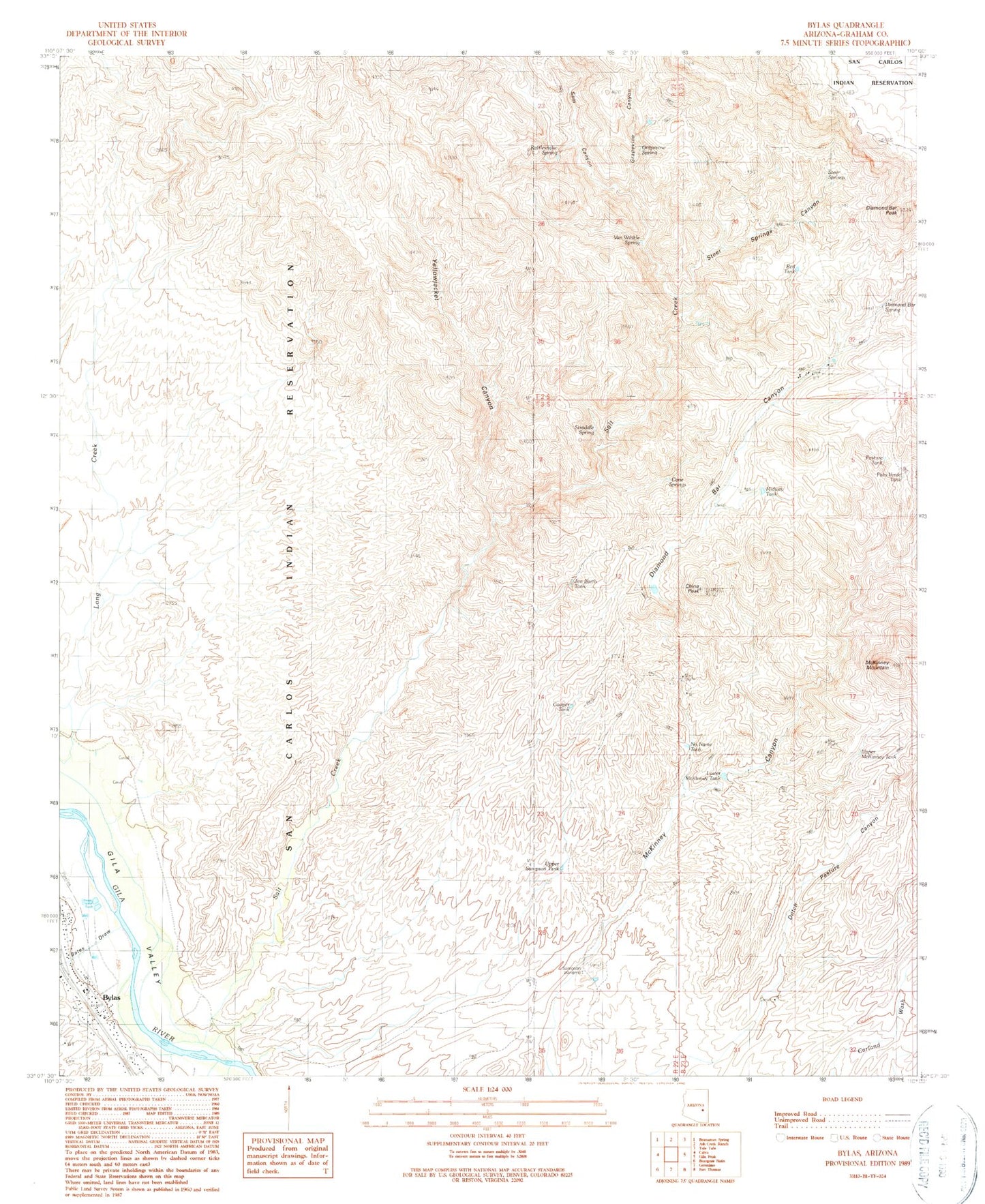
Classic USGS Bylas Arizona 7.5'x7.5' Topo Map
Couldn't load pickup availability
Historical USGS topographic quad map of Bylas in the state of Arizona. Map scale may vary for some years, but is generally around 1:24,000. Print size is approximately 24" x 27"
This quadrangle is in the following counties: Graham.
The map contains contour lines, roads, rivers, towns, and lakes. Printed on high-quality waterproof paper with UV fade-resistant inks, and shipped rolled.
Contains the following named places: Arizona Highway Department Maintenance Yard, Bylas, Bylas Census Designated Place, Bylas Health Center San Carlos Service Unit, Cane Springs, China Peak, Cooper Tank, Diamond Bar Canyon, Diamond Bar Peak, Diamond Bar Ranch, Diamond Bar Spring, Grapevine Canyon, Grapevine Spring, Jim Barth Tank, Longstreet Tank, Lower McKinney Tank, McKinney Mountain, Midway Tank, No Name Tank, Our Savior Lutheran School, Palo Verde Tank, Pasture Tank, Rattlesnake Spring, Red Tank, Salt Creek, Sam Canyon, Sampson Windmill, Steer Springs, Steer Springs Canyon, Straddle Spring, Upper McKinney Tank, Upper Sampson Tank, Van Winkle Spring, Yellowjacket Canyon