
MyTopo
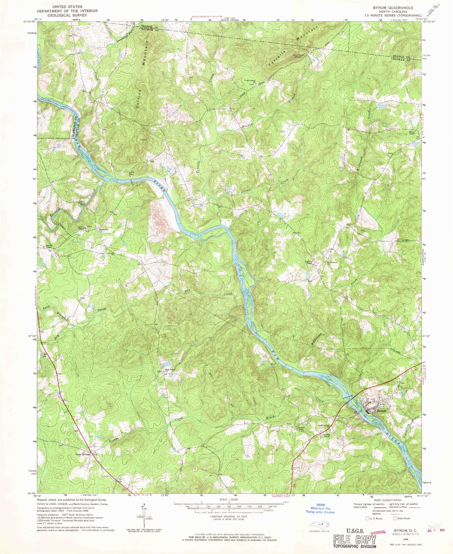
Classic USGS Bynum North Carolina 7.5'x7.5' Topo Map
Couldn't load pickup availability
Historical USGS topographic quad map of Bynum in the state of North Carolina. Map scale is 1:24000. Print size is approximately 24" x 27"
This quadrangle is in the following counties: Alamance, Chatham, Orange.
The map contains contour lines, roads, rivers, towns, and lakes. Printed on high-quality waterproof paper with UV fade-resistant inks, and shipped rolled.
Contains the following named places: Baldwin Mill Pond, Baldwin Millpond Dam, Big Branch, Brooks Creek, Browns Chapel, Bynum, Cedar Grove Church, Collins Creek, Collins Mountain, Crows Creek, Dry Creek, Faircloth Lake, Faircloth Lake Dam, Gum Springs, Hamlets Chapel, Haven Creek, Il Penseroso Acres Lake, Il Penseroso Acres Lake Dam, Long Branch, Manns Chapel, Meadow Branch, Mount Pleasant Church, New Salem Church, North Chatham Volunteer Fire Department Station 4, Odell Pond, Odell Pond Dam, Persimmon Nursery Branch, Pokeberry Creek, Rock Springs Church, Russells Chapel, Terrells, Terrells Chapel, Terrells Creek, Terrells Creek, Terrells Mountain, Township of Baldwin, WDCG-FM (Durham), Wilkinson Creek, Williams Pond, Williams Pond Dam, WUNC-FM (Chapel Hill), WUNC-TV (Chapel Hill)


