
MyTopo
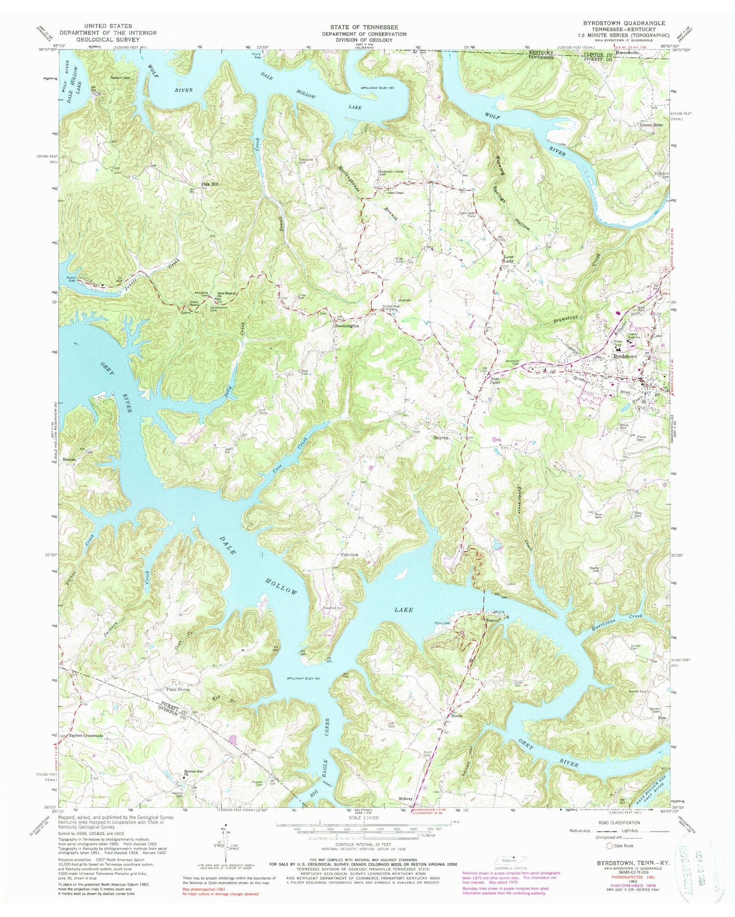
Classic USGS Byrdstown Tennessee 7.5'x7.5' Topo Map
Couldn't load pickup availability
Historical USGS topographic quad map of Byrdstown in the states of Tennessee, Kentucky. Map scale may vary for some years, but is generally around 1:24,000. Print size is approximately 24" x 27"
This quadrangle is in the following counties: Clinton, Overton, Pickett.
The map contains contour lines, roads, rivers, towns, and lakes. Printed on high-quality waterproof paper with UV fade-resistant inks, and shipped rolled.
Contains the following named places: Amonett - Dillon Cemetery, Amonette Bend, Amonette Cemetery, Anderson-Jones Cemetery, Babb Ford, Barnes, Barnes Creek, Barnes School, Big Eagle Creek, Bloomington, Bloomington School, Blowing Springs Hollow, Bond Cemetery, Boom, Brimstone Creek, Byrdstown, Byrdstown Division, Byrdstown First Baptist Church, Byrdstown Pickett County Volunteer Fire Department, Byrdstown Post Office, Clark Mountain Poultry Farms, Commissioner District 2, Commissioner District 4, Cope Cemetery, Cope Creek, Cordell Hull Birthplace, County High School, Cove Creek, Cove Creek Recreation Area, Cross Cemetery, E A Garrett Cemetery, Eagles Cove Marina, Fairview, Fairview School, Faix, Flowers Cemetery, Franklin Ferry, Garrett Hollow, Government Cemetery, Grace Chapel, Green Brier, Greenbrier School, Gum Grove Church, Harveys Store, Hatcher Cemetery, Hatcher Hall Cemetery, Hatcher Hall Church, Hatchers Hall School, Hill Cemetery, Holt Cemeteries, Horsetrough Hollow, Huntersville, Hurricane Creek, Jackson Creek, Jehu Reeder Sr and Jr Gravesite, Jolly Creek, Jones Chapel, Jones School, Key Branch, Lone Maple School, Love Lady, Love Lady Cemetery, Lovelkady School, Meetinghouse Branch, Midway, Midway Division, Millers Chapel, Mitchell Store, Mullins Cemetery, Neal Cemetery, Oak Hill, Oak Hill School, Obey River Recreation Area, Pendergrass Creek, Pickett County Ambulance Service, Pickett County Court House, Pickett County Elementary School, Pickett County High School, Pickett County Sheriff's Office, Pierce Cemetery, Pipern Bend, Plain Grove, Plain Grove School, Polk Garrett Cemetery, Pryor Bend, Pryor Cemetery, Rayburn Cemetery, Reedertown Cemetery, Riley Cemetery, Sand Branch Church, Sewell Creek, Slick Hill School, Smith Cemetery, Smyrna, Smyrna Church, Smyrna School, Star Point, Star Point Dock, Story Cemetery, Sunset, Sunset Dock, Tompkins Cemetery, Town of Byrdstown, Union B School, Willis Groce Cemetery, ZIP Code: 38549


