MyTopo
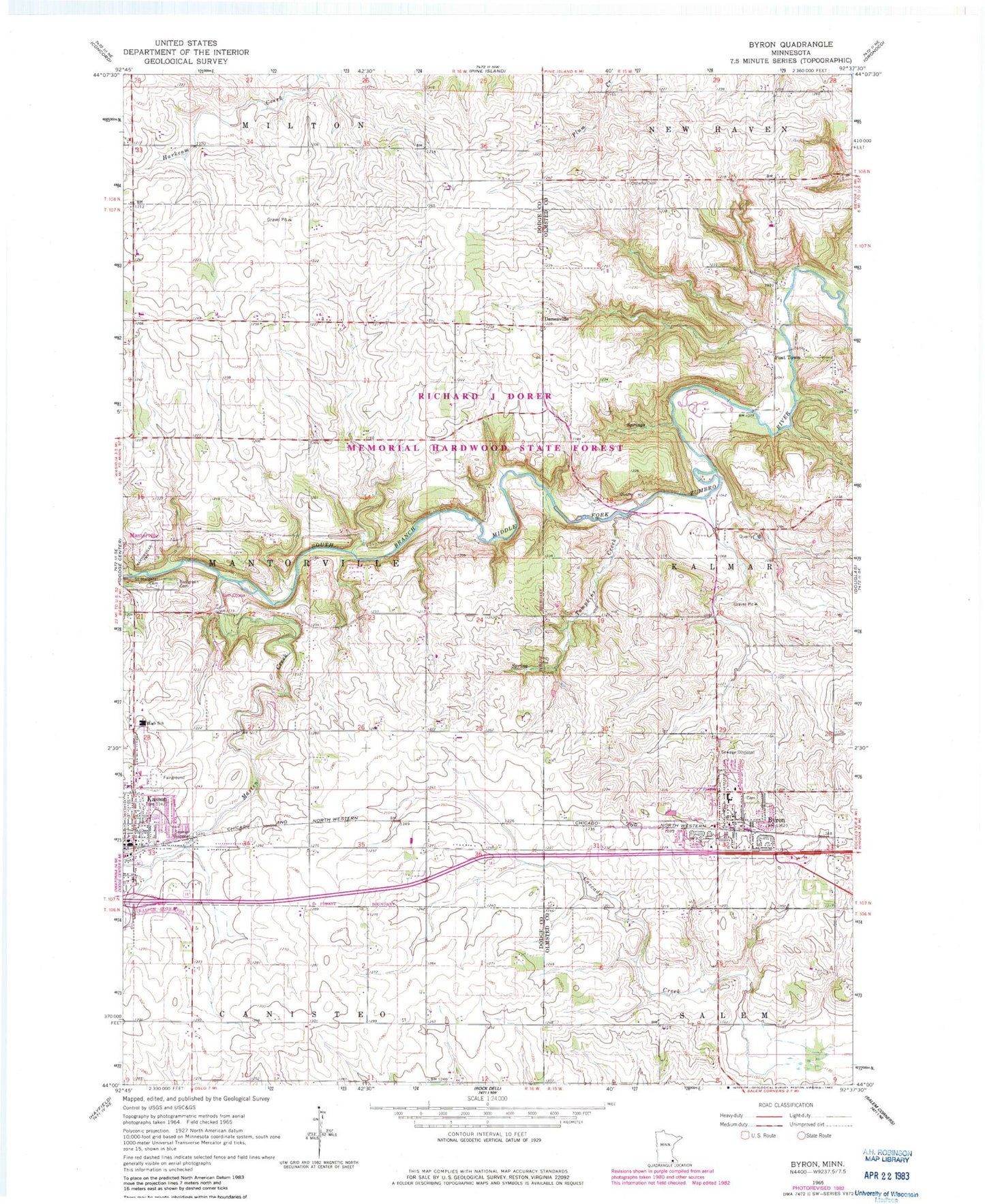
Classic USGS Byron Minnesota 7.5'x7.5' Topo Map
Couldn't load pickup availability
Historical USGS topographic quad map of Byron in the state of Minnesota. Map scale is 1:24000. Print size is approximately 24" x 27"
This quadrangle is in the following counties: Dodge, Olmsted.
The map contains contour lines, roads, rivers, towns, and lakes. Printed on high-quality waterproof paper with UV fade-resistant inks, and shipped rolled.
Contains the following named places: Byron, Byron, Byron Cemetery, Byron Elementary School, Byron Fire Department, Byron High School, Byron Intermediate School, Byron Post Office, Christ Lutheran Church, Christ the King Catholic Church, City of Byron, City of Kasson, Community Celebration Church, Danesville, Double B Farms, Evergreen Cemetery, Holy Family Catholic Church, Kasson, Kasson Police Department, Kasson Police Department, Kasson Post Office, Kasson Public Library, Kasson-Mantorville Elementary School, Kasson-Mantorville Senior High, KRCH-FM (Rochester), Masten Creek, Mount Moriah Lutheran Church, Mount Sion Independent Lutheran Church, Olmsted Medical Group Center, Othello Cemetery, Oxbow Park, Post Town, Saint Margaret Cemetery, Saint Peter's Episcopal Church, Tompkins Creek, Township of Mantorville, United Methodist Church, Zumbro Ridge Farms