MyTopo
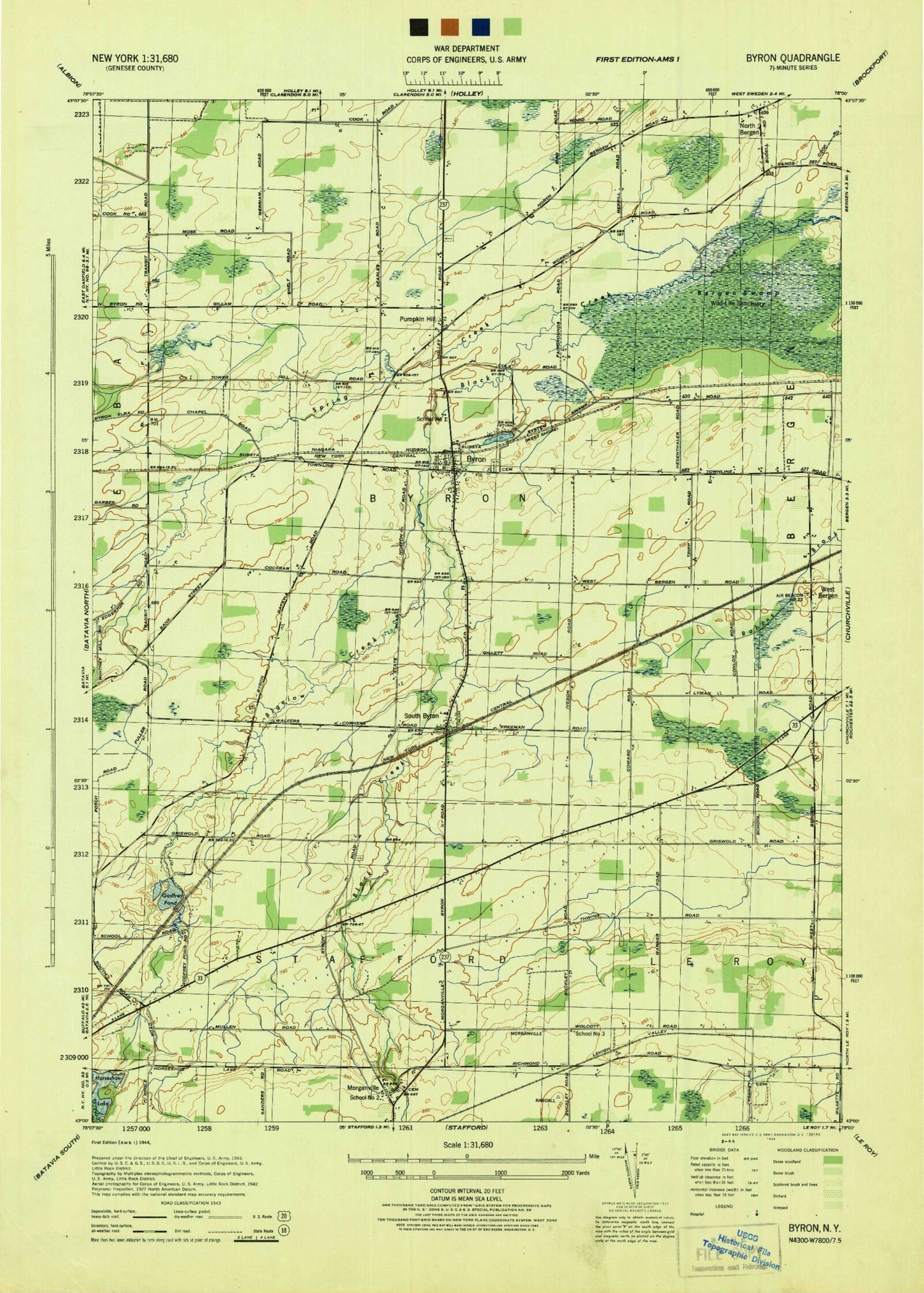
Classic USGS Byron New York 7.5'x7.5' Topo Map
Couldn't load pickup availability
Historical USGS topographic quad map of Byron in the state of New York. Map scale may vary for some years, but is generally around 1:24,000. Print size is approximately 24" x 27"
This quadrangle is in the following counties: Genesee.
The map contains contour lines, roads, rivers, towns, and lakes. Printed on high-quality waterproof paper with UV fade-resistant inks, and shipped rolled.
Contains the following named places: Bethel Baptist Church of Bergen, Big O Farms, Bigelow Creek, Byron, Byron - Bergen Elementary School, Byron - Bergen High School, Byron - Bergen Middle School, Byron Airpark, Byron Cemetery, Byron Fire Department, Byron Post Office, Byron Presbyterian Church, Byron-Bergen Swamp, Casswell Hill, Forsythe Hill, Godfrey Pond, Harris Hill, Horseshoe Lake, Langworthy Cemetery, Lidke Hill, Mill Pond, Morganville, Morganville Cemetery, Morganville United Church of Christ, North Bergen, North Byron Cemetery, Pumpkin Hill, Randall Cemetery, Schafer Potato Farms, School Number 1, School Number 2, School Number 3, Sodom Cemetery, South Byron, South Byron Post Office, South Byron Volunteer Fire Company, Southwoods Recreational Vehicle Resort, Spring Creek, Stafford Airport, Thwing Cemetery, Tower Hill, Town of Byron, Walker Cemetery, West Bergen, ZIP Code: 14422