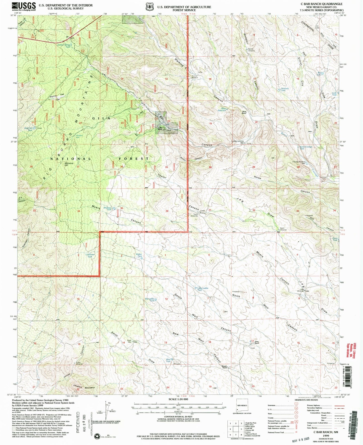
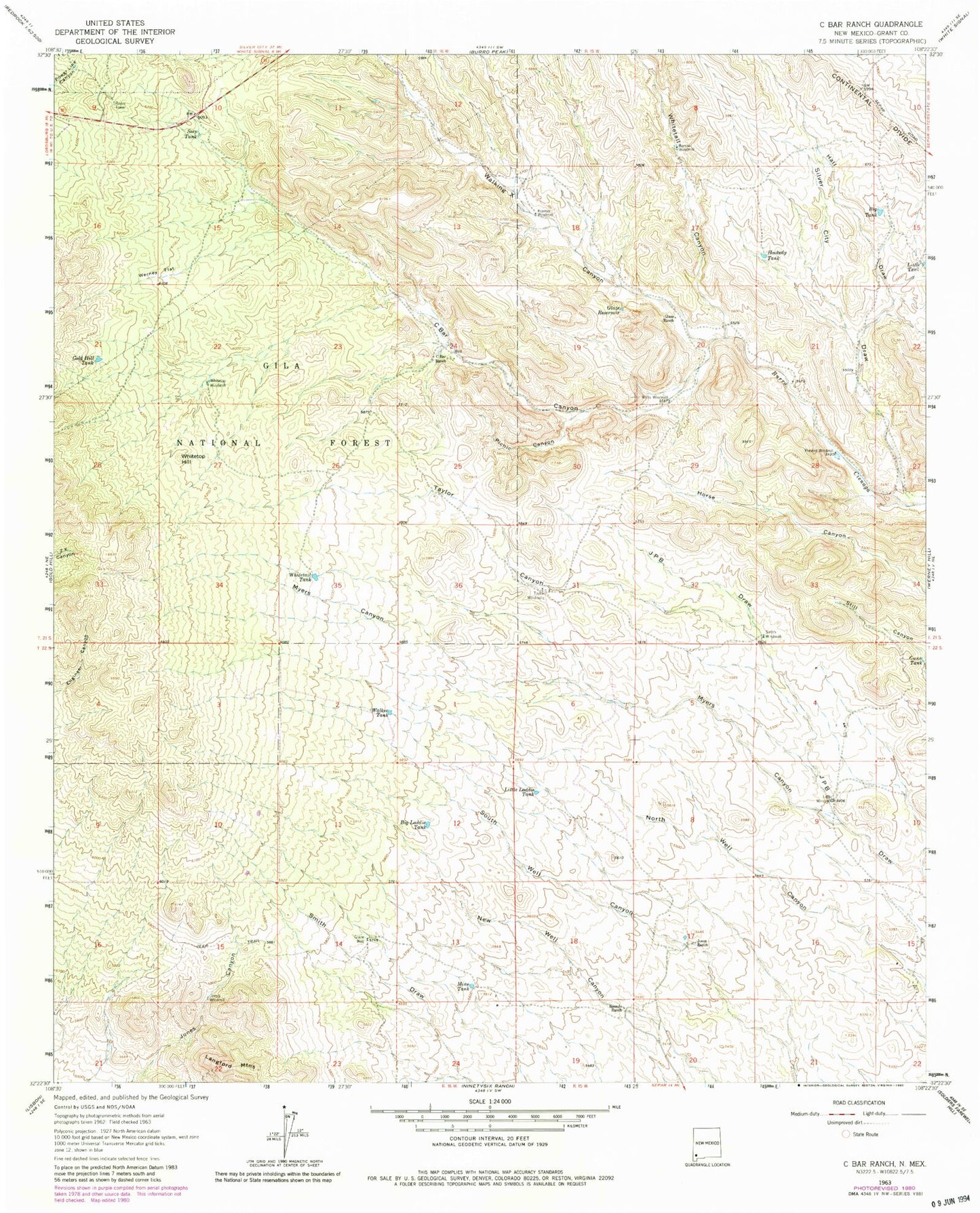
MyTopo
Classic USGS C Bar Ranch New Mexico 7.5'x7.5' Topo Map
Couldn't load pickup availability
Historical USGS topographic quad map of C Bar Ranch in the state of New Mexico. Map scale may vary for some years, but is generally around 1:24,000. Print size is approximately 24" x 27"
This quadrangle is in the following counties: Grant.
The map contains contour lines, roads, rivers, towns, and lakes. Printed on high-quality waterproof paper with UV fade-resistant inks, and shipped rolled.
Contains the following named places: American Deposit, Barrow Windmill, Big Laddie Tank, Big Tank, Blacktail Tank, Bounds Ranch, Burro Cienga Tank, C Bar Canyon, C Bar Ranch, C Bar Water Well, Double Strike Deposit, Glaze Ranch, Glaze Reservoir, Glaze Well, Gold Hill Tank, Gunn Tank, Hall Draw, Hookedy Tank, Jones Ranch, Jones Windmill, Juniper Spring Tank, Kramer Windmill, Little Laddie Tank, Little Tank, Little Windmill, Lonesome Tank, Mine Tank, Myers Canyon, Picnic Canyon, Prevost Windmill, Seep Tank, Silver City Draw, Smith Windmill, Taylor Canyon, Taylor Windmills, Walker Tank, Walking X Canyon, Werney Flat, Whitetail Canyon, Whitetop Hill, Whitetop Well, Whitetop Windmill, Willis Windmill