MyTopo
Classic USGS C.C. Cragin Reservoir Arizona 7.5'x7.5' Topo Map
Couldn't load pickup availability
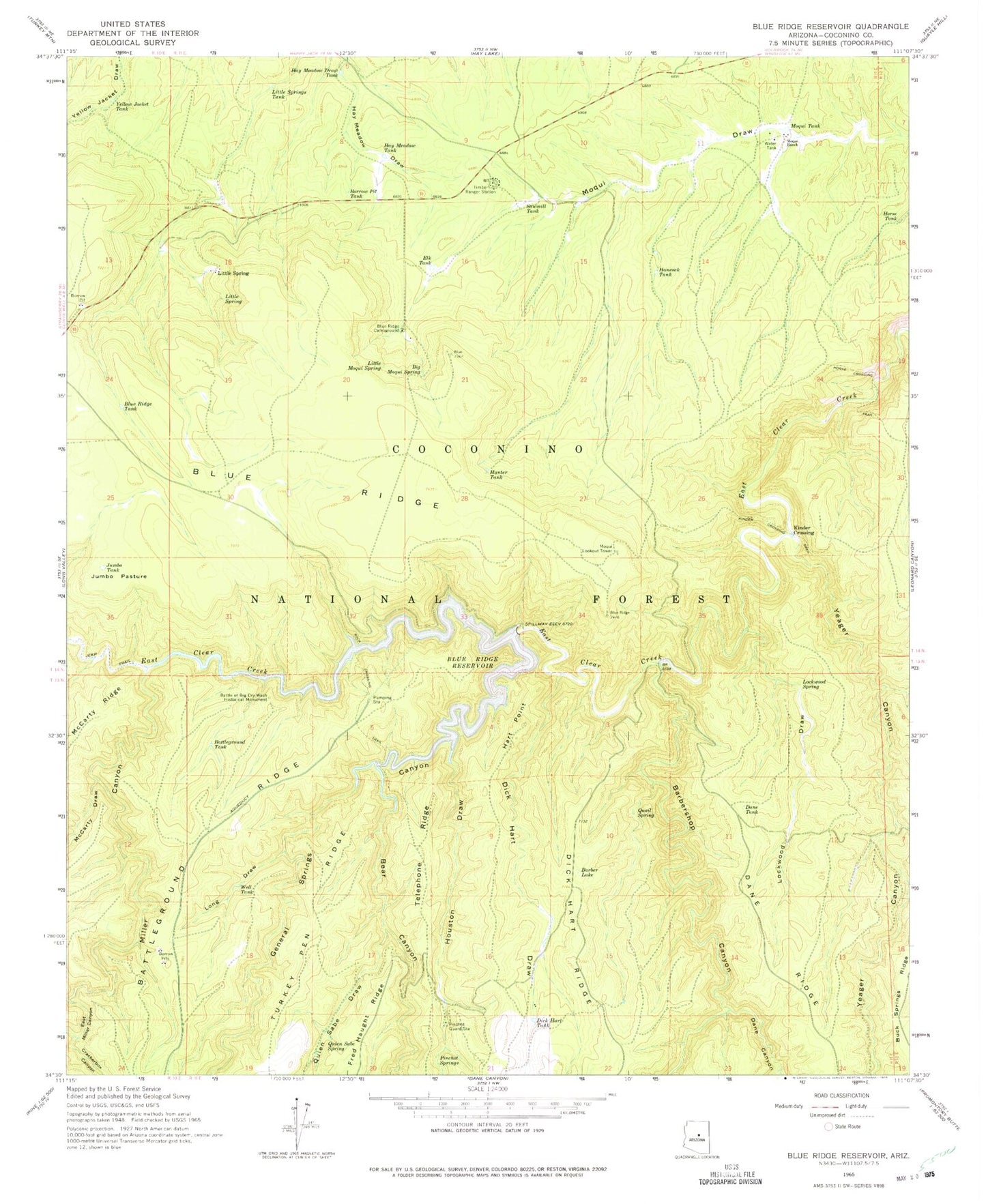
Historical USGS topographic quad map of C.C. Cragin Reservoir in the state of Arizona. Map scale may vary for some years, but is generally around 1:24,000. Print size is approximately 24" x 27"
This quadrangle is in the following counties: Coconino.
The map contains contour lines, roads, rivers, towns, and lakes. Printed on high-quality waterproof paper with UV fade-resistant inks, and shipped rolled.
Contains the following named places: Barber Lake, Barber Tank, Barbershop Canyon, Battle of Big Dry Wash Historical Monument, Battleground Tank, Bear Canyon, Bell Tank, Big Moqui Spring, Birthday Tank, Blue Ridge Boat Launch, Blue Ridge Campground, Blue Ridge Tank, Borrow Pit Tank, C.C. Cragin Dam, C.C. Cragin Reservoir, Crackerbox Canyon, Dane Canyon, Dane Tank, Dick Hart Draw, Dick Hart Tank, Dink Tank, Elk Tank, General Springs Canyon, Granada Tank, Hancock Tank, Hart Point, Hay Meadow Draw, Hay Meadow Draw Tank, Hay Meadow Tank, Horse Crossing, Horse Crossing Trail, Horse Tank, Houston Draw, Hunter Tank, Jumbo Pasture, Jumbo Tank, Kinder Crossing, Kinder Crossing Trail, Little Moqui Spring, Little Spring, Little Springs Tank, Lockwood Draw, Lockwood Spring, Long Draw, Mackin Tank, McCarty Draw, McClintock Draw, Miller Canyon, Mogollon Rim Maintenance Yard, Mogollon Rim Ranger District Office, Moqui Lookout Tower, Moqui Ranch, Moqui Tank, Mountan Tank, O D Tank, Oak Tank, Pinchot Guard Station, Pinchot Springs, Quail Spring, Quien Sabe Draw, Quien Sabe Spring, Rock Crossing, Rock Crossing Campground, Rock Crossing Trail, Rush Tank, Sawmill Tank, Section Twentyseven Tank, Sinkhole Tank, Still Tank, Timber Ranger Station, Topsoil Tank, Water Right Tank, Well Tank, Yeager Canyon, Yellow Jacket Tank