MyTopo
Classic USGS Caballo New Mexico 7.5'x7.5' Topo Map
Couldn't load pickup availability
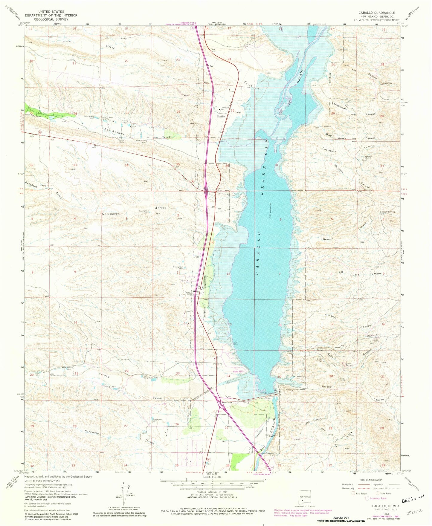
Historical USGS topographic quad map of Caballo in the state of New Mexico. Map scale may vary for some years, but is generally around 1:24,000. Print size is approximately 24" x 27"
This quadrangle is in the following counties: Sierra.
The map contains contour lines, roads, rivers, towns, and lakes. Printed on high-quality waterproof paper with UV fade-resistant inks, and shipped rolled.
Contains the following named places: 40 B Water Well, 47 A Water Well, 48 Water Well, Apache Canyon, Apache Tank, Arrey Derry Fire Department Station 1, Ash Canyon, Ash Spring, Bat Cave Canyon, Black Beauty, Black Beauty Group, Blondie Claims, Burbank Canyon, Caballo, Caballo Canyon, Caballo Cemetery, Caballo Census Designated Place, Caballo Community Church, Caballo Dam, Caballo Fire Rescue, Caballo Mountain Mining and Leaching, Caballo Post Office, Caballo Reservoir, Caballo Weather Station, Chambers Canyon, Dredge Tailings 1, Dredge Tailings 2, Dredge Tailings Five, Dredge Tailings Four, Dredge Tailings Six, Flordillo Canyon, Granite Canyon, Granite Peak, Granite Spring, Greenhorn Arroyo, Greyback Arroyo, LA 1119, LA 19 Water Well, LA 42 Water Well, LA-2S Water Well, Las Animas Creek, Longbottom Canyon, Longbottom Canyon Ruin Historic Site, Lyda K Mine, Lyda-K, Oasis, Oasis Census Designated Place, Percha Creek, Percha Diversion Dam, Pittsburg, Pulido Canyon, Red Cloud Claims, Seco Creek, Wild Horse Canyon