MyTopo
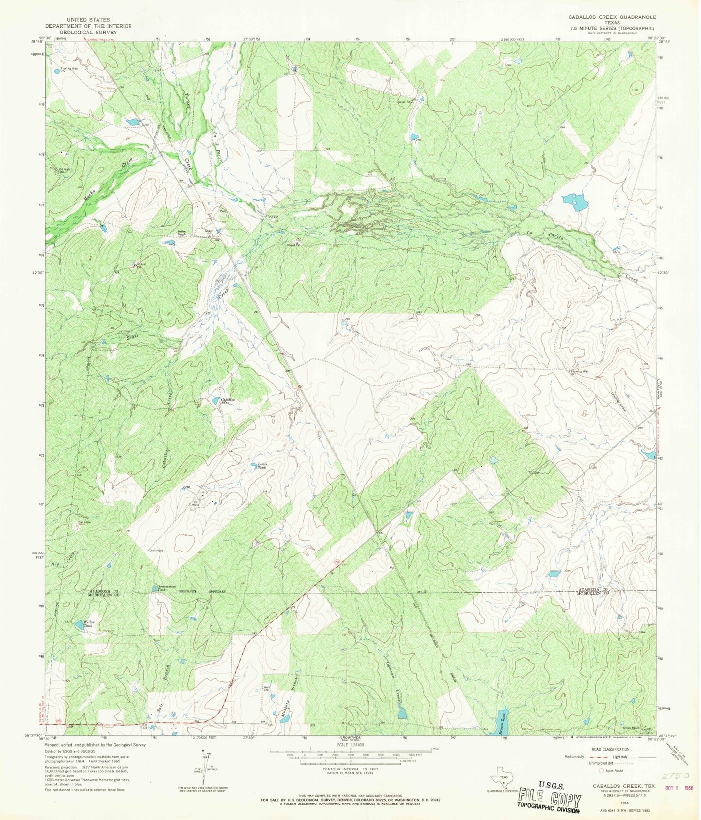
Classic USGS Caballos Creek Texas 7.5'x7.5' Topo Map
Couldn't load pickup availability
Historical USGS topographic quad map of Caballos Creek in the state of Texas. Map scale may vary for some years, but is generally around 1:24,000. Print size is approximately 24" x 27"
This quadrangle is in the following counties: Atascosa, McMullen.
The map contains contour lines, roads, rivers, towns, and lakes. Printed on high-quality waterproof paper with UV fade-resistant inks, and shipped rolled.
Contains the following named places: 74 Ranch Airport, 74 Ranch Dam Number 1, 74 Ranch Dam Number 2, 78075, Brown Ranch, Caballos Creek, Caballos Tank, Government Tank, Lake Number 1, Lake Number 2, Landa Memorial Branch Library, Lewis Tank, Macho Creek, McCreless Branch Library, Peeler Dam, Peeler Lake, Peeler Ranch, San Miguel Electric Cooperative, Souse Creek, Turkey Creek, Willow Tank