MyTopo
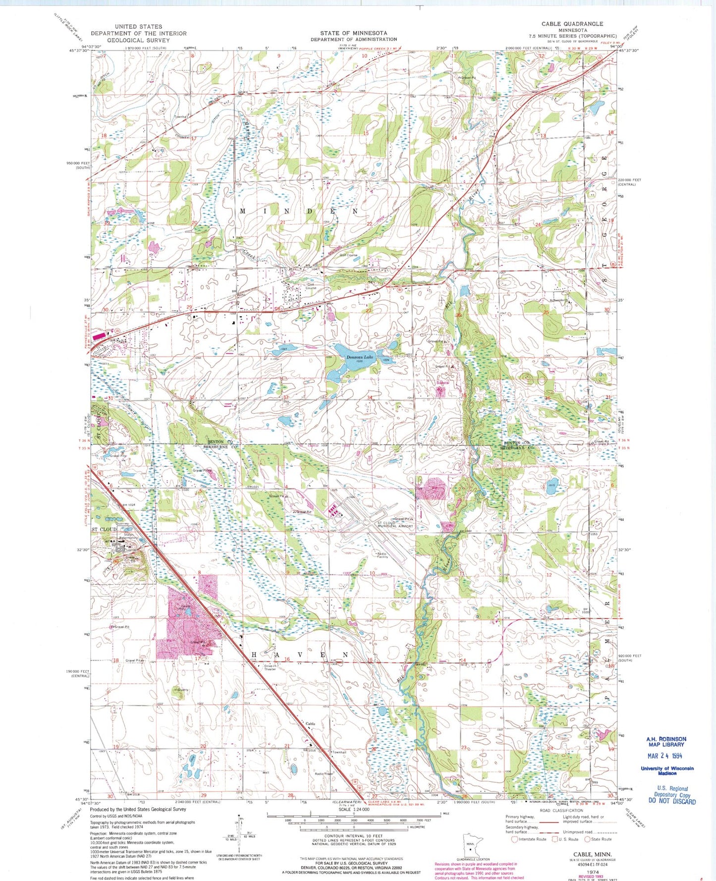
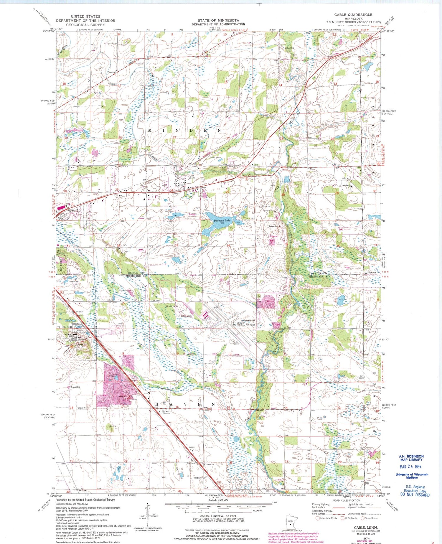
Classic USGS Cable Minnesota 7.5'x7.5' Topo Map
Couldn't load pickup availability
Historical USGS topographic quad map of Cable in the state of Minnesota. Map scale may vary for some years, but is generally around 1:24,000. Print size is approximately 24" x 27"
This quadrangle is in the following counties: Benton, Sherburne.
The map contains contour lines, roads, rivers, towns, and lakes. Printed on high-quality waterproof paper with UV fade-resistant inks, and shipped rolled.
Contains the following named places: Aysta Field Airport, Cable, Cable Post Office, Central Minnesota Rest Area, County Ditch Number Eleven, County Ditch Number Three, Donovan Lake, First Granite Quarry Historical Marker, Mayhew Creek, Minnesota Correctional Facility - Saint Cloud, Minnesota Reformatory Cemetery, Saint Cloud Campground and RV Park, Saint Cloud Fire Department Station 4, Saint Cloud Historical Marker, Saint Cloud Hospital Heliport, Saint John's Lutheran Church, Saint Patrick's Cemetery, Saint Patricks Church, St Cloud Regional Airport, The Fairways Golf Course, Township of Haven, Township of Minden, Wapicada Golf Course, Woodland Hills Park, ZIP Code: 56304