MyTopo
Classic USGS Cabo Rojo Puerto Rico 7.5'x7.5' Topo Map
Couldn't load pickup availability
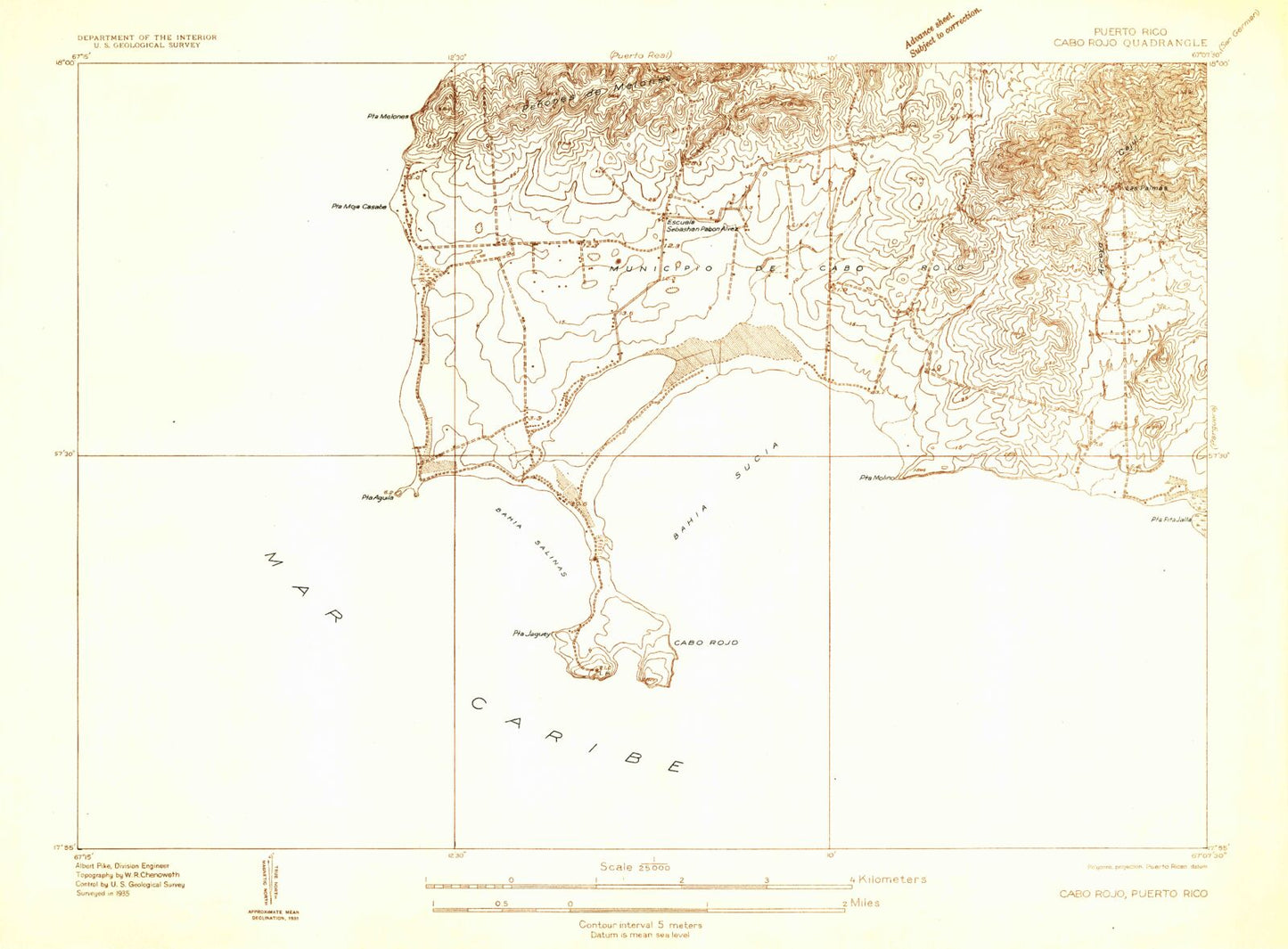
Historical USGS topographic quad map of Cabo Rojo in the state of Puerto Rico. Map scale may vary for some years, but is generally around 1:24,000. Print size is approximately 24" x 27"
This quadrangle is in the following counties: Cabo Rojo.
The map contains contour lines, roads, rivers, towns, and lakes. Printed on high-quality waterproof paper with UV fade-resistant inks, and shipped rolled.
Contains the following named places: Arroyo Cajul, Bahia Salinas, Bahia Salinas Beach, Bahia Sucia, Bajo Casabe, Boqueron Barrio, Bosque Estatal de Boqueron, Bosque Estatal Los Morillos, Cabo Rojo, Cabo Rojo National Wildlife Refuge, Caribbean Bureau of Foreign Broadcast Service, Centro de la Industria de la Sal, Corozo, Corozo Salt Flats, Cullingford Field Airport, El Combate, El Combate Comunidad, El Faro de Cabo Rojo, Escuela Sebastian Pabon Alyes, Las Palmas, Llanos Costa Barrio, Municipio de Cabo Rojo, Penones de Melones, Playa Aguila, Playa El Combate, Playa Salinas, Playuela Beach, Pole Ojea, Pole Ojea Comunidad, Punta Aguila, Punta Jaguey, Punta Melones, Punta Moja Casabe, Punta Molino, Roca Ola, WMIO-FM (Cabo Rojo), ZIP Code: 00622