
MyTopo
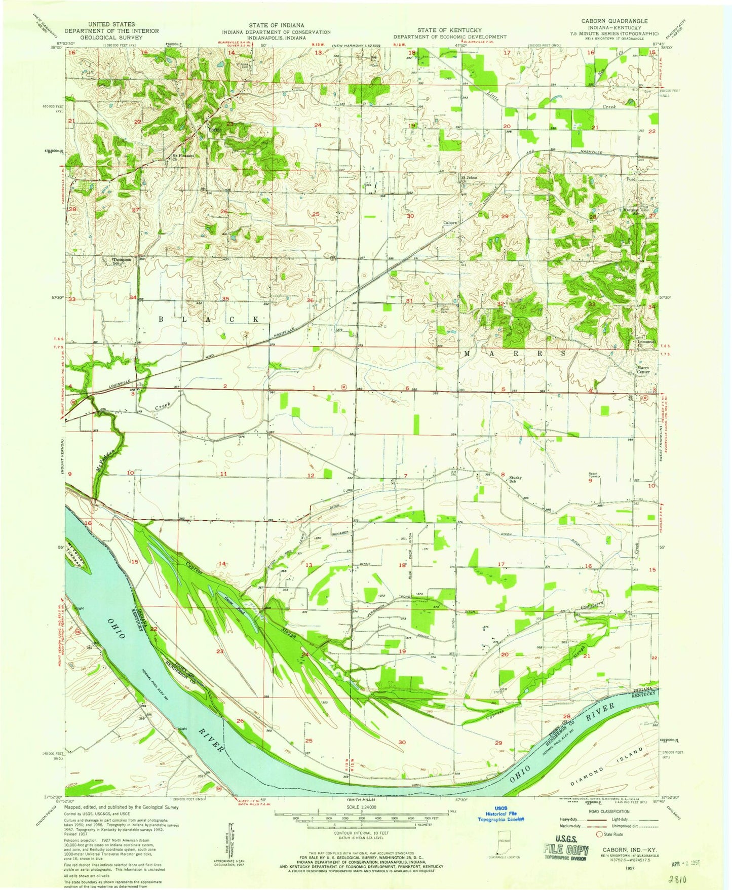
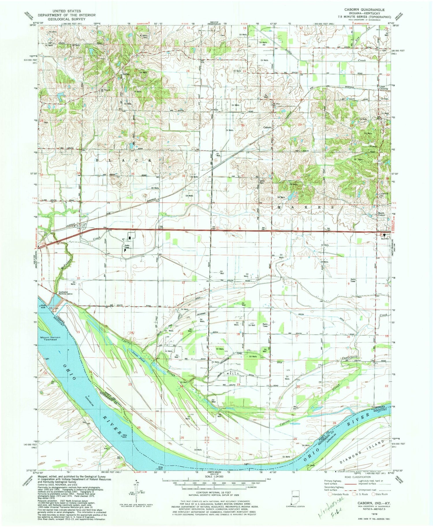
Classic USGS Caborn Indiana 7.5'x7.5' Topo Map
Couldn't load pickup availability
Historical USGS topographic quad map of Caborn in the states of Indiana, Kentucky. Map scale may vary for some years, but is generally around 1:24,000. Print size is approximately 24" x 27"
This quadrangle is in the following counties: Henderson, Posey.
The map contains contour lines, roads, rivers, towns, and lakes. Printed on high-quality waterproof paper with UV fade-resistant inks, and shipped rolled.
Contains the following named places: Blue Pond, Blue Pond Ditch, Bufkin, Caborn, Calvin Cemetery, Castleberry Creek, Crunk Ditch, Cypress Slough, Diamond Island, Dixon and Lewis Ditch, Dixon Ditch, Goose Pond, Hartman School, Hickory Branch Post Office, Hilakos Airport, Immanuel Church, Lewis Airport, Longs Landing Post Light, Marrs Center, Marrs Township Volunteer Fire Department Station 2, Marrs Volunteer Fire Department, Mount Pleasant Church, Mount Vernon Towhead Island, Neu Creek, Persimmon Pond Ditch, Posey Patch Airport, Saint Johns Cemetery, Saint Johns Church, Schieber Ditch, Southwind Maritime Centre, Stucky School, Thompson School, Township of Marrs, Zeller Elevation Company Airport