MyTopo
Classic USGS Cabot Vermont 7.5'x7.5' Topo Map
Couldn't load pickup availability
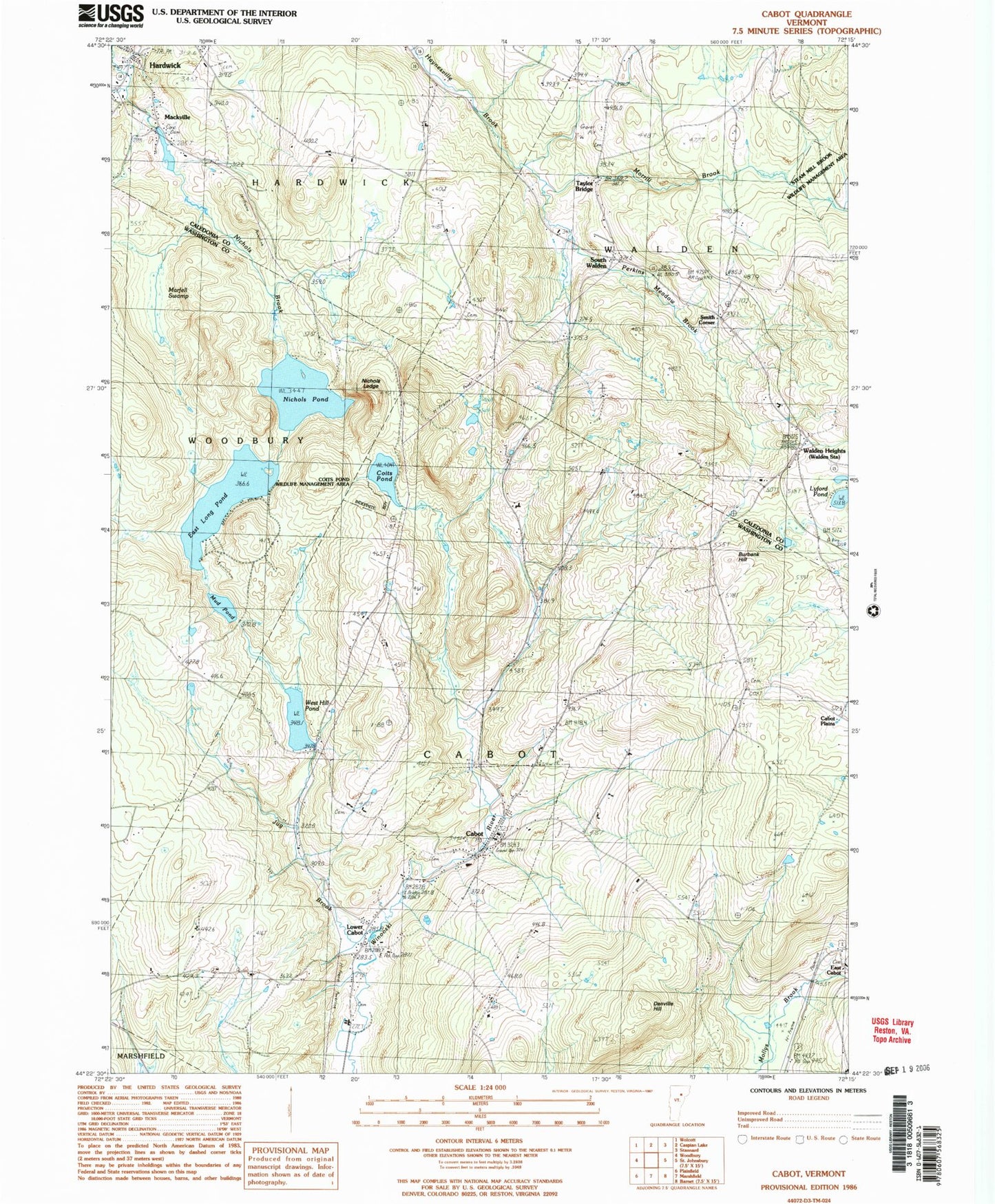
Historical USGS topographic quad map of Cabot in the state of Vermont. Typical map scale is 1:24,000, but may vary for certain years, if available. Print size: 24" x 27"
This quadrangle is in the following counties: Caledonia, Washington.
The map contains contour lines, roads, rivers, towns, and lakes. Printed on high-quality waterproof paper with UV fade-resistant inks, and shipped rolled.
Contains the following named places: Burbank Hill, Cabot, Center Cemetery, Coits Pond, Danville Hill, Durant Cemetery, East Long Pond, Houston Hill School, Jug Brook, Lower Cabot, Mackville, Martell Swamp, Perkins Meadow Brook, Morrill Brook, Mud Pond, Nichols Brook, Nichols Ledge, Nichols Pond, Cabot Plains Cemetery, South Woodbury Cemetery, Taylor Bridge, Walden Heights, Walden Station, West Hill Pond, Westhill Cemetery, East Cabot, Smith Corner, South Walden, Town of Cabot, West Hill Pond Dam, Nichols Pond Dam, East Long Pond Dam, Mackville Dam, Mackville Pond, Cabot Plains Cemetery, Cabot Post Office, Cabot School, Cabot Village Cemetery, East Cabot Cemetery, United Church of Cabot, West Hill Cemetery, Fairview - Saint Roberts Cemetery, Folsom Cemetery, Houston Hill Cemetery, Idle Hours Campground, South Walden Cemetery, Steam Mill Brook Wildlife Management Area, Stevens Hill Cemetery, Walden Heights Cemetery, Cabot Volunteer Fire Department, Walden Fire Department, Village of Cabot (historical), Lightning Bolt Field, Catamount Airfield, Cabot Emergency Ambulance, Dunstable Farm, Cabot Census Designated Place